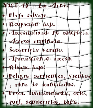
La Arnía, playa
![]() La playa de la Arnía se encuentra en la localidad de Liencres, perteneciente al municipio de Piélagos; en la costa central de Cantabria. Su arenal de reducido tamaño, 150 metros de longitud y 50 metros de anchura media, da entrada a un área mayor delimitada por acantilados que parcialmente filtran y modulan el oleaje.
La playa de la Arnía se encuentra en la localidad de Liencres, perteneciente al municipio de Piélagos; en la costa central de Cantabria. Su arenal de reducido tamaño, 150 metros de longitud y 50 metros de anchura media, da entrada a un área mayor delimitada por acantilados que parcialmente filtran y modulan el oleaje.
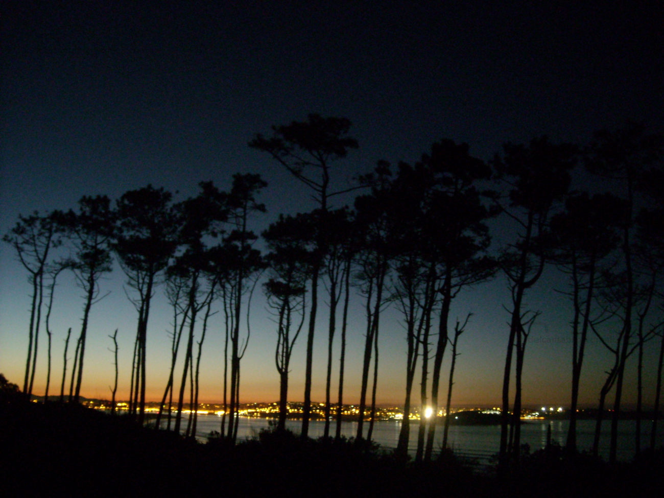
La línea de costa, situada en el ala derecha de la playa, define la extensión de La Arnía. El ala izquierda dispone de un escarpe rocoso, resto erosionado de la arcaica costa cántabra, que protege parte de la pequeña ensenada. Esta formación, debido al efecto del Mar Cantábrico, redefine su figura tanto sobre el nivel del mar como en su plataforma base. El acceso se realiza a través de una empinada cuesta. Precediendo a La Arnía, desde la rampa de entrada y a su lado izquierdo, se encuentra un entorno formado por rasa mareal, acantilados y otras formaciones geológicas de singular belleza.
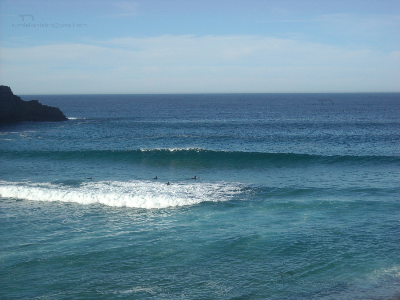
El oleaje es generalmente fuerte, siendo hábil para practicar surf cuando su tamaño es medio-bajo. Las fuertes condiciones de la zona y las limitadas dimensiones de la playa condicionan la navegación. Destacan los fondos marinos, que con el mar en calma suponen un disfrute para los sentidos.

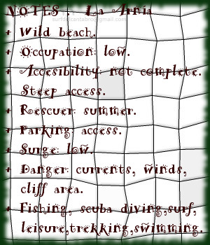
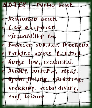
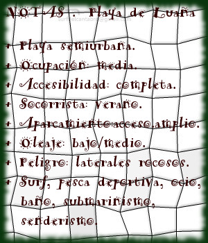
La Arnía, beach
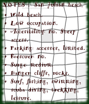
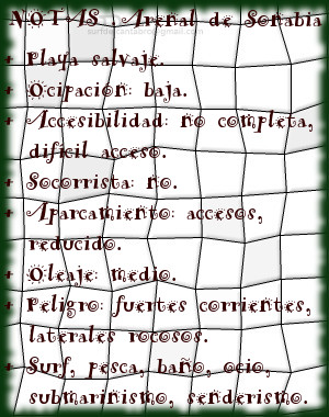
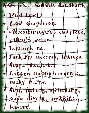
![]() The beach of La Arnía is in the locality of Liencres, belonging to the municipality of Piélagos; on the central coast of Cantabria. Its sandbank of limited size, 150 meters of length and 50 meters of average width, gives entry to a bigger area delimited by cliffs that partially leak and modulate the surge.
The beach of La Arnía is in the locality of Liencres, belonging to the municipality of Piélagos; on the central coast of Cantabria. Its sandbank of limited size, 150 meters of length and 50 meters of average width, gives entry to a bigger area delimited by cliffs that partially leak and modulate the surge.
The line of coast, placed in the right wing of the beach, defines the extension of La Arnía. The left wing has one scarp rocky, eroded rest of the archaic Cantabrian coast, which protects part of the small inlet. This formation, due to the effect of the Cantsabrian Sea re-defines its figure so much on the level of the sea as in its base platform. The access is realized across an steep slope. Preceding La Arnía, from the ramp of entry and its left side, finds an environment formed by level mareal, cliffs and other geological formations with singular beauty.
The waves are generally strong, being adept at surfing when its size is medium-low. The strong conditions in the area and the limited dimensions of the beach condition the navigation. Highlights the seabed, posed a treat for the senses with the calm sea.