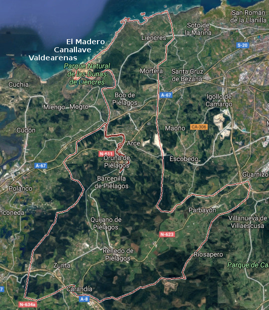
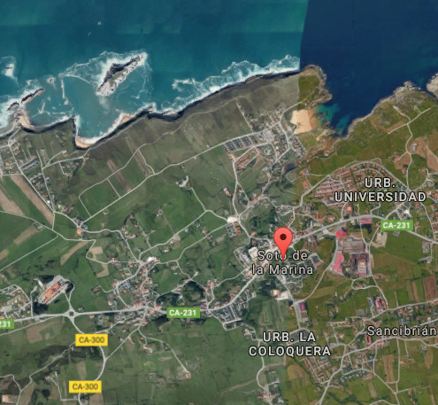
Piélagos, villa

Icono Español. Icon Spanish. Piélagos, villa, village El municipio de Piélagos se encuentra emplazado en la costa central de Cantabria. Ocupando la zona oeste de esta parte del litoral, está compuesto por las siguientes localidades : Arce, Barcenilla, Boo, Carandía, Liencres, Mortera, Oruña, Parbayón, Quijano, Vioño de Piélagos, Zurita y Renedo de Piélagos; capital del municipio.

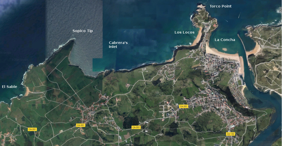
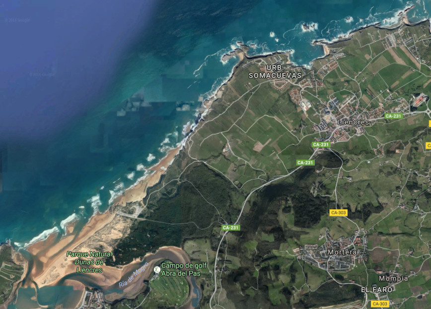
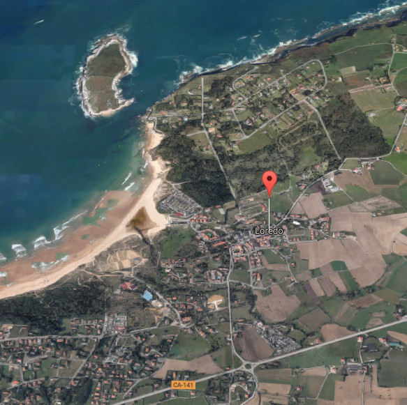
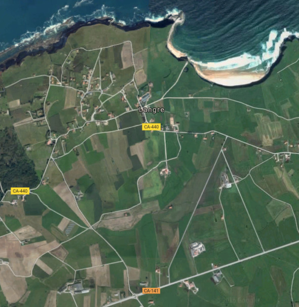
La costa de Piélagos, accesible desde la localidad de Liencres, comprende parte de la Costa Quebrada y las playas de Valdearenas y Canallave. El margen que saluda al océano recibe la fuerza del Mar Cantábrico que la moldea y configura su diseño. La presencia de corrientes y vientos que registran los arenales acompañan la navegación, el paseo; coloreando la naturaleza salvaje del entorno. Los acantilados se suceden a través del sendero, apareciendo pequeñas calas accesibles en marea baja.

El territorio, habitado desde la prehistoria, dispone de varios yacimientos arqueológicos y cuevas rupestres como las de Santián o Covalejos. Destacan en todas las localidades del municipio la presencia de casas de arquitectura montañesa, hechas de piedra y madera, con un balcón típico en su frente y doble arco de entrada a la vivienda. La expresión arquitectónica presente en el municipio de Piélagos recorre varios siglos de historia. la Torre de Velo del siglo XIV, el Palacio del Marqués de la Conquista Real del siglo XVII, el Palacio de los Condes de Mortera y el Palacio de Montalbán; ambos del siglo XIX, son ejemplos indicativos de la variada muestra que vamos a encontrar.

Icono Inglés. Icon English. Piélagos, villa, village The municipality of Piélagos is located on the central coast of Cantabria. Occupying the west zone of this part of the littoral, it is composed by the following localities: Arce, Barcenilla, Boo, Carandía, Liencres, Mortera, Oruña, Parbayón, Quijano, Vioño de Piélagos, Zurita and Renedo de Piélagos; the capital of the municipality.

The coast of Piélagos, accessible from the locality of Liencres, covers part of the Quebrada Coast and the beaches of Valdearenas and Canallave. The margin that greets the ocean receives the force of the Cantabrian Sea that molds and forms its design. The presence of currents and winds that register the sandbanks accompany the navigation, the walk; coloring the wild nature of the environment. The cliffs take place across the path, appearing small accessible coves in low tide.

The territory, populated from the prehistory, has several archaeological deposits and caverns as the cave of Santián or Covalejos. Stand out in all the localities of the municipality the presence of houses of mountain architecture, made of stone and wood, with a typical balcony in its forehead and double arch of entry to the housing. The architectural expression present in the municipality of Piélagos crosses several centuries of history. The Tower of Velo of the 14th century, the Palace of the Marquess of the Royal Conquest of the 17th century, the Palace of the Counts of Mortera and Montalbán’s Palace; both of the 19th century, are indicative examples of the varied sample that we are going to find.

 Piélagos, villa, village. Icon text divider

Piélagos, tour

Icono español-inglés. Icon Spanish-English. Piélagos, villa, village. Map Piélagos, village

Piélagos, map

Piélagos, villa, village. icon close cities

Share

Santa Cruz de Bezana, villa

Icono Español. Icon Spanish. Santa Cruz de Bezana, villa, village Santa Cruz de Bezana es una localidad y municipio emplazado en la costa central de Cantabria. Situado junto a la ciudad de Santander, el municipio comprenden las siguientes localidades : Maoño, Azoños, Mompía, Prezanes, Soto de la Marina, Sancibrián y Bezana; la capital del municipio.

La villa hunde si historia en el tiempo, corroborado por restos prehistóricos y diversos útiles encontrados en el municipio. Destacan, como presencia singular, varios cilindros de mampostería de cierta altura utilizados antaño para el cultivo de parras y la obtención de vino. Dos casonas blasonadas del siglo XVII y la Iglesia Parroquial de Bezana, de estilo neogótico, componen una muestra de la arquitectura y vida del lugar. Siendo una zona residencial en la actualidad su diseño y estética forman una composición que combina pasado y presente de forma natural. Debido a su proximidad a la capital cántabra, dispone de todos los servicios y conexiones por tren o carretera.

Las playas de Covachos y San Juan de la Canal, situadas en el extremo Oeste de la costa quebrada, conectan Santa Cruz de Bezana con el Mar Cantábrico a través de sus arenales, acantilados, urros e islotes, plasmando una imagen cuya plasticidad conserva una tonalidad única.

Santa Cruz de Bezana, village

Icono Inglés. Icon English. Santa Cruz de Bezana, villa, village Santa Cruz de Bezana is a locality and municipality sited in the central coast of Cantabria. Placed close to the city of Santander, the municipality is formed by the following localities: Maoño, Azoños, Mompía, Prezanes, Soto de la Marina, Sancibrián and Bezana; the capital of the municipality.

The villa sinks its history in the time, corroborated by prehistoric and diverse useful remains found in the municipality. Stand out, as singular presence, several cylinders of masonry with certain height used long ago for the growing of grapevines and the obtaining wine. Two emblazoned mansions about the 17th century and the Parochial Church of Bezana, about Neogothic style, compose a sample of the architecture and local life. Being a residential zone at present its design and aesthetics form a composition that combines past and present in natural way. Due to its proximity to the Cantabrian capital, it has all the services and connections for train or road.

The beaches of Covachos and San Juan of the Canal, placed in the West extreme of the broken coast, connect Santa Cruz de Bezana with the Cantabrian Sea across its sandbanks, cliffs, sea-rocks and islands, forming an image which plasticity preserves a singular tonality.

Santa Cruz de Bezana, villa, village. Icon text divider

Santa Cruz de Bezana, routes

Icono español-inglés. Icon Spanish-English. Santa Cruz de Bezana, villa, village. Map Santa Cruz de Bezana, village

Santa Cruz de Bezana, map

Santa Cruz de Bezana, villa, village. icon close cities

Share

Suances, villa

Icono Español. Icon Spanish. Suances, villa, village Suances es un municipio y capital municipal situado en el extremo occidental de la costa central de Cantabria. Su población que sobrepasa los 8500 habitantes, ocupa un extenso territorio que comprende varias localidades y se extiende desde la costa hasta el interior.

Su costa comienza en la desembocadura del Río Saja, donde se localiza la playa de La Concha y la Punta del Torco. Atravesando la Ensenada de Cabrera que contiene a las playas de Los Locos y la Tablía, se alcanza Punta Ballota y detrás la playa El Sable, donde finaliza la costa del municipio. La línea de costa dispone un recorrido sobre acantilados y playas, con sendas practicables en la mayor parte del recorrido. Destaca la Punta del Torco, una península que separa las dos ensenadas del municipio y ofrece una visión panorámica de toda esta costa.

Suances es un villa turística por excelencia, predominando edificios de nueva construcción para zona residencial y ocupación estival. La riqueza arquitectónica de la zona es variada, destacando la arquitectura religiosa con edificios como la Iglesia de Suances del siglo XVII. La arquitectura civil cuenta con varias casas señoriales, Casa de los Polanco, palacios, Castillo de Florencio Ceruti y restos de construcciones defensivas costeras así como la Casa del Ayuntamiento.

Suances, village

Icono Inglés. Icon English. Suances, villa, village Suances is a municipality and the municipal capital placed in the western end of the central coast of Cantabria. Its population who exceeds 8500 inhabitants, occupies an extensive territory that covers several localities and spreads from the coast up to the interior.

Its coast begins in the river mouth of the Saja, where there is located the beach of La Concha and the Point of the Torco. Crossing Cabrera’s Inlet that it contains the beaches of Los Locos and the Tablía, is reached Ballota’s Tip and behind the beach The Sable, where finishes the coast of the municipality. The line of coast arranges a tour over cliffs and beaches, with practicable paths in most of the tour. Stands out the Point of the Torco, a peninsula that separates both inlets of the municipality and offers a panoramic vision of all this coast.

Suances is a tourist excellent villa, predominating over buildings of new construction for residential zone and summer occupation. The architectural wealth of the zone is varied, emphasizing the religious architecture with buildings as Suances’s Church; of the 17th century. The civil architecture possesses several lordly houses, House of the Polanco, palaces, Florencio Ceruti’s Castle, remains of defensive coastal constructions as well as the Town hall.

Suances, villa, village. Icon text divider

Suances, routes

Icono español-inglés. Icon Spanish-English. Suances, villa, village. Map Suances, village

suances, map

Suances, villa, village. icon close cities

Share

Liencres, villa

Icono Español. Icon Spanish. Liencres, villa, village Liencres es una localidad costera ubicada en la costa Central de Cantabria y perteneciente al municipio de Piélagos. Su población de más de 3500 habitantes ocupa un extenso territorio de relieve montañoso, con amplias praderas de pasto y acantilados.

El núcleo de población principal se aglutina entorno a la carretera nacional que atraviesa la villa y la conecta con Santander por el Este y otras localidades costeras hacia el Oeste. Siendo una zona residencial en la actualidad, conserva casas de piedra antiguas y construcciones como la Iglesia de Santa Eulalia de Liencres ó el Castillo de Pedraja, del cual se conservan la ruinas.

La naturaleza de Liencres conservada prácticamente en estado natural y salvaje, comienza en el Este de la localidad. La playa La Arnía, de configuración singular, cuenta con una rasa mareal modelada por efecto del mar y la climatología. La costa continua hasta encontrar la playa de Portío que contiene una ensenada parapetada islotes, testimonio prehistórico de la antigua línea de costa. Las playas de Canallave y Valdearenas delimitan la villa, amparados por el Parque Natural de las Dunas de Liencres.

Icono Inglés. Icon English. Liencres, villa, village Liencres is a coastal locality placed in the central coast of Cantabria and belonging to the municipality of Piélagos. Its population overcomes 3500 inhabitants occupies an extensive territory of mountainous relief, with wide meadows of pasture and cliffs.

The population center is agglutinated near the national road that crosses the villa and connects it with Santander, for the East, and other coastal localities, towards the West. Being a residential zone nowadays, there are ancient houses of stone and constructions as the Church of Holy Eulalia de Liencres or Pedraja’s Castle, which only preserve its ruines.

Liencres’s nature preserved practically in natural and wild condition, begins in the East of the locality. The beach La Arnía, of singular configuration, possesses a tidal platform shaped by effect of the sea and the climatology. The coast continues up to finding Portío’s beach that contains a inlet sheltered by islands, prehistoric testimony of the former line of coast. The beaches of Canallave and Valdearenas delimit the village, covered by the Nature reserve of Liencres’s Dunes.

Liencres, villa, village. Icon text divider

liencres, routes

Icono español-inglés. Icon Spanish-English. Liencres, villa, village. Map Liencres, village

Liencres, map

Liencres, villa, village. icon close cities

Share

Soto de la Marina, villa

Icono Español. Icon Spanish. Soto de la Marina, villa, village Soto de la Marina es una localidad costera emplazada al noroeste de la ciudad de Santander. Perteneciente al municipio de Santa Cruz de Bezana, su población media de 3500 habitantes ocupa un extenso territorio comienza en la costa y se extiende hacia el interior; hasta el valle de Camargo.

Esta particular villa es una zona residencial que conserva edificios antiguos como la Parroquia de San Salvador de Vivero y su torre. La carretera nacional que conecta la zona con la capital cántabra y el oeste, vertebra y condiciona la zona en sus nuevas construcciones. Las playas, San Juan de la Canal y Covachos, distan entre sí apenas 1,5 kilómetros. Dispuestas en mar abierto, ofrecen distintas panorámicas de la costa y configuración. La playa de Covachos alberga en su mitad un islote, conocido como Isla del Castro, que parte el arenal en dos mitades con la marea baja y es plenamente cubierta en marea alta; protegiendo la ensenada.

Soto de la Marina, village

Icono Inglés. Icon English. Soto de la Marina, villa, village Soto de la Marina is a coastal locality placed to the northwest of the city of Santander. Belonging to the municipality of Santa Cruz de Bezana, its population of 3500 inhabitants occupies an extensive territory that begins on the coast and spreads towards the inland; up to Camargo’s valley.

This peculiar villa is a residential zone that preserves ancient buildings as the Parish of San Salvador of Vivero and its tower. The national road that connects the zone with the Cantabrian capital and the west, organises and determines the zone in its new constructions. The beaches, San Juan de la Canal and Covachos, are at a distance of scarcely 1,5 kilometres between them. Arranged on the open sea, them offer different panoramic of the coast and configuration. Covachos’s beach shelters in its half an island known as Island of the Castro, which divides the sandbank in two halves with the low tide and is fullly covered in high tide; protecting the inlet.

Soto de la Marina, villa, village. Icon text divider

Soto de la Marina, routes

Icono español-inglés. Icon Spanish-English. Soto de la Marina, villa, village. Map Soto de la Marina, village

Soto de la Marina. map

Soto de la Marina, villa, village. icon close cities

Share

Santander, ciudad

Icono Español. Icon Spanish. Santander, ciudad city Santander, ciudad emplazada en la costa central de Cantabria, es la capital cántabra. Su contorno habita con el Mar Cántabrico por el norte,este y sur. Su morfología y entorno configuran la ciudad a través de la bahía ,el mar y el puerto; ampliando su extensión hacia el oeste e interior.

La arquitectura de la ciudad va desde el gótico, destacando en la Catedral de Santander, hasta el siglo XXI,con los edificios de nueva construcción presentes. La Iglesia de la Anunciación perteneciente al Barroco, El Mercado de la Esperanza del siglo XIX… El edificio del Ayuntamiento articula su espacio entrono a una plaza que sitúa a sus pies, en las proximidades del centro y la artería principal de la ciudad. Más construcciones, barrios y calles la esculpen y hablan de su historia y carácter.

El Paseo marítimo y costero de la ciudad comienza en el puerto, prolongando su recorrido hasta el Palacio de la Magdalena y el Sardinero. El norte, accesible desde los barrios de Cueto y Monte, dispone de sendas que avanzan paralelas a la costa y son hábiles en ciertos tramos del recorrido. Desde el Faro de Cabo Mayor, punto más septentrional con acceso habilitado,se dispone de una perspectiva que dirige su atención hacia el mar y el oeste de Cantabria atravesando la entrada de la bahía que embellece y sustancia su esencia. La Isla de Mouro, a la entrada de la bahía, da testimonio del transito portuario y pesquero; ofreciendo un espectáculo singular con mar fuerte.

Santander, city

Icono Inglés. Icon English. Santander, ciudad, city Santander, city located in the central coast of Cantabria, is the Cantabrian capital. Its contour lives with the Cantabrian Sea for the north, east and south. Its morphology and environment form the city across the bay, the sea and the port; increasing its extension towards the west and inland.

The architecture of the city goes from the Gothic, standing out in the Cathedral of Santander, up to the 21st century, with the buildings of new construction that are present. The Church of the Annunciation belonging to the Baroque, The Market of the Hope of the 19th century… The building of the City hall articulates its space arround an square that is places to its feet, in the proximities of the center and the principal artery of the city. More constructions, neighborhoods and streets sculpt it and talk about its history and character.

The maritime and coastal promenade of the city begins in the port, prolonging its tour up to the La Magdalena Palace and the Sardinero. The north, accessible from the neighborhoods of Cueto and Monte, has paths that advance parallel to the coast and are skilful in certain sections of the tour. From the Lighthouse of Cape Mayor , the most north point with available access, is arranged of a perspective that directs its attention to the sea and the west of Cantabria, crossing the entry of the bay that it embellishes and substance its essence. Mouro’s Island, at the entry of the bay, gives testimony of the port and fishing traffic; offering a singular spectacle with strong sea.

Santander, ciudad city. Icon text divider

Santander, routes

Icono español-inglés. Icon Spanish-English. Santander, ciudad, city. Map Santander, city

Santander, map

Santander, ciudad, city. icon close cities

Share

Pedreña, villa

Icono Español. Icon Spanish. Pedreña, villa village Pedreña es una villa ubicada en la cara sur de la Bahía de Santander y perteneciente al municipio de Marina de Cudeyo. Su núcleo de población apenas alcanza los 1500 habitantes y ocupa un extenso territorio que contiene la carretera nacional que recorre el sur de la bahía, a la que se asoma, y conecta con el resto de villas costeras del entorno.

El trazado sencillo de la villa descansa sobre casas de piedra, barrios, urbanizaciones de nueva construcción, prados y bosques. Su Paseo Marítimo descubre un trayecto de mediana extensión que conecta el muelle con el puerto deportivo. Ambos lados acompañan y lustran el camino. En una parte, un singular campo de golf; cuna de campeones. El otro lado recibe la brisa de la bahía acompañada de un paisaje único de Santander, el puerto y la bahía. EL final del paseo termina en el puente que une la localidad con Somo. Desde allí, podemos contemplar el final de la Ría de Cubas, una pequeña bahía de singular belleza por su forma y entorno poético que la rodea.

La parte oeste transita por barriadas de casas antiguas y edificios, servidos por una acera que acompaña todo el trayecto. Un campo de golf municipal cuyo contorno posee un camino que cuenta con bancos y enclaves desde donde disfrutar una nueva perspectiva de la capital cántabra acompañada del ancestral trabajo de las mariscadoras de Pedreña que faenan con la bajamar.

Pedreña, village

Icono Inglés. Icon English. Pedreña, villa, village Pedreña is a locality placed in the south face of the Bay of Santander and belonging to the municipality of Marina de Cudeyo. Its core of population scarcely reaches 1500 inhabitants and occupies an extensive territory that contains the national road that crosses the south of the bay, to which it appears, and connects with the rest of coastal villages of the surroundings.

The simple tracing of the villa rests on houses of stone, neighborhoods, urbanizations of new construction, meadows and forests. Its Maritime Promenade discovers a route of medium extension that connects the dock with the marina. Both sides accompany and shine the way. In a part, a singular golf course; champions’ cradle. Another side receives the breeze of the bay accompanied of the unique landscape of Santander, the port and the bay. The end of the walk finishes in the bridge that links the locality with Somo. From there, we can contemplate the Rivermouth of Cubas , an small bay of singular beauty for its form and poetical environment that surrounds it.

The part west passes along ancient attached houses and buildings, served by a sidewalk that accompanies the whole distance. A municipal golf course which contour possesses a way that has banks and enclaves from where enjoying a new perspective of the Cantabrian capital accompanied with the ancestral work of the gatherer of shellfish that labour with the low tide.

Pedreña, villa village. Icon text divider

pedrena, routes

Icono español-inglés. Icon Spanish-English. Pedreña, villa, village. Map Pedreña, village

Pedreña, map

Pedreña, villa, village. icon close cities

Share

Somo, villa

Icono Español. Icon Spanish. Somo, villa village Somo es una localidad perteneciente al municipio de Ribamontán al Mar. Emplazada al sur de la Bahía de Santander, en la costa central de Cantabria, es por sus extensos arenales y entorno un lugar ideal para la práctica del surf y deportes acuáticos.

El acceso a la población se puede realizar por carretera ó barco. Un servicio regular de lanchas lo comunica con Santander, con parada en el puerto de Pedreña o destino directo a la playa El Puntal desde los meses de Mayo a Septiembre. El gran arenal de Somo tiene una longitud que sobrepasa los cuatro kilómetros. Ocupando su área sobre una lengua de arena que recoge el frontal de la bahía y la desembocadura de la Ría de Cubas. Las Dunas del Puntal enmarcan la cara sur y destacan las sustanciales diferencias entre las distintas zonas.

El paseo marítimo de Somo se inicia en el centro de la villa extendiendo su ruta hacia el oeste. Presentando sus playas, dunas y bosques. La ciudad de Santander se divisa al noroeste através de la Isla de Mouro, la Península de la Magdalena y el puerto. El Mar Cantábrico habitando el frente y llenando todo el espacio, seduce y embellece todo lugar sobre el que posemos la vista. El final del paseo, tras dos kilómetros, desemboca en el embarcadero. Espacio este que recoge el transporte marítimo y un sin fin de pequeñas barcas de recreo y pesca. Más allá el Puente de Somo que supone la delimitación de la villa y la continuación del camino hacia otras singulares partes de Cantabria.

Somo, village

Icono Inglés. Icon English. Somo, villa, village Somo is a locality belonging to the municipality of Ribamontán al Mar. Located to the south of the Bay of Santander, on the central coast of Cantabria, it is for its extensive sandbanks and enviroment an ideal place for the practice of surf and aquatic sports.

The access to the population can be realized by road or ship. A regular service of boats communicates it with Santander, with stop in the port of Pedreña or direct destination to the beach El Puntal from May to September. The great sandbank of Somo has a length that exceeds four kilometres. Occupying its area on a tongue of sand that gathers the frontal of the bay and the Stuary of Cubas. The Dunes of El Puntal frame the south face and stand out the substantial differences between the different zones.

The Maritime Promenade of Somo begins in the center of the villa extending its route towards the west. Presenting its beaches, dunes and forests. The city of Santander is spied to the northwest through the Island of Mouro, the Peninsula of La Magdalena and the port. The Cantabrian Sea living in the front and fills the whole space, it seduces and embellishes any place on which we put the glance. The end of the boardwalk, after two kilometres, ends in the pier. This space gathers maritime transport and an inumerable quantity of small boats of playtime and fishing. Beyond, the Bridge of Somo that supposes the delimiting of the villa and the continuation of the way towards other singular parts of Cantabria.

Somo, villa village. Icon text divider

Somo, routes

Icono español-inglés. Icon Spanish-English. Somo, villa, village. Map Somo, village

Somo, city

Somo, villa, village. icon close cities

Share

Loredo, villa

Icono Español. Icon Spanish. Loredo, villa village
Loredo, pequeña villa costera perteneciente al municipio de Ribamontán al Mar, está situado en la costa central de Cantabria. Su baja densidad de población, apenas cuenta con 700 habitantes, puebla la gran extensión de Loredo entorno a su costa y playas.

Las casas de piedra que pueblan la zona, los verdes prados, sus dunas y bosques, ofrecen sensaciones que entretienen la vista, susurran al oído melodías que trae el mar y aderezan el olfato con recuerdos o nuevas sensaciones. Todos estos atractivos lucen en las fiestas de la localidad, en cualquier visita a la zona y en una carrera internacional de caballos que se celebra en sus arenales.

El trazado de la localidad está condicionado por la curva que dibuja su costa a través de sus arenales. Destaca la Isla de Santa Marina, en la parte central de Loredo y separada de tierra firme por una distancia de 50 metros. Cuando el Mar Cantábrico lanza su fuerza la isla recibe olas de grandes dimensiones que puede superar los 10 metros de altura. Conocida como zona de grandes olas, sus fondos de roca, la fuerza del mar y su lejanía la convierten en un lugar solo apto para profesionales y surfers experimentados. Otro lugar importante, conocido como La Curva, que por su fisonomía registra oleaje prácticamente durante todo el año y ofrece rutas y disfrute desde su arena y entorno.

Loredo, village

Icono Inglés. Icon English. Loredo, villa, village Loredo, small coastal villa belonging to the municipality of Ribamontán al Mar, is placed on the central coast of Cantabria. Its low density of population, scarcely it possesses 700 inhabitants, populates the great extension of Loredo around to its coast and beaches.

The houses of stone that are in the zone, the green meadows, its dunes and forests, offer sensations that entertain the sight, whisper to the ear melodies that the sea brings and season the smell with recollections or new sensations. All these attractions shine in the holidays of the locality, in any visit to the zone and in an international career of horses that is celebrated in its sandbanks.

The tracing of the locality is determined by the curve that draws its coast across its sandbanks. Stand out the Island of Santa Marina, in the central part of Loredo, which is separated from firm land for a distance of 50 meters. When the Cantabrian Sea throws its force the island receives waves of big dimensions that can overcome 10 meters of height. Known as big waves zone, its funds of rock, the force of the sea and distance turn it into a place only suitable for professionals and experienced surfers. Another important place; known as The Curve, which for his physiognomy allows surge practically all the year round and offers routes and enjoyment through its sand and environment.

Loredo, villa village. Icon text divider

loredo, rutas

Icono español-inglés. Icon Spanish-English. Loredo, villa, village. Map Loredo, village

loredo, villa

Loredo, villa, village. icon close cities

Share

Langre, villa

Icono Español. Icon Spanish. Langre, villa village Langre es una pequeño pueblo costero situado en la costa central de Cantabria y perteneciente al municipio de Ribamontán al Mar. Emplazado al sureste de la Bahía de Santander, toda su costa se encuentra en mar abierto que cimenta parte de la esencia de la localidad.

El acceso a Langre se hace a través de carretera nacional la cual recorre y permite descubrir la villa. Campos de siembra, estabulaciones ganaderas y casas de piedra acompañan el camino que cose la tierra de forma irregular conectando barrios y casas. La Iglesia de San Félix, construida en el siglo XVII, es el mejor ejemplo de construcciones de manpostería existentes en la zona.

Los acantilados de Langre reúnen altura, geología y belleza. Moldeados por el Mar Cantábrico, existen formaciones geológicas diferenciadas. Desde el Mirador de Llaranza podemos disfrutar de una vista panorámica del océano, la capital cántabra y la rasa mareal situada a sus pies. El Mirador de Langre, que posibilita la entrada a la playa, descubre una vista completa del arenal y sus acantilados. EL paso por su arenal nos transportará a otro tiempo a través de los sonidos del mar, su espacio, rincones y múltiples sensaciones.

Langre, village

Icono Inglés. Icon English. Langre, villa, village Langre is an small coastal village placed in the central coast of Cantabria and belonging to the municipality of Ribamontán al Mar. Sited to the south-east of the Bay of Santander, all its coast meets with the open sea that confers part of the essence of the locality.

The access to Langre is done across national road which crosses and allows to discover the village. Fields, farmsteads and houses of stone accompany the way that sews the land with irregular form, connecting neighborhoods and houses. San Félix’s Church, constructed in the 17th century, is the best example of constructions of masonry existing in the zone.

The cliffs of Langre have height, geology and beauty. Molded by the Cantabrian Sea, there exist differentiated geological formations. From Llaranza’s Viewing-point we can enjoy a panoramic sight of the ocean, the Cantabrian capital and tidal plain placed to its bottom. Langre’s Viewing-point, which makes possible the entry to the beach, discovers a complete sight of the sandbank and its cliffs. The walk along its sandbank will transport us to another time across the sounds of the sea, its space, corners and multiple sensations.

Langre, villa village. Icon text divider

langre, routes

Icono español-inglés. Icon Spanish-English. Langre, villa, village. Map Langre, village

Langre, villa

Langre, villa, village. icon close cities

Share