El Rosal, playa

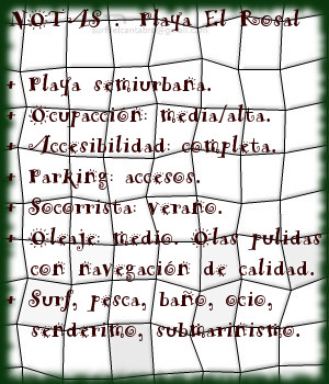
Icono Español. Icon Spanish. El Rosal, playa La playa El Rosal, también conocida como Tostadero, está situada en el municipio de San Vicente de la Barquera, en la costa occidental de Cantabria. Delimitada en su lado izquierdo por un espigón que separa el arenal de la Ría de San Vicente de la Barquera. Su longitud de 360 metros y anchura media de 60 metros disponen una pequeña área parcialmente protegida del oleaje.

Cuenta, su espigón, con un pequeño faro en el extremo final. Este punto, situado a 150 metros de la orilla, es conocido como el Farolillo. La zona dispone de otro malecón natural, el Islote de Peña Menor, que cubre totalmente al primero. Estas barreras naturales que preservan a la zona del Mar Cantábrico y filtran el oleaje que hasta allí llega, junto con las características del entorno ayudan a producir unas ondas especiales que abren sus alas a lo ancho para llegar posteriormente hasta el arenal.

Cuando las series de olas salvan los espigones, nace una ola que abre a ambos lados. De pendiente suave y prolongada, aparecen recorridos medios a derechas. Sí las condiciones son favorables la apertura izquierda de la onda puede alcanzar un trayecto mayor. La superficie pulida del agua, el rizamiento de la ola y el desplazamiento prolongado de las elevaciones que transportan las ondas consiguen crear olas cuyos parámetros son sólo valores que, en conjunto y después de surfear, hablan de la naturaleza del Cantábrico en esta parte de Cantabria.
Cabecera Cities Place Beaches. El Rosal, playa
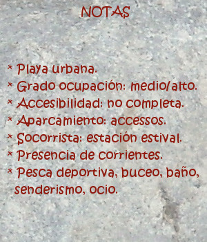
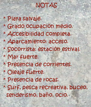
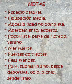
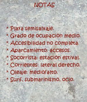
El Rosal, notas

El Rosal, playa

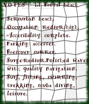
Icono Inglés. Icon English. El Rosal, beach The beach El Rosal, also known as Tostadero, is placed in the municipality of San Vicente de la Barquera, in the western coast of Cantabria. Delimited in its left side for a breakwater that separates the sandbank of the Stuary of San Vicente de la Barquera. Its length of 360 meters and average width of 60 meters arrange an small area partially protected from the surge.

It counts,its dyke,with an small beacon in the final end. This point placed to 150 meters of the shore, is known as el farolillo. The zone has another natural levee, Peña Menor Islet, which covers totally to the first one. These natural barriers that preserve to the zone of the Cantabrian Sea and leak the surge that comes up to there, together with the characteristics of the environment help to produce a few special waves that open its wings widthways; and will arrive later up to the sandbank.

When the series of waves overcomes the levees, there is born a wave that opens to both sides. Of soft and long slope, a medium distance tours that open to the right appear. If the conditions are favorable the left opening of the wave can reach a major distance. The polished surface of the water, the curling of the wave and the long displacement of the elevations that transport the waves manage to create waves which parameters are only values that as a whole and after surfing speak about the nature of the Cantabrian Sea in this part of Cantabria.

Cabecera Cities Place Beaches. El Rosal, beach
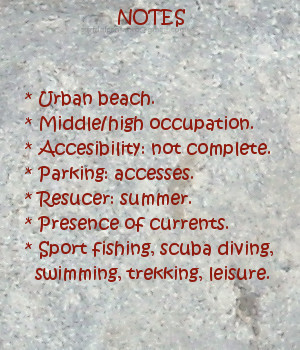
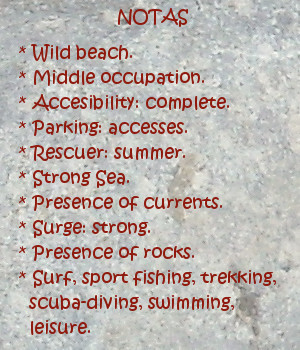
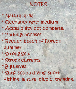
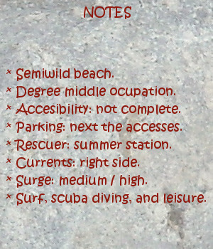
El Rosal, notes

Share

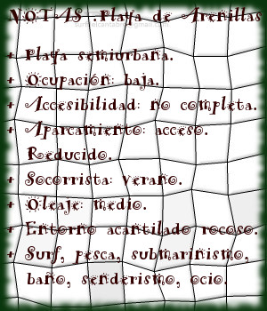
Playa de Arenillas. Islares

Icono Español. Icon Spanish. Playa de Arenillas, Islares La Playa de Arenillas está situada en la localidad de Islares, perteneciente al municipio de Castro Urdiales, en la costa oriental de Cantabria. Es una pequeña cala de 50 metros de longitud y anchura media aproximada de 15 metros que prácticamente queda cubierta con la marea alta.

Sus tranquilas aguas bañan el lado izquierdo de la Ensenada de Oriñón. El agua cristalina y su contorno rocoso hacen de la Playa de Arenillas una zona ideal para practicar submarinismo, cuando las condiciones del oleaje lo permiten. Recogida entre formaciones rocosas y protegida parcialmente, recibe las olas que llegan a la playa de Oriñón. El oleaje, ligeramente suavizado; respecto de la playa grande, mantiene una cadencia optima. Olas de menor tamaño, equilibradas y pulidas llegan a su orilla. Las ondas en Islares están condicionadas por Isla Cercada, que rompe las grandes masas de agua que entran a la ensenada, para reconstruir una forma reducida posteriormente. Con su fuerza limitada y pequeño recorrido favorecen las maniobras. Abren su avance hacia la derecha, teniendo los acantilados en frente, disponiendo la navegación a ambos lados. El lado derecho de la onda se extiende en dirección hacia Oriñón, acotado por la desembocadura del Río Agüera, interrumpe su recorrido a la entrada del arenal grande.

Localizada a los pies del macizo Cerredo, al cobijo de la curva rocosa que la contiene, se dispone la Playa de Arenillas. Un pequeño aparcamiento campestre hace de antesala a la pequeña cala que ofrece y regala ella sus aguas, sus olas, la vista panorámica del entorno espectacular y único en Cantabria. Caminantes y surfistas; al encuentro de la belleza que en ella comienza.

Cabecera Cities Place Beaches. Playa de Arenillas. Islares
Playa de Arenillas, Islares. Notas

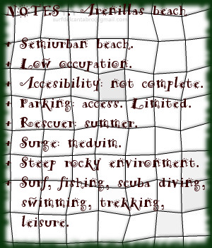
Arenillas beach. Islares

Icono Inglés. Icon English. Arenillas beach. Islares The Beach of Arenillas is placed in the locality of Islares, belonging to the municiplaity of Castro Urdiales, in the oriental coast of Cantabria. It is a small cove with 50 meters of length and average approximate width of 15 meters that practically remains covered with the high tide.

Its calm waters surround the left side of Oriñón’s Inlet. The crystalline water and its rocky contour do of the Beach of Arenillas an ideal zone to practise scuba diving, when the conditions of the surge allow it. Gathered between rocky formations and partially protected, it receives the waves that come to Oriñón’s beach. The surge, lightly smoothed; in relation to the big beach, it endures an ideal cadence. Waves of minor size, balanced and polished come to its shore. The waves in Islares are determined by Cercada Island, which breaks the big masses of water that enter to the inlet, to reconstruct a limited form later. With its limited force and small tour, them are suitable for the maneuvers. Them head its advance for the right, having the cliffs in front of them and opening the navigation to both sides. The right side of the wave spreads in direction towards Oriñón, annotated by the Agüera river mouth, interrupts its tour at the entrance of the big sandbank.

Located to the feet of the massif Cerredo, in the cover up of the rocky curve that contains it, arranges the Beach of Arenillas. An small rural parking does of anteroom to the small cove that offers and gives its waters, its waves, the panoramic sight of the spectacular and unique environment in Cantabria. Wayfarers and surfers; to the meeting of the beauty that in it begins.

Cabecera Cities Place Beaches. Arenillas beach. Islares
Arenillas beach, Islares. Notes

Share

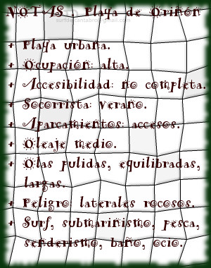
Oriñón, playa

Icono Español. Icon Spanish. Oriñón playa La playa de Oriñón está situada en el pueblo costero de Oriñón, perteneciente al municipio de Castro Urdiales, en la costa oriental de Cantabria. Sus dimensiones, un kilómetro de largo y anchura media aproximada de 100 metros, son uno de los atributos que forman parte de la playa. Situando el arenal sobre el plano, el resto de características va dimensionando y definiendo una singular y espectacular zona. Pues es la Ensenada de Oriñón un área de alto nivel para deportes acuáticos y el entretenimiento.

La separación entre los macizos de Cerredo y Candina forman la Ensenada de Oriñón que contiene a la playa. Proporcionan estos montes protección al arenal actuando como un filtro natural eólico. La Ría de Oriñón, situada en la desembocadura del Río Agüera, acota a la playa en su principio, y provoca que la diferencia entre las mareas altas y bajas hagan aparecer 500 metros de playa. En frente de Oriñón, el Mar Cantábrico. Salpicado de islotes y con la península La Punta de Sonabia, conocida como la Ballena, actuando de medio cierre. Esta configuración hace barrera y transforma el oleaje que llega a la ensenada.

Las olas que arriban a la playa de Oriñón son principalmente de izquierdas. La amplitud del banco de arena permite varios picos de olas, que en la zona central abren a ambos lados. La superficie pulida de las olas, su equilibrada pendiente y la longitud que pueden alcanzar éstas, hacen de la navegación una experiencia donde el mar penetra a través de los sentidos y la vista disfruta del entorno que recorre.

Cabecera Cities Place Beaches. Oriñón playa
Oriñón playa. Notas

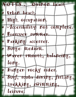
Oriñón, beach

Icono Inglés. Icon English. Oriñón, beach The beach of Oriñón is placed in the coastal village of Oriñón, belonging to the municipality of Castro Urdiales, in the oriental coast of Cantabria. Its dimensions, a kilometre of length and average approximate width of 100 meters, are one of the attributes that form a part of the beach. Placing the sandbank on the plane, the rest of characteristics measure and define a singular and spectacular zone. So it is the Inlet of Oriñón a high-level area for aquatic sports and the entertaiment.

The separation between the massifs of Cerredo and Candina form the Inlet of Oriñón that it contains the beach. These mounts provide protection to the sandbank acting as a natural wind filter. The Stuary of Oriñón, placed in the Agüera river mouth, encloses the beach in its beginning, and provokes the difference between the high and low tides that make appear 500 meters of beach. In front of Oriñón, the Cantabrian Sea. Splashed with islands and with the peninsula Tip of Sobania, known as the Whale, acting of half a closing. This configuration does barrier and transforms the surge that comes to the inlet.

The waves that arrive at Oriñón’s beach are principally of left sides. The extent of the sandbank is home to several beaks of waves, which in the central zone open to both sides. The polished surface of the waves, its balanced slope and the length that these can reach; it do of the navigation an experience where the Sea penetrates across the senses and the sight enjoys the environment that crosses.

Cabecera Cities Place Beaches. Oriñón, beach
Oriñó beach, Notes

Share

Isla, playa

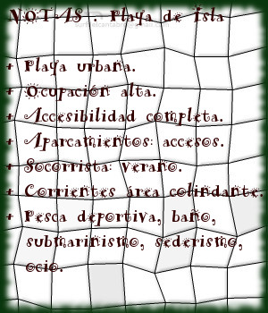
Icono Español. Icon Spanish. Isla, beach La playa de Isla, también conocida como playa del Sable, se encuentra en la localidad de Isla, perteneciente al municipio de Arnuero. Situada en la costa oriental de Cantabria, es un playa urbana de 150 metros de longitud y anchura media de 50 metros. Su belleza y emplazamiento hacen que tenga un alto grado de ocupación.

Su entorno rocoso, acantilado y urbanizado forman una simbiosis dirigida por la belleza de la naturaleza, del entorno y del paisaje final que componen todos estos elementos. El aparcamiento abundante, precede a la entrada al pequeño y singular arenal. Desde allí podemos recorrer el ala derecha que conforma la playa y la separa de la playa de los Barcos y la Ría de Quejo. Un pequeño paseo que ofrecerá un momento de contemplación para disfrutar del paisaje y las características de la playa. Ante los ojos del caminante, aparecen la extensión y lo indómito del Mar Cantábrico en esta parte de la costa cántabra. Perfilando la costa, tintadola de azul y blanco, el trasiego del mar a su encuentro con la orilla y las rocas.

A su lado izquierdo, otro acantilado la contiene. Separando la playa del mar abierto y protegiendo un espacio donde el agua cristalina arriba en calma a modo de piscina natural. Sus extremos, su arena, la calidad de sus aguas, el viento que sobre ella vuela, dejan entrever parte de su belleza, de su propia naturaleza.

Cabecera Cities Place Beaches. Isla, beach
Playa de Isla, Notas

Isla, beach

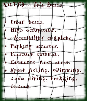
Icono Inglés. Icon English. Isla, beach The beach of Isla, also known as The beach of the Saber, is in the locality of Isla, belonging to the municipality of Arnuero. Placed on the oriental coast of Cantabria, it is an urban beach of 150 meters of length and average width of 50 meters. Its beauty and emplacement contributes to its high degree occupation.

Its rocky, steep and urbanized environment creates a symbiosis directed by the beauty of the nature, of the environment and of the final landscape that all these elements compose. The abundant parking, precedes at the entry to the small and singular sandbank. From there we can cross the right wing that shapes the beach and separates it from the beach of the Barcos and Stuary of Quejo. A small walk that will offer a moment of contemplation to enjoy the landscape and the characteristics of the beach. In front of the eyes of the wayfarer, will appear the extension and force of the Cantabrian Sea in this part of the Cantabrian coast. It outlines the coast, painting it with blue and white, the movement of the Sea to its meeting with the shore and rocks.

To its left side, another cliff contains it. Separating the beach of the open sea and preserves a space where the crystalline water arrives in calmness as a natural swimming pool. Its ends, its sand, the quality of its waters, the wind that flies over it, allow to guess part of its beauty, of its own nature.

Cabecera Cities Place Beaches. Isla, beach
Isla beach, Notes

Share

Oyambre, playa

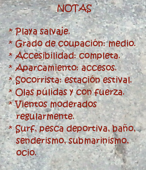
Icono Español. Icon Spanish. Oyambre, playa La playa de Oyambre está situada en el municipio de Valdáliga, emplazado en la costa occidental de Cantabria. Situada dentro del Parque Natural de Oyambre, es un extenso arenal de 1800 metros de longitud dispuestos en linea recta y curvando su ala izquierda por la morfología de su entorno dominado por acantilados. El extremo derecho continúa a través de la costa cántabra hasta perderse en el horizonte.

La entrada a la playa se realiza a través de un pequeño aparcamiento habilitado para 50 vehículos, aproximadamente. La contemplación de Oyambre produce en el caminante una sensación acogedora e intima, que contrasta con la amplitud y enormidad del entorno. Salvaje y naturalmente dibujada, es recorrida por el viento en toda su plenitud que la visita de forma casi regular. Su extensión se plasma por medio de una llanura de arena endurecida, con una leve pendiente hasta la orilla, a modo de invitación para conocer sus aguas. La playa de oyambre, por sus características, sirvió en el siglo pasado de pista de aterrizaje del llamado «Pájaro amarillo»; primer avión que cruzó el Océano Atlántico en una travesía de 29 horas. Esto da una idea de la singularidad del lugar.

Baña el Mar la costa y la playa, ondula suavemente el fondo arenoso por los efectos de las mareas y el oleaje. Aparecen las ondas en diversos picos de olas que existen en la playa. Su forma pulida y recorrido alargado,en la zona central, se combina con áreas donde estas recorren menor extensión y favorecen las maniobras. Golpea el Mar Cantábrico al surfista, iniciando así la navegación, naciendo su viaje sobre las olas. Travesía prolongada y colmada, pues a la energía que inyecta la velocidad se suma la pureza del agua, del aire, la belleza de la costa al fondo, que por sensaciones llegan a uno mismo y terminan por prender el fuego en el interior.

comic, mountain
Playa de Oyambre, notas

Oyambre, beach

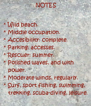
Icono Inglés. Icon English. Oyambre, beach The beach of Oyambre is placed in the municipality of Valdáliga, located in the western coast of Cantabria. Housed inside the Nature Reserve of Oyambre, it is an extensive sandbank of 1800 meters of length arranged on straight line; with a left wing curved because of the morphology of its environment dominated by cliffs. The right wing continues across the Cantabrian coast up to getting lost in the horizon.

The entry to the beach is realized across an small parking enabled for 50 vehicles, approximately. Oyambre’s contemplation produces in the wayfarer a cozy and intimate sensation, that contrasts with its length and enormity of its environment. Wild and naturally drawn, is crossed by the wind in all its fullness that visits it almost regularly. Its extension takes form by means of a plain of hard sand, with a slight earring up to the shore, as an invitation to know his waters. The beach of Oyambre, for its characteristics, was used int the last century as a runway of the so called yellow Bird; the first plane that crossed the Atlantic Ocean in a voyage of 29 hours. This gives an idea about the singularity of the zone.

The Sea bathes the coast and the beach, it waving softly the sandy bottom due to the effects of the tides and the surge. The waves appear in diverse beaks that exist in the beach. Its polished form and elongated tour, in the central zone, combines with areas where them are in less extension and allow the maneuvers. It strikes the Cantabrian Sea to the surfer, initiating in this way the navigation, borning his trip on the waves. Long and fulfilled voyage, because at the energy that injects the speed is added the purity of the water, of the air, the beauty of the coast in the background, which through its sensations come to oneself and them end for lighting the fire inside.

comic, mountain
Oyambre beach, notes

Share

La Maruca, lugar

Icono Español. Icon Spanish. la maruca lugar La Maruca es una ensenada natural ubicada en la desembocadura del Arroyo de la Tejona o Ría de San Pedro del Mar. Emplazada en la costa norte de la ciudad de Santander en el barrio de Monte, su forma de «L» invertida alberga un pequeño puerto pesquero, la playa de la Maruca y los acantilados que acompañan al Mar Cantábrico hasta su encuentro con la ensenada.

Dispone de un paseo marítimo que se ocupa toda su extensión, dando acceso a una zona amplia de aparcamientos, restaurantes, y al Centro de Interpretación del Litoral; museo dedicado al mar. Antigua zona de pescadores, en el centro de la ensenada se erige la estatua de un pescador, homenaje a la gente del mar que puebla el barrio de Monte.

La playa de la Maruca es de arena fina, abundante en rocas, de irregular y original forma, es apta para el baño y el recreo. La pesca deportiva y el submarinismo encuentran en esta zona condiciones naturales ideales. El fondo rocoso y arenoso,junto con la proximidad del mar abierto, contribuyen al enriquecimiento de los fondos marinos y la abundancia de especies de peces, a lo que se suma la presencia ocasional de focas y delfines.

comic, mountain
La Maruca lugar, notas

La Maruca, place

Icono Inglés. Icon English La Maruca is a natural inlet located in the mouth of the Creek of La Tejona or Stuary of San Pedro del Mar. Located on the north coast of the city of Santander, in Monte’s neighborhood, its form of «L» reversed shelters an small fishing port, the beach of the Maruca and the cliffs that accompany the Cantabrian Sea up to its meeting with the inlet.

It has a promenade that extends across all its area, leading to a wide zone of parkings, restaurants, and to the Center of Interpretation of the Littoral; museum dedicated to the sea. Fishermen’s ancient zone, in the center of the inlet the statue of a fisherman is raised, honoring to the people of the sea who populates Monte’s neighborhood.

The beach of the Maruca is of thin sand, abundant in rocks, of irregular and original form, it is suitable for swimming and the entertainment. The sports fishing and the scuba diving find in this zone a natural ideal conditions. The rocky and sandy bottom, together with the proximity of the open sea, contribute to the enrichment of the sea beds and the abundance of species of fish, plus the occasional presence of seals and dolphins.

comic, mountain
La Maruca place, notes

Share

Galizano, playa

Icono Español. Icon Spanish. Galizano beach Galizano es una localidad cántabra, perteneciente al municipio de Ribamontán al Mar. Situado junto a la Ría la Canal, desembocadura del río Herrera, esta configuración ha formado la playa de Galizano, también llamada de San Miguel o de la Canal.

Los acantilados que presenta la costa de Galizano tienen vegetación abundante y fondo marino rocoso. El fuerte oleaje que llega a la zona convierte la practica del surf en una actividad sólo recomendada para surfers experimentados. La longitud de la playa es de 150 metros. Su irregular y original forma, dibujada por la ría que traza el camino del arenal entre los acantilados que la rodean hasta alcanzar el mar, tiene una anchura media de 100 metros, que en bajamar permite el acceso a pequeñas calas.

Es su entorno salvaje propicio para realizar rutas de senderismo que se extienden hasta Langre; hacia el oeste y Ajo; hacia el este. El trayecto transcurrirá repleto de estímulos. Acantilados verticales y estratificados, golpeados en su base por el mar, hablan de la historia del tiempo escrita su piel. Montes y montañas, cuevas, arrecifes rocosos,… hacen de la pesca recreativa y el buceo actividades completas, regalando en cada ocasión una nueva experiencia.

comic, mountain
Galizano playa, notas

Galizano, beach

Icono Inglés. Icon English. Galizano playa Galizano is a Cantabrian locality, belonging to the municipality of Ribamontán al Mar. Placed next to the rivermouth La Canal, which is the end of the river Herrera, this configuration has formed Galizano’s beach, also call San Miguel or La Canal.

The cliffs that Galizano’s coast presents have abundant vegetation and rocky sea bottom. The strong surge that comes to the zone turns the practice of the surf into an activity only recommended for surfers experienced. The length of the beach is 150 meters. Its irregular and original form, drawn by the rivermouth that plans the way of the sandbank between the cliffs that surround it up to reaching the sea, it has an average width of 100 meters, which in low tide allows the access to small coves.

It is its wild environment, propitious to realize trekking routes that spread up to Langre; towards the west and Ajo; eastward. The journey will pass replete with stimuli. Cliffs vertical and stratified , struck in its base for the sea that speak about the history of the time written in its skin. Mounts and mountains, caves, rocky reefs… that do of the recreative fishing and the scuba-diving; complete activities, giving in every occasion a new experience.

comic, mountain
Galizano beach, notes

Share

Isla de Santa Marina, lugar

Icono Español. Icon Spanish. Loredo beach La Isla de Santa Marina se encuentra al final del extenso arenal que une Somo con Loredo. En frente de la costa, separada de tierra firme por apenas 50 metros en marea baja, está una isla que tiene una extensión de 18,5 hectáreas. Formada por rocas y cubierta parcialmente de vegetación, convive con el Mar Cantábrico que la baña, golpea y moldea. Su contorno submarino se halla cubierto por rocas y pequeños arrecifes, propiciados por el efecto del mar y el clima.
El brazo de mar que la separa de la costa tiene corrientes fuertes y peligrosas, constituyendo una zona de gran interés para la práctica de la pesca recreativa y el submarinismo. Aparecen, a partir de esa separación, dos zonas diferentes en la isla que originan dos grandes olas. En la cara de la Santa Marina que mira a la Bahía de Santander, aparece una ola que abre a derechas. Cuando las condiciones del océano se endurecen, esta ola supera con facilidad los cinco metros de altura. Las factores extremos de la mar, el fondo rocoso y las corrientes hacen que la ola sólo sea aconsejada para profesionales y gente muy experimentada. En el otro lado la isla, que saluda a mar abierto, aparece una ola que abre a izquierda cuyo tamaño puede superar también los cinco metros de altura con las condiciones adecuadas. A mayor distancia de la costa, prácticamente en alta mar, las condiciones se endurecen aún más, siendo sólo apto para profesionales y gente experimentada consciente de los riesgos.

El parking que se sitúa en frente de la isla, en posición elevada, proporciona una visión panorámica de la bahía y el entorno. Desde allí se abren dos sendas que llegan por la izquierda hasta la playa de Loredo y por la derecha hasta la playa de Langre. Caminos que avanzan paralelos a la línea de costa. Acantilados y otras formaciones geológicas además de la flora y fauna existentes en los bosques cercanos acompañarán el recorrido.

Es Santa Marina una isla singular, no sólo por ser la más extensa de la costa cantábrica, pues proporciona experiencias a cualquier persona, deportista o caminante, que a ella se acerque.

comic, mountain
SantaMarina, notas

Santa Marina Island, place

Icono Inglés. Icon English. Loredo beach Santa Marina Island is placed at the end of the extensive sandbank that joins Somo with Loredo. Opposite the coast, separated from firm land by scarcely 50 meters in low tide, there is an island that has an extension of 18,5 hectares. Formed by rocks and covered partially of vegetation, it coexists with Cantabrian Sea that bathes, throbs and molds it. Its submarine contour is covered by rocks and small reefs propitiated by the effect of the sea and the climate. The inlet that separates it from the coast has strong and dangerous currents, constituting a zone of great interest for the recreative fishing and the scuba diving. Two different zones appear in the island, from this separation, that originate two big waves. In the face of the Santa Marina Island that looks towards the Bay of Santander, there appears a wave that opens to right. When the conditions of the ocean harden, this wave overcomes with facility five meters of height. Extreme conditions of the sea, the rocky bottom and the currents do that the wave only would be recomended for professionals and very experienced surfers. In the other side of the island, which greets to open sea, appears a wave that opens to left side which size can overcome also five meters of height with the suitable conditions. To major distance of the coast, practically on the high sea, the conditions harden even more, being only suitable for professionals and experienced conscious surfers of the risks.

The parking that is in front of the island, in high position, provides a panoramic vision of the bay and the environment. From there, two paths begin its travel; that come for the left side up to Loredo’s beach and for the right up to Langre’s beach. Routes that advance parallel to the line of coast. Cliffs and other geological formations besides the existing flora and fauna in the nearby forests will accompany the tour.

A singular island is Santa Marina, not only for being the most extensive of the Cantabrian coast, since it provides experiences to any person, sportsman or wayfarer, who approach it.

comic, mountain
SantaMarina, notes

Share

Langre, playa

Icono Español. Icon Spanish. Langre beach La playa de Langre se ubica en la localidad de Langre, perteneciente al municipio de Ribamontán al mar. Esta localidad costera, se encuentra con el mar a través de sus acantilados que se extienden varios kilómetros. El arenal tiene una longitud aproximada de 800 metros y una anchura media de 60 metros. A su espalda un acantilado, con forma de media luna achatada y de 25 metros de altura, la contiene en su totalidad. En sus alas, la línea de costa entra en el mar a modo de cabo, completando un entorno único de singular belleza. A la izquierda la Punta de Langre protege la ensenada, a la derecha la Punta Rodico delimita su extensión final. La fisonomía del lugar acota la playa de Langre y filtra el oleaje parcialmente, pues no pierde el Mar Cantábrico su naturaleza salvaje; sino que se transforma y renace. Existen así olas diferentes en todo el área, conservando una zona de aguas tranquilas en su lado izquierdo, bajo la protección del acantilado.

comic, mountain
Langre, Notas

Langre, beach

Icono Inglés. Icon English. Langre beach The beach of Langre is located in the locality of Langre, belonging to the municipality of Ribamontán al Mar. This coastal locality, meets the sea across its cliffs that several kilometres spread. The sandbank has an approximate length of 800 meters and a width of 60 meters. To its back, the cliff with form of flattened half moon and of 25 meters of height, contains it. In its wings, the line of coast enters in the sea as a cape, completing an special environment of singular beauty. To the left side the Tip of Langre protects the inlet, to the right the Rodico Tip delimits its end extension. The local physiognomy annotates Langre’s beach and leaks the surge partially, because the Cantabrian sea does not lose its wild nature; but it is transformed and reborn. So different waves exist in the area, preserving a zone of calm waters in its left side, under the protection of the cliff.

comic, mountain
Langre, Notes

Share

Puerto Calderón, acceso

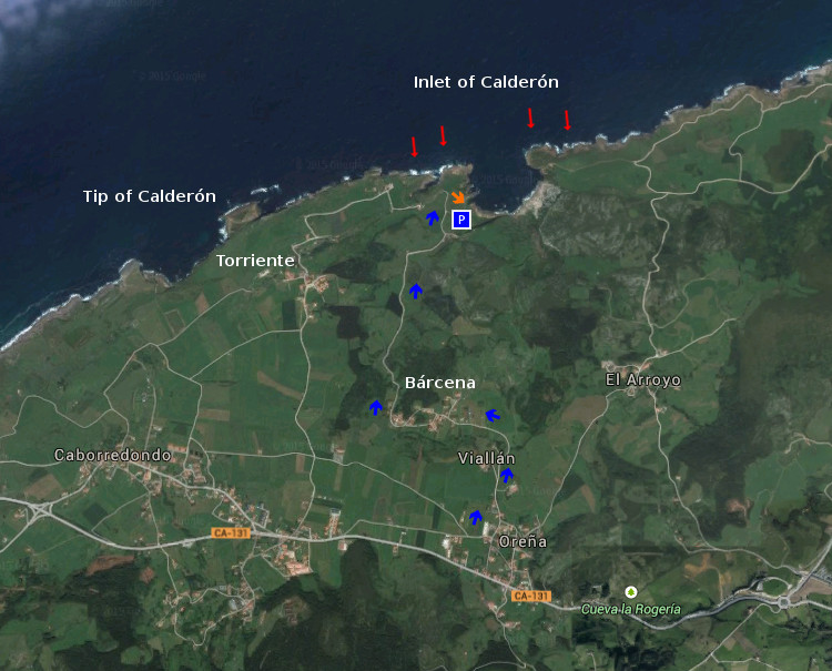
Icono Español. Icon Spanish. Puerto Calderón, acceso El Puerto de Calderón es una ensenada natural situada en el municipio de Alfoz de Lloredo. Rodeada de acantilados y con un pequeño muelle en su base, cuenta con unas condiciones idóneas para practicar submarinismo. El ocio, la pesca y el entretenimiento adquieren mayor significado en este marco incomparable. Tiene un único acceso, a través de la carretera que llega desde el pueblo de Bárcena hasta la ensenada. Donde termina la carretera, hay un pequeño aparcamiento situado a 100 metros de la entrada.

Calderón Port, access

Icono. Icon. Calderón Port, access The Port of Calderón is a natural inlet placed in the municipality of Alfoz de Lloredo. Surrounded with cliffs and a small wharf in its base, it possesses suitable conditions to practise . The leisure, the fishing and the entertainment acquire major meaning in this incomparable frame. There is one only access, across the road that comes from the town of Bárcena up to the inlet. Where the road finishes, there is a small parking placed to 100 meters of the entry.

Icono español-inglés. Icon Spanish-English. Calderón Puerto, Port; acceso/access Acceso/Beach Access

Puerto Calderón, Calderón Port, inlet

Share