Monthly Archives: noviembre 2016

Miengo, villa
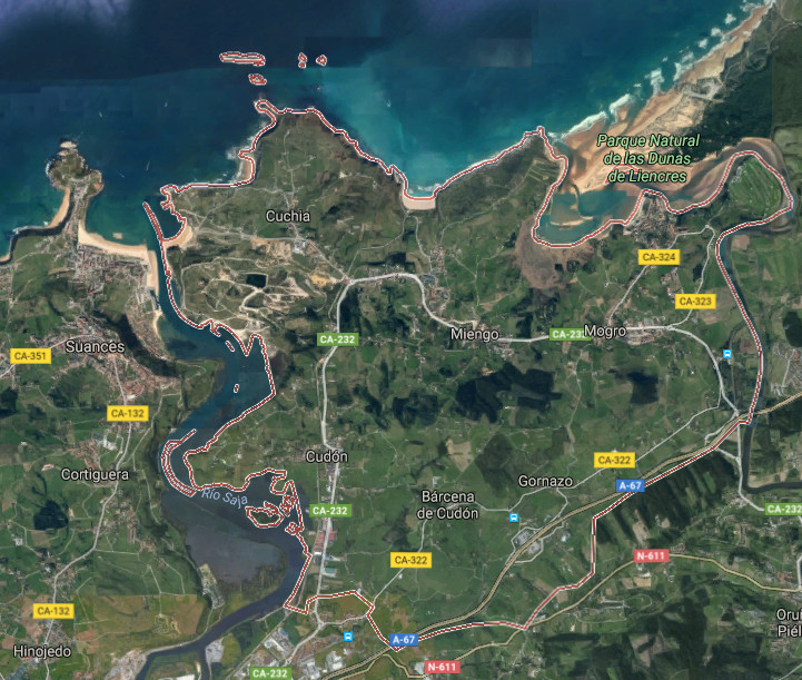
![]() Miengo es un municipio y localidad situado en la costa central de Cantabria. Limitando al oeste con Suances y al este con Santa Cruz de Bezana, se encuentra en las proximidades de la ciudad de Santander. Pertenecen a su municipalidad las siguientes localidades: Barcena de Cudón, Cuchía, Cudón, Gornazo, Mogro y Miengo; capital del ayuntamiento.
Miengo es un municipio y localidad situado en la costa central de Cantabria. Limitando al oeste con Suances y al este con Santa Cruz de Bezana, se encuentra en las proximidades de la ciudad de Santander. Pertenecen a su municipalidad las siguientes localidades: Barcena de Cudón, Cuchía, Cudón, Gornazo, Mogro y Miengo; capital del ayuntamiento.
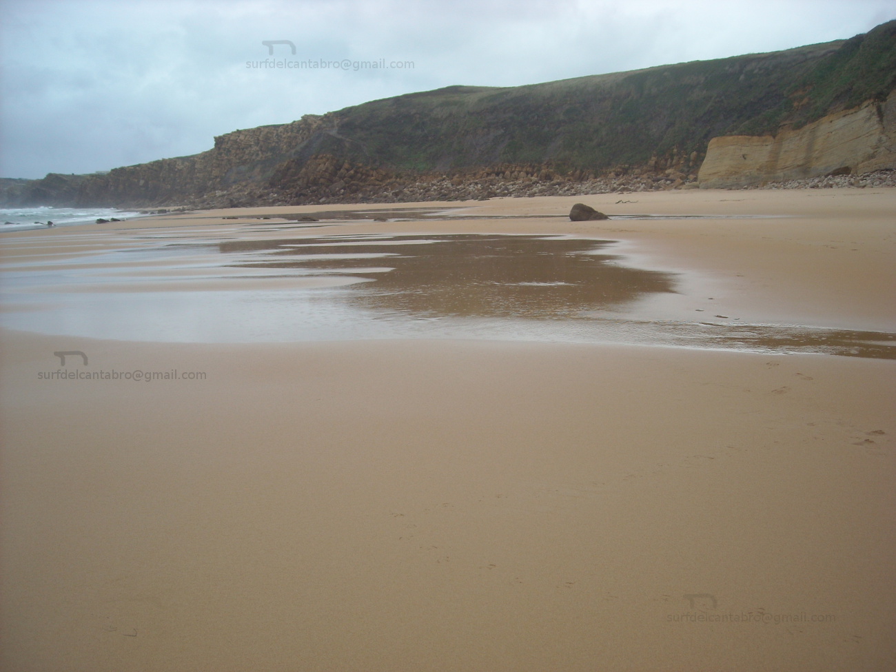
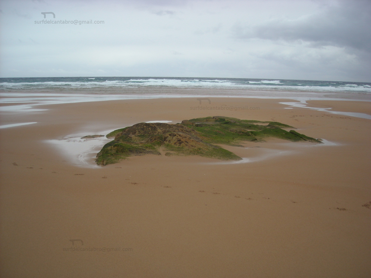
Su emplazamiento, ubicado en una zona de transito entre dos grandes ciudades; Santander y Torrelavega, lo comunican por carretera nacional y autovía, existiendo además líneas regulares de trenes y autobuses hacia ambas urbes. Los atractivos turísticos cercanos no merman los propios del municipio que debido a su orografía y costa tintan la mirada y la estancia de un singular tono. Las playas de Cuchía, Los Caballos, Usgo, Robayera y Usil, distribuidas a lo largo del litoral menicense, se entremezclan con pequeñas calas, acantilados e islas. El irregular dibujo costero que dispone multitud de orientaciones en sus localizaciones y la naturaleza salvaje del Mar Cantábrico, diseñan paisajes erosionados; esculpidos a través del tiempo. Las islas de: los Conejos, Pasiega, Casilda, Segunda y Solita forman parte de su patrimonio y dan testimonio de la arcaica línea de costa.
El territorio que avanza tierra adentro, es acotado por el Río Saja en el extremo Oeste y el Río Pas en el Este. La Ría de Mogro, desembocadura del Pas, nutre y amplía el Parque Natural de Las Dunas de Liencres. Otro ingrediente de la villa es el patrimonio arquitectónico que se divide entre construcciones religiosas, como el Santuario de la Virgen del Monte o la Iglesia de San Juan Bautista, y construcciones civiles; destacando el Palacio de los Herrera o de la Dehesa.
![]() Miengo is a municipality and locality placed in the central coast of Cantabria. Delimiting in the western part with Suances and Santa Curz de Bezana in the eastern side, it is in the proximities of the city of Santander. The following localities belong to its township: Barcena de Cudón, Cuchía, Cudón, Gornazo, Mogro and Miengo; the capital of the town.
Miengo is a municipality and locality placed in the central coast of Cantabria. Delimiting in the western part with Suances and Santa Curz de Bezana in the eastern side, it is in the proximities of the city of Santander. The following localities belong to its township: Barcena de Cudón, Cuchía, Cudón, Gornazo, Mogro and Miengo; the capital of the town.
Its emplacement located in a zone of traffic between two big cities; Santander and Torrelavega, communicates it by national road and highway, existing in addition regular lines of trains and buses towards both cities. The tourist nearby attractions do not reduce the own ones of the municipality that due to its orography and coast dye the look and the stay of a singular tone. The beaches of Cuchía, Los Caballos, Usgo, Robayera and Usil distributed along the littoral menicense, intermingle with small coves, cliffs and islands. The irregular coastal drawing that arranges multitude of orientations in its locations and the wild nature of the Cantabrian Sea, design eroded landscapes; sculpted across the time. The islands of: Los Conejos, Pasiega, Casilda, Segunda and Solita form a part of its heritage and give testimony of the archaic coastline.
The territory that advances land in, is annotated by the Saja River in the extreme West and the Pas River in the East. The Stuary of Mogro, river mouth of the Pas, nourishes and extends the Nature reserve of Liencres’s Dunes. Another ingredient of the villa is the architectural heritage that is divided between religious constructions, as the Sanctuary of the Virgin del Monte or the Church of San Juan Bautista, and civil constructions; emphasizing the Palace of the Herrera or the Dehesa.
![]()

 Miengo, village

Piélagos, villa
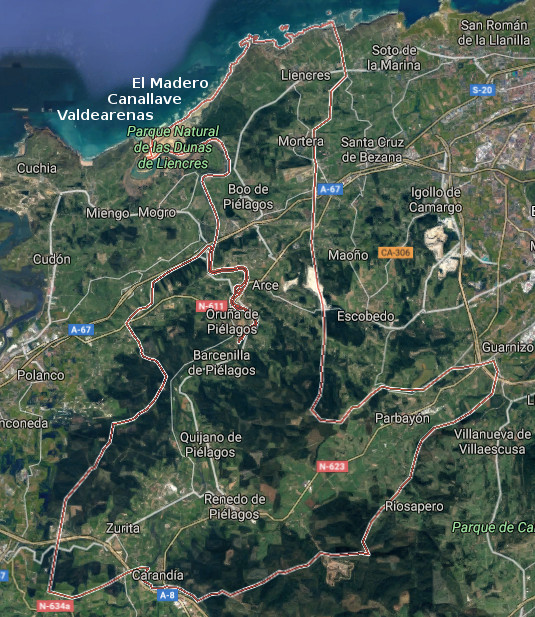
![]() El municipio de Piélagos se encuentra emplazado en la costa central de Cantabria. Ocupando la zona oeste de esta parte del litoral, está compuesto por las siguientes localidades : Arce, Barcenilla, Boo, Carandía, Liencres, Mortera, Oruña, Parbayón, Quijano, Vioño de Piélagos, Zurita y Renedo de Piélagos; capital del municipio.
El municipio de Piélagos se encuentra emplazado en la costa central de Cantabria. Ocupando la zona oeste de esta parte del litoral, está compuesto por las siguientes localidades : Arce, Barcenilla, Boo, Carandía, Liencres, Mortera, Oruña, Parbayón, Quijano, Vioño de Piélagos, Zurita y Renedo de Piélagos; capital del municipio.
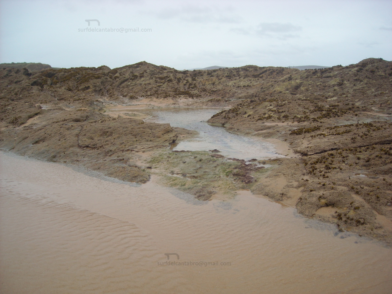
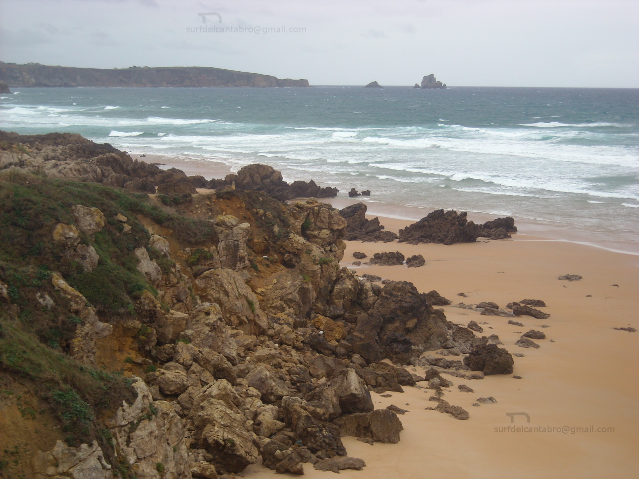
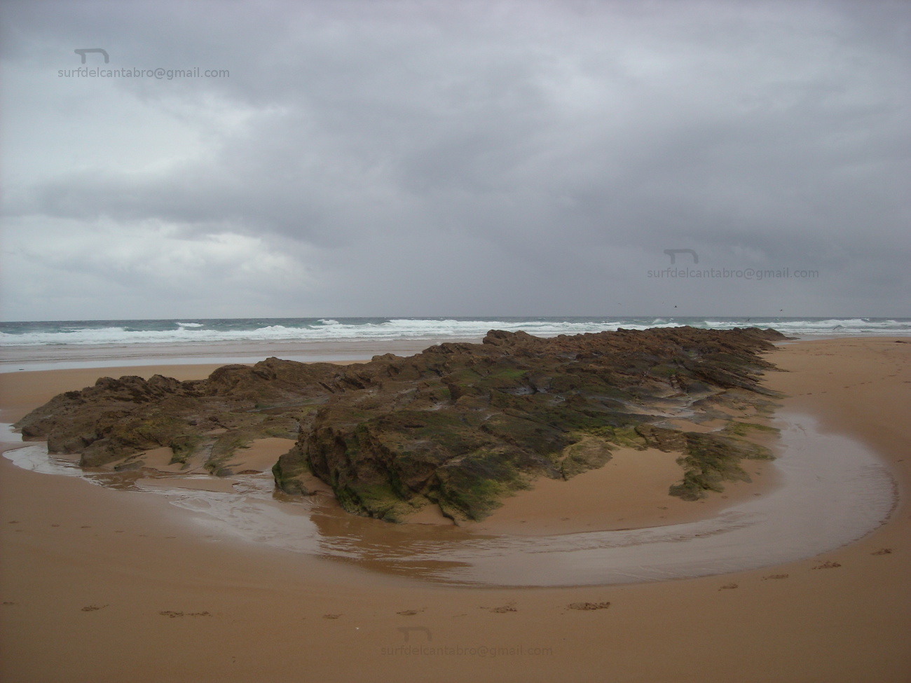
La costa de Piélagos, accesible desde la localidad de Liencres, comprende parte de la Costa Quebrada y las playas de Valdearenas y Canallave. El margen que saluda al océano recibe la fuerza del Mar Cantábrico que la moldea y configura su diseño. La presencia de corrientes y vientos que registran los arenales acompañan la navegación, el paseo; coloreando la naturaleza salvaje del entorno. Los acantilados se suceden a través del sendero, apareciendo pequeñas calas accesibles en marea baja.
El territorio, habitado desde la prehistoria, dispone de varios yacimientos arqueológicos y cuevas rupestres como las de Santián o Covalejos. Destacan en todas las localidades del municipio la presencia de casas de arquitectura montañesa, hechas de piedra y madera, con un balcón típico en su frente y doble arco de entrada a la vivienda. La expresión arquitectónica presente en el municipio de Piélagos recorre varios siglos de historia. la Torre de Velo del siglo XIV, el Palacio del Marqués de la Conquista Real del siglo XVII, el Palacio de los Condes de Mortera y el Palacio de Montalbán; ambos del siglo XIX, son ejemplos indicativos de la variada muestra que vamos a encontrar.
![]() The municipality of Piélagos is located on the central coast of Cantabria. Occupying the west zone of this part of the littoral, it is composed by the following localities: Arce, Barcenilla, Boo, Carandía, Liencres, Mortera, Oruña, Parbayón, Quijano, Vioño de Piélagos, Zurita and Renedo de Piélagos; the capital of the municipality.
The municipality of Piélagos is located on the central coast of Cantabria. Occupying the west zone of this part of the littoral, it is composed by the following localities: Arce, Barcenilla, Boo, Carandía, Liencres, Mortera, Oruña, Parbayón, Quijano, Vioño de Piélagos, Zurita and Renedo de Piélagos; the capital of the municipality.
The coast of Piélagos, accessible from the locality of Liencres, covers part of the Quebrada Coast and the beaches of Valdearenas and Canallave. The margin that greets the ocean receives the force of the Cantabrian Sea that molds and forms its design. The presence of currents and winds that register the sandbanks accompany the navigation, the walk; coloring the wild nature of the environment. The cliffs take place across the path, appearing small accessible coves in low tide.
The territory, populated from the prehistory, has several archaeological deposits and caverns as the cave of Santián or Covalejos. Stand out in all the localities of the municipality the presence of houses of mountain architecture, made of stone and wood, with a typical balcony in its forehead and double arch of entry to the housing. The architectural expression present in the municipality of Piélagos crosses several centuries of history. The Tower of Velo of the 14th century, the Palace of the Marquess of the Royal Conquest of the 17th century, the Palace of the Counts of Mortera and Montalbán’s Palace; both of the 19th century, are indicative examples of the varied sample that we are going to find.
![]()

Piélagos, village
Santa Cruz de Bezana, villa
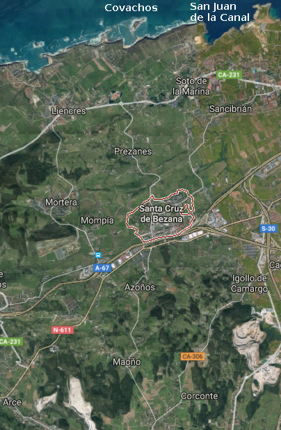
![]() Santa Cruz de Bezana es una localidad y municipio emplazado en la costa central de Cantabria. Situado junto a la ciudad de Santander, el municipio comprenden las siguientes localidades : Maoño, Azoños, Mompía, Prezanes, Soto de la Marina, Sancibrián y Bezana; la capital del municipio.
Santa Cruz de Bezana es una localidad y municipio emplazado en la costa central de Cantabria. Situado junto a la ciudad de Santander, el municipio comprenden las siguientes localidades : Maoño, Azoños, Mompía, Prezanes, Soto de la Marina, Sancibrián y Bezana; la capital del municipio.
La villa hunde si historia en el tiempo, corroborado por restos prehistóricos y diversos útiles encontrados en el municipio. Destacan, como presencia singular, varios cilindros de mampostería de cierta altura utilizados antaño para el cultivo de parras y la obtención de vino. Dos casonas blasonadas del siglo XVII y la Iglesia Parroquial de Bezana, de estilo neogótico, componen una muestra de la arquitectura y vida del lugar. Siendo una zona residencial en la actualidad su diseño y estética forman una composición que combina pasado y presente de forma natural. Debido a su proximidad a la capital cántabra, dispone de todos los servicios y conexiones por tren o carretera.
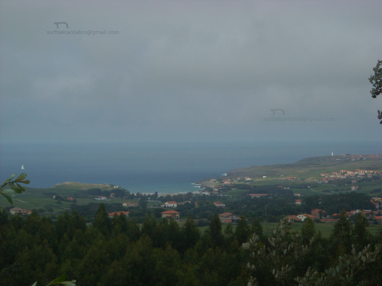
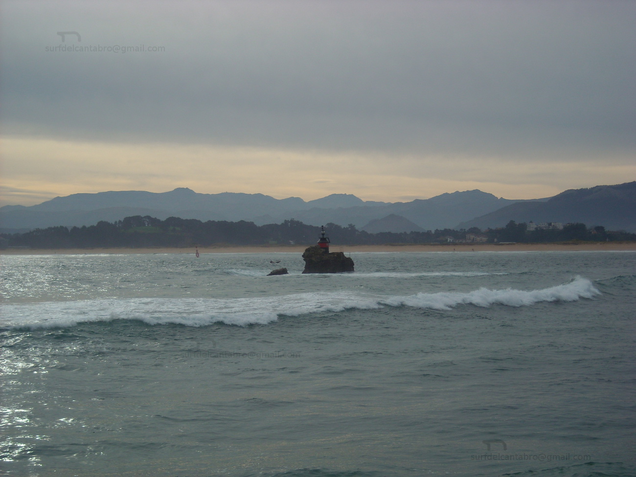
Las playas de Covachos y San Juan de la Canal, situadas en el extremo Oeste de la costa quebrada, conectan Santa Cruz de Bezana con el Mar Cantábrico a través de sus arenales, acantilados, urros e islotes, plasmando una imagen cuya plasticidad conserva una tonalidad única.
Santa Cruz de Bezana, village
![]() Santa Cruz de Bezana is a locality and municipality sited in the central coast of Cantabria. Placed close to the city of Santander, the municipality is formed by the following localities: Maoño, Azoños, Mompía, Prezanes, Soto de la Marina, Sancibrián and Bezana; the capital of the municipality.
Santa Cruz de Bezana is a locality and municipality sited in the central coast of Cantabria. Placed close to the city of Santander, the municipality is formed by the following localities: Maoño, Azoños, Mompía, Prezanes, Soto de la Marina, Sancibrián and Bezana; the capital of the municipality.
The villa sinks its history in the time, corroborated by prehistoric and diverse useful remains found in the municipality. Stand out, as singular presence, several cylinders of masonry with certain height used long ago for the growing of grapevines and the obtaining wine. Two emblazoned mansions about the 17th century and the Parochial Church of Bezana, about Neogothic style, compose a sample of the architecture and local life. Being a residential zone at present its design and aesthetics form a composition that combines past and present in natural way. Due to its proximity to the Cantabrian capital, it has all the services and connections for train or road.
The beaches of Covachos and San Juan of the Canal, placed in the West extreme of the broken coast, connect Santa Cruz de Bezana with the Cantabrian Sea across its sandbanks, cliffs, sea-rocks and islands, forming an image which plasticity preserves a singular tonality.
![]()

Santa Cruz de Bezana, village