
Comillas, villa
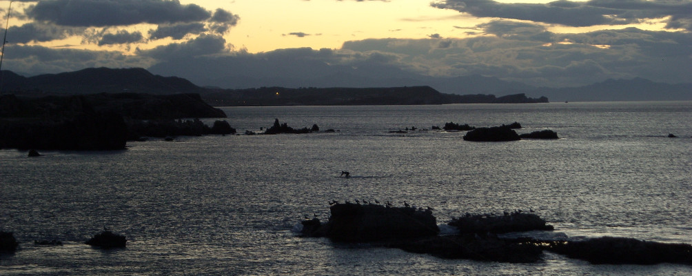
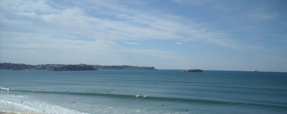
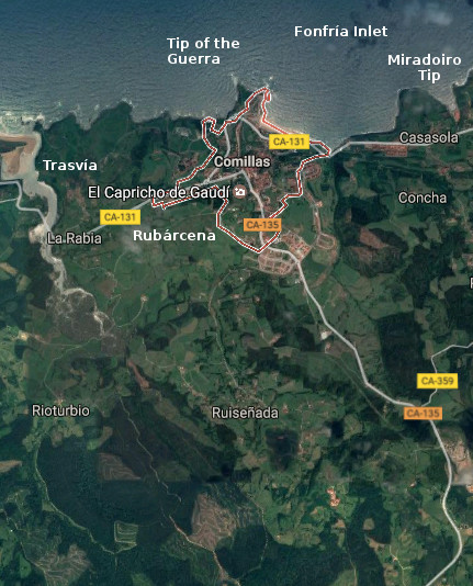
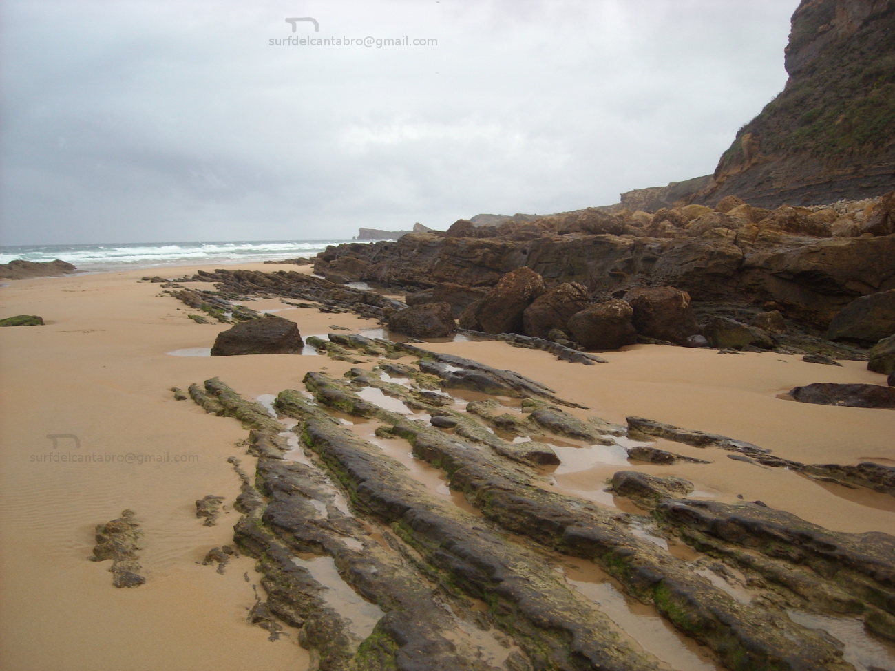
![]() Comillas, villa y municipio situado en la costa occidental de Cantabria, dispone de un variado litoral con irregular forma. Los cabos Punta de la Guerra y Punta del Miradoiro contiene la Ensenada de Fonfría. EL puerto pesquero, la playa de Comillas y los acantilados son algunos de los atractivos de su costa que junto con el Paseo Marítimo, redondean una bella imagen de gratificante contemplación en cualquiera de los puntos de su recorrido. Las localidades que componen el municipio son: La Rabia, Rioturbio, Rubárcena, Ruiseñada, Trasvía y Comillas; capital de la circunscripción.
Comillas, villa y municipio situado en la costa occidental de Cantabria, dispone de un variado litoral con irregular forma. Los cabos Punta de la Guerra y Punta del Miradoiro contiene la Ensenada de Fonfría. EL puerto pesquero, la playa de Comillas y los acantilados son algunos de los atractivos de su costa que junto con el Paseo Marítimo, redondean una bella imagen de gratificante contemplación en cualquiera de los puntos de su recorrido. Las localidades que componen el municipio son: La Rabia, Rioturbio, Rubárcena, Ruiseñada, Trasvía y Comillas; capital de la circunscripción.
La abundancia de cuevas, debido a su orografía, que cuentan con pinturas y útiles dan testimonio de la presencia de pobladores desde la prehistoria. Destacan la Cueva de la Meaza, la Cueva de Portillo y el castro de la Peña del Castillo. La Mina Numa situdada en la localidad de Ruiseñada, explotada desde la antiguedad conserva restos de la época romana. Los documentos más antiguos que asientan la historia de Comillas datan del siglo XI, a partir de aquí se entremezcla el desarrollo de la villa, las artes, oficios y su desarrollo arquitectónico jalonando siglo a siglo. La industria ballenera, la torre de Garcilaso I de la Vega (conocida como el Torreón), el desarrollo del puerto, la Iglesia parroquial que cuenta con reconstrucciones en diferentes épocas, son algunos de los episodios históricos que se han escrito en la villa de Comillas.
En la actualidad la arquitectura modernista realizada en el siglo XIX constituye la muestra más visible de su patrimonio. El Palacio de Sobrellano, El Capricho de Gaudí y La Universidad Pontificia de Comillas son las singularidades que coronan la belleza asentada desde el pavimento de sus calles, colinas y prados, la particular configuración de su territorio que dio origen a su nombre.
![]() Comillas, village and municipality placed in the western coast of Cantabria, has a varied littoral with irregular form. The capes: Tip of the Guerra and Tip of the Miradoiro contains the Inlet of Fonfría. The fishing port, the beach of Comillas and the cliffs are some of the attractives of its coast, that combined with the Maritime Promenade, round up a beautiful image of gratifying contemplation in any of the points of its tour. The localities that compose the municipality are: La Rabia, Rioturbio, Rubárcena, Ruiseñada, Trasvía and Comillas; capital of the circumscription.
Comillas, village and municipality placed in the western coast of Cantabria, has a varied littoral with irregular form. The capes: Tip of the Guerra and Tip of the Miradoiro contains the Inlet of Fonfría. The fishing port, the beach of Comillas and the cliffs are some of the attractives of its coast, that combined with the Maritime Promenade, round up a beautiful image of gratifying contemplation in any of the points of its tour. The localities that compose the municipality are: La Rabia, Rioturbio, Rubárcena, Ruiseñada, Trasvía and Comillas; capital of the circumscription.
The abundance of caves, due to its orography, which possess paintings and useful that give testimony of the settlers’ presence from the prehistory. Stand out the Cave of the Meaza, the Cave of Portillo and the Celtic fortification of the Peña del Castillo. The Mine Numa placed in Ruiseñada’s locality, exploited since anciente times preserv rests of the Roman epoch. The most former documents that agree the history of Comillas date back to the 11th century, from here there intermingles the development of the villa, the arts, trades and its architectural development marking century a century. The whaler industry, the tower of Garcilaso I de la Vega (known as the Torreón), the development of the port, the parochial Church that possesses reconstructions in different epochs, are some of the historical episodes that have been written in the village of Comillas.
At present, the modernist architecture realized in the 19th century constitutes the most visible sample of its heritage. The Palace of Sobrellano, The Caprice of Gaudí and The University Pontificia of Comillas are the singularities that crown the beauty seated from the pavement of its streets, hills and meadows, the particular configuration of the territory that gave origin to its name.
![]()

 Comillas, village

Cobreces, villa
![]()
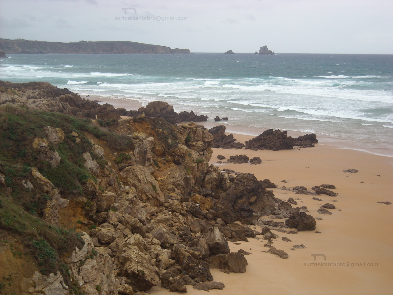
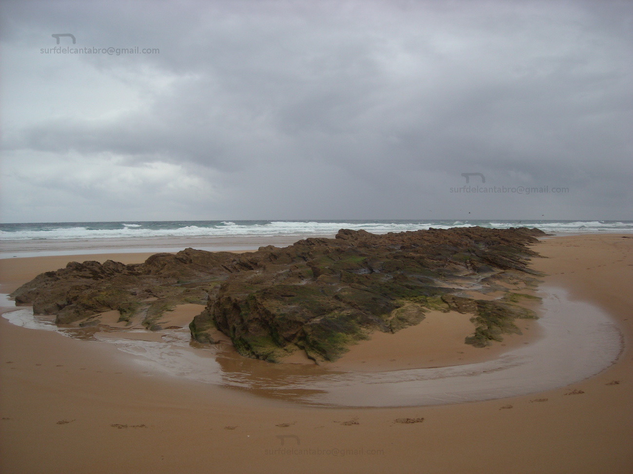
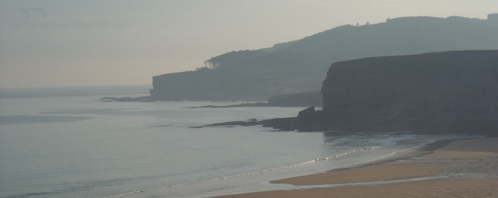
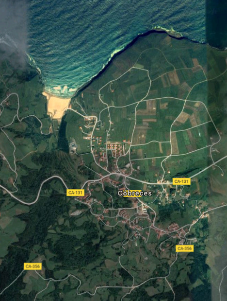
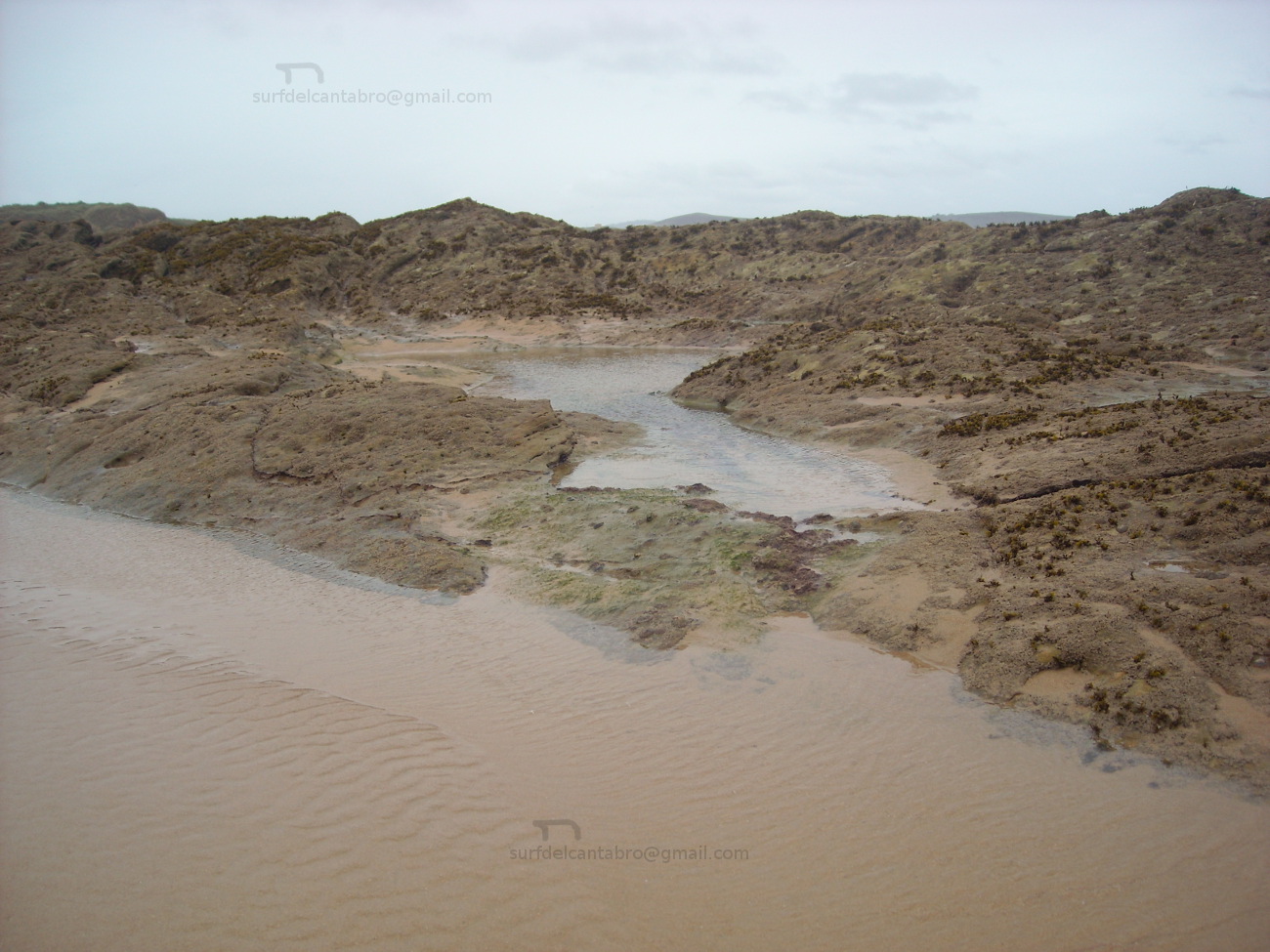
Cóbreces es una pequeña localidad costera perteneciente al municipio de Alfoz de Lloredo. Emplazado en la costa occidental de Cantabria, su núcleo urbano dista apenas 500 metros de la playa de Luaña. La configuración del litoral, en esta zona, abre una ensenada que termina desembocando en el arenal. El entorno acompaña a su singularidad. Conserva un estado natural semisalvaje, rodeado de praderas, colinas,acantilados y bosques.
Los orígenes de la villa se remontan al siglo X. El testimonio y registro de su historia es el patrimonio arquitectónico. La arquitectura civil destaca con edificios como el Palacio de Villegas, Casal de Castro y el Instituto Agrícola Práctico Quirós; edificio construido en el siglo XX sobre la antigua casa del linaje de Quirós. La arquitectura religiosa refleja los pasos de la historia y el camino de los linajes. El lugar que ocupaba el antiguo monasterio de San Félix del siglo X es el actual emplazamiento de la Iglesia de San Felices de Mies, del siglo XV. La Abadía de Santa María de Viaceli, la Ermita de Santa Ana o La Iglesia de San Pedro Ad vincula son otros ejemplos de su riqueza.
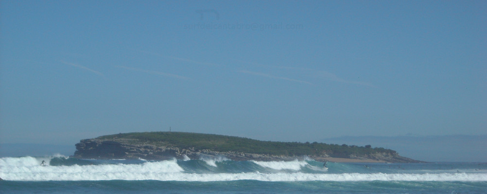
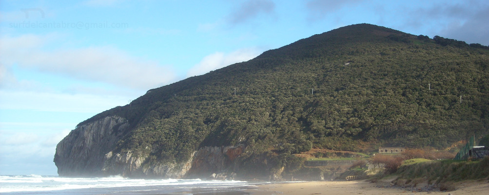
La costa acantilada e irregular de Cóbreces descubre en su trazado varias zonas a modo de mirador. La altura del litoral, la naturaleza que puebla de praderas hasta su borde y el Mar Cantábrico son algunos de los ingredientes que producen un lugar idílico e idóneo para disfrutar del esparcimiento. El acantilado de Bolao es una muestra de su costa. El acceso por carretera comarcal desemboca en un pequeño aparcamiento campestre. A 200 metros aparecen restos de los antiguos molinos de marea, el sonido del océano es proyectado hacia tierra y las lastras que contiene la formación, presentan el espacio a la vista.
![]() Cóbreces is an small coastal locality belonging to the municipality of Alfoz de Lloredo. Located on the western coast of Cantabria, its urban core is far scarcely 500 meters of Luaña’s beach. The configuration of the littoral, in this zone, opens an inlet that finally ends in the sandbank. The environment accompanies to its singularity. There preserves a semi-wild nature, surrounded with meadows, hills, cliffs and forests.
Cóbreces is an small coastal locality belonging to the municipality of Alfoz de Lloredo. Located on the western coast of Cantabria, its urban core is far scarcely 500 meters of Luaña’s beach. The configuration of the littoral, in this zone, opens an inlet that finally ends in the sandbank. The environment accompanies to its singularity. There preserves a semi-wild nature, surrounded with meadows, hills, cliffs and forests.
The origins of the villa go back to the 10th century. Testimony and record of its history is the architectural heritage. The civil architecture stands out with buildings as Villegas’s Palace, Casal de Castro and the Agricultural Practical Institute Quirós; building constructed in the 20th century over the former house of Quirós’s lineage. The religious architecture reflects the steps of the history and the way of the lineages. The place that was occupying San Félix’s former monastery of the 10th century is the current emplacement of San Felices de Mies Church, of the 15th century. The Abbey of Santa Maria de Viaceli, the Hermitage of Holy Ana or San Pedro Ad vincula Church are other examples of its wealth.
The steep and irregular coast of Cóbreces discovers in its tracing several zones as viewing-point. The height of the littoral, the nature that populates with meadows up to its edge and the Cantabrian Sea are some of the ingredients that produce an idyllic and suitable place to enjoy the scattering. Bolao’s cliff is a sample of its coast. The access, by regional road, ends in a small rural parking. In 200 meters there appear remains of the former mills of tide, the sound of the ocean is projected towards land and the flagstones that contains the formation , present the space at sight.
![]()

Cobreces, village
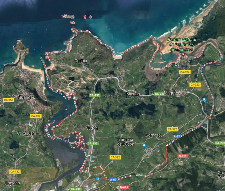
Miengo, villa
![]() Miengo es un municipio y localidad situado en la costa central de Cantabria. Limitando al oeste con Suances y al este con Santa Cruz de Bezana, se encuentra en las proximidades de la ciudad de Santander. Pertenecen a su municipalidad las siguientes localidades: Barcena de Cudón, Cuchía, Cudón, Gornazo, Mogro y Miengo; capital del ayuntamiento.
Miengo es un municipio y localidad situado en la costa central de Cantabria. Limitando al oeste con Suances y al este con Santa Cruz de Bezana, se encuentra en las proximidades de la ciudad de Santander. Pertenecen a su municipalidad las siguientes localidades: Barcena de Cudón, Cuchía, Cudón, Gornazo, Mogro y Miengo; capital del ayuntamiento.
Su emplazamiento, ubicado en una zona de transito entre dos grandes ciudades; Santander y Torrelavega, lo comunican por carretera nacional y autovía, existiendo además líneas regulares de trenes y autobuses hacia ambas urbes. Los atractivos turísticos cercanos no merman los propios del municipio que debido a su orografía y costa tintan la mirada y la estancia de un singular tono. Las playas de Cuchía, Los Caballos, Usgo, Robayera y Usil, distribuidas a lo largo del litoral menicense, se entremezclan con pequeñas calas, acantilados e islas. El irregular dibujo costero que dispone multitud de orientaciones en sus localizaciones y la naturaleza salvaje del Mar Cantábrico, diseñan paisajes erosionados; esculpidos a través del tiempo. Las islas de: los Conejos, Pasiega, Casilda, Segunda y Solita forman parte de su patrimonio y dan testimonio de la arcaica línea de costa.
El territorio que avanza tierra adentro, es acotado por el Río Saja en el extremo Oeste y el Río Pas en el Este. La Ría de Mogro, desembocadura del Pas, nutre y amplía el Parque Natural de Las Dunas de Liencres. Otro ingrediente de la villa es el patrimonio arquitectónico que se divide entre construcciones religiosas, como el Santuario de la Virgen del Monte o la Iglesia de San Juan Bautista, y construcciones civiles; destacando el Palacio de los Herrera o de la Dehesa.
![]() Miengo is a municipality and locality placed in the central coast of Cantabria. Delimiting in the western part with Suances and Santa Curz de Bezana in the eastern side, it is in the proximities of the city of Santander. The following localities belong to its township: Barcena de Cudón, Cuchía, Cudón, Gornazo, Mogro and Miengo; the capital of the town.
Miengo is a municipality and locality placed in the central coast of Cantabria. Delimiting in the western part with Suances and Santa Curz de Bezana in the eastern side, it is in the proximities of the city of Santander. The following localities belong to its township: Barcena de Cudón, Cuchía, Cudón, Gornazo, Mogro and Miengo; the capital of the town.
Its emplacement located in a zone of traffic between two big cities; Santander and Torrelavega, communicates it by national road and highway, existing in addition regular lines of trains and buses towards both cities. The tourist nearby attractions do not reduce the own ones of the municipality that due to its orography and coast dye the look and the stay of a singular tone. The beaches of Cuchía, Los Caballos, Usgo, Robayera and Usil distributed along the littoral menicense, intermingle with small coves, cliffs and islands. The irregular coastal drawing that arranges multitude of orientations in its locations and the wild nature of the Cantabrian Sea, design eroded landscapes; sculpted across the time. The islands of: Los Conejos, Pasiega, Casilda, Segunda and Solita form a part of its heritage and give testimony of the archaic coastline.
The territory that advances land in, is annotated by the Saja River in the extreme West and the Pas River in the East. The Stuary of Mogro, river mouth of the Pas, nourishes and extends the Nature reserve of Liencres’s Dunes. Another ingredient of the villa is the architectural heritage that is divided between religious constructions, as the Sanctuary of the Virgin del Monte or the Church of San Juan Bautista, and civil constructions; emphasizing the Palace of the Herrera or the Dehesa.
![]()

Miengo, village