
Año Santo Lebaniego
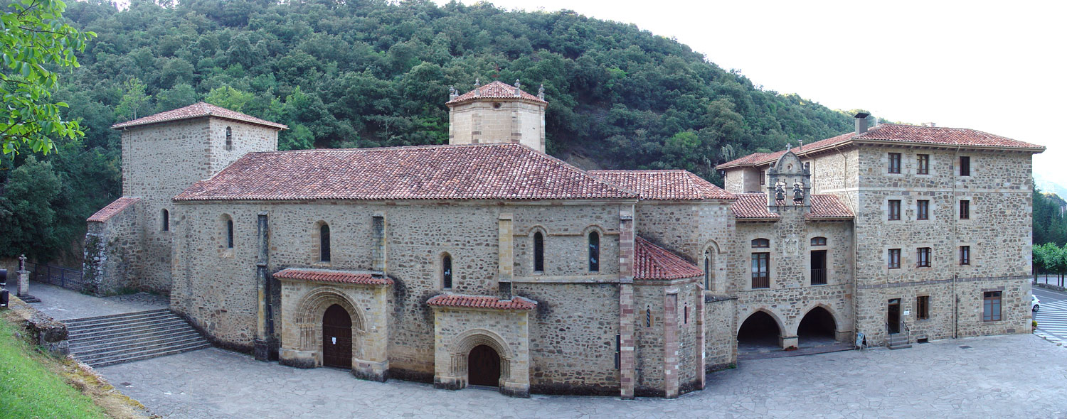
![]() El año Santo Lebaniego en el Monasterio de Santo Toribio de Liébana, en Cantabria, es celebrado en aquellas ocasiones en las que el 16 de Abril es Domingo. Este año el inicio de la celebración se realiza una semana posterior, el 23 de Abril, por coincidir el 16 de abril con la Pascua.
El año Santo Lebaniego en el Monasterio de Santo Toribio de Liébana, en Cantabria, es celebrado en aquellas ocasiones en las que el 16 de Abril es Domingo. Este año el inicio de la celebración se realiza una semana posterior, el 23 de Abril, por coincidir el 16 de abril con la Pascua.
Orígenes
La tradición existente, expresada a lo largo de los siglos desde el año 1480, dio inicio al Jubileo en Santo Toribio de Liébana a través de los Papas Julio II y León X. Durante una semana se celebraba el jubileo. Es en el año 1967 cuando el Papa Pablo VI expresa que el Año Santo se extendiera a un año entero, permitiendo que más fieles pudieran disfrutar de la indulgencia plenaria y del singular acontecimiento.
Lignum Crucis. Excepcionalidad
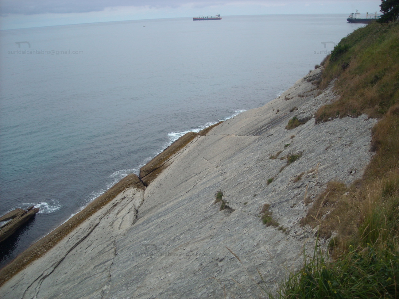
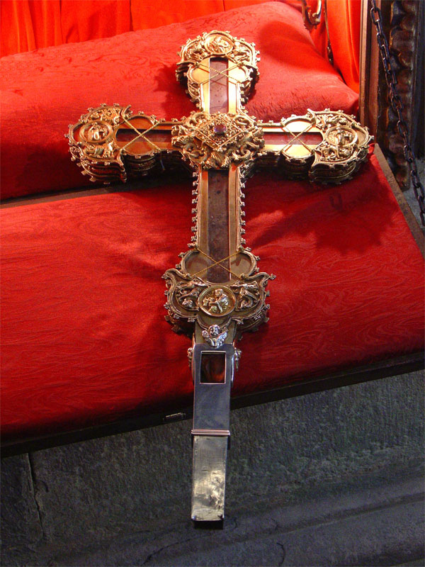
El Monasterio de Santo Toribio de Liébana conserva el fragmento más grande de la cruz de Cristo que existe en el mundo. La reliquia conocida como Lignum Crucis, es una parte perteneciente al brazo izquierdo de la cruz de Cristo.
Es su particularidad única, por su trascendencia religiosa y manifestación; que se celebra en otros seis lugares en el mundo, siete en total. Jerusalén, Roma, Santiago de Compostela, Santo Toribio de Liébana, Urda, Caravaca de la Cruz y Valencia son los lugares donde se celebra lo que se conoce como Jubileo in perpetuum.
Puerta del Perdón. Indulgencia plenaria
La Puerta del Perdón, que se abre al comienzo del Año Jubilar lebaniego, proporciona la indulgencia plenaria. Este acto de purificación de las penas debe ir acompañado del sacramento de la Reconciliación, recibir la comunión, rezar el Credo, y rezar por la persona e intenciones del Papa.
Liébana, Holly Year
![]() The Holy year of Liébana in the Monastery of Saint Toribio de Liébana, in Cantabria, is celebrated in those occasions in which April 16 is A Sunday. This year the beginning of the celebration is realized a later week, April 23, for coinciding on April 16 with the Easter.
The Holy year of Liébana in the Monastery of Saint Toribio de Liébana, in Cantabria, is celebrated in those occasions in which April 16 is A Sunday. This year the beginning of the celebration is realized a later week, April 23, for coinciding on April 16 with the Easter.
Origins
The existing tradition expressed throughout the centuries from the year 1480, gave beginning to the Jubilee in Saint Toribio de Liébana across the Popes Julio II and León X. For one week the jubilee was celebrated. It is in the year 1967 when the Pope Paul VI expresses that the Holy Year should spread to an entire year, allowing that more persons could enjoy the plenary indulgence and the singular event.
Lignum Cruscis. Exceptionality
The Monastery of Saint Toribio de Liébana preserves the biggest fragment of Cross of Christ that exists in the world. The relic known as Lignum Crucis, is a part belonging to the left arm of Cross of Christ.
It is its unique particularity, for its religious transcendency and manifestation; that is celebrated in other six places in the world, seven in total. Jerusalem, Rome, Santiago de Compostela, Saint Toribio de Liébana, Urda, Caravaca de la Cruz and Valencia are the places where there is celebrated what is known as Jubilee in perpetuum.
THe Door of the Pardon. Plenary Indulgence
The Door of the Pardon, which is opened to the beginning of the Holy Year of Liébana, provides the plenary indulgence. This act of purification of sorrow must go accompanied of the sacrament of the Reconciliation, to receive the communion, to say the Creed, and to pray for the person and intentions of the Pope.
![]()
 Lignum Crucis
![]()
![]()
Santo Toribio de Liébana
![]()
![]()

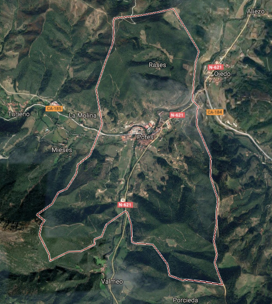
Potes, villa y capital de Liébana
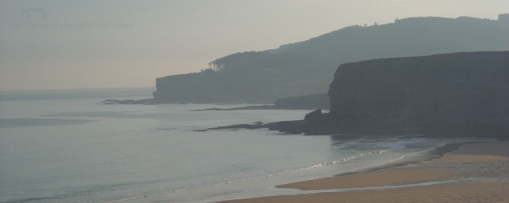
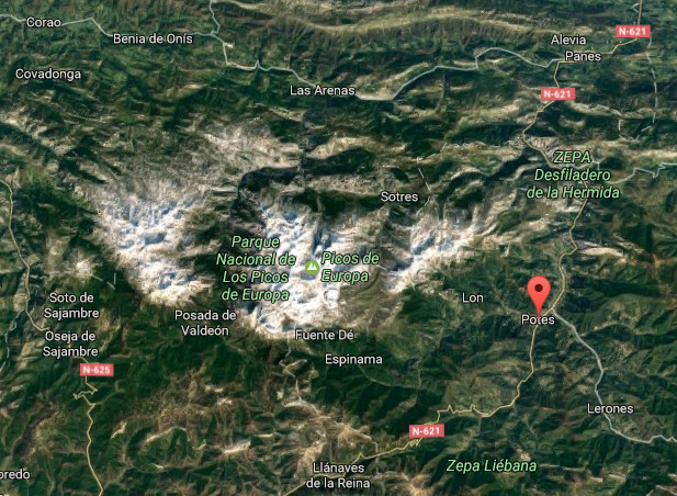
![]() Potes es una localidad situada en la región occidental de Cantabria. Emplazada en la comarca de Liébana y siendo su capital, se encuentra a 291 metros de altitud, en el corazón del Parque Nacional de Picos de Europa.
Potes es una localidad situada en la región occidental de Cantabria. Emplazada en la comarca de Liébana y siendo su capital, se encuentra a 291 metros de altitud, en el corazón del Parque Nacional de Picos de Europa.
La localización única de la villa la convierte en un punto de encuentro de cuatro valles. Recibe la desembocadura del Río Quiviesa, que sirve de afluente al Río Deva el cual nace en el Macizo Cántabrico. La orografía montañosa que perfila su contorno delimita la comarca y configura un entorno natural excepcional. La existencia de valles en su interior representa diferencias de altitud y crea un microclima mediterráneo en el fondo de este gran valle que se torna atlántico a medida que ascendemos hasta los picos que alcanzan los 2000 metros.
Habitada desde tiempos prehistóricos, fue repoblada en el siglo VIII y IX durante La Reconquista. En aquella época recibió numerosa población que contribuyó a enriquecer la vida y cultura de Liébana a lo largo de la Edad Media. Destacan la Torre del Infantado, Torre del Orejón de la Lama, la Iglesia de San Vicente y el Puente de San Cayetano cómo muestras arquitectónicas de una época. La configuración de Potes, sus barrios, calles y plazas trasmiten el paso del tiempo y la historia vivida. Los barrios de la Solana y el Sol concentran numerosas edificaciones que hacen del casco histórico Bien de Interés Cultural.
Es su clima característico el que posibilita la existencia del cultivo de la vid que sirve para elaborar el orujo de Potes. Abundan las encinas y alcornoques, característicos del bosque mediterráneo, entremezclados con especies propias del bosque atlántico como el hayedo y el roble. Otras especies como tejos, alisos, acebos, avellanos, chopos … amplían la diversidad y embellecen su naturaleza.
Potes, village and capital of Liébana
![]() Potes it is a locality placed in the western region of Cantabria. Located in the region of Liébana and being its capital, it is to 291 meters of altitude, in the heart of the National Park of Picos de Europa.
Potes it is a locality placed in the western region of Cantabria. Located in the region of Liébana and being its capital, it is to 291 meters of altitude, in the heart of the National Park of Picos de Europa.
The unique location of the villa turns it into a point of meeting of four valleys. It receives the river mouth of the river Quiviesa, tributary to the Rio Deva which is born in the Cantabrian Range. The mountainous orography that outlines his contour delimits the region and forms an excepcional natural environment. The existence of valleys inside it represents differences of altitude and creates a Mediterranean microclimate at the back of this great valley that becomes Atlantic as we ascend up to the beaks that reach 2000 meters.
Populated from prehistoric times, it was repopulated in the 8th century and the IXth during The Reconquest. In that epoch Potes received numerous population who helped to enrich the life and culture of Liébana along the Middle Ages. Emphasize the Tower of the Infantado, Tower of Orejón de la Lama, San Vicente’s Church and San Cayetano’s Bridge as architectural examples of an epoch. The configuration of Potes, its neighborhoods, streets and squares transfer the passage of time and the lived history. The neighborhoods of the Solana and the Sol concentrate numerous buildings that do of the historical center an Heritage of Cultural Interest.
It is its typical climate the one that makes possible the existence of the culture of the grapevine that serves to elaborate the grape marc of Potes. The holm oaks and cork oaks abound, typical of the Mediterranean forest, intermingled with own species of the Atlantic forest as the hayedo and the oak. Other species like yews, alder-trees, hollies, hazels, black poplars … extend the diversity and embellish its nature.
![]()

Potes, village
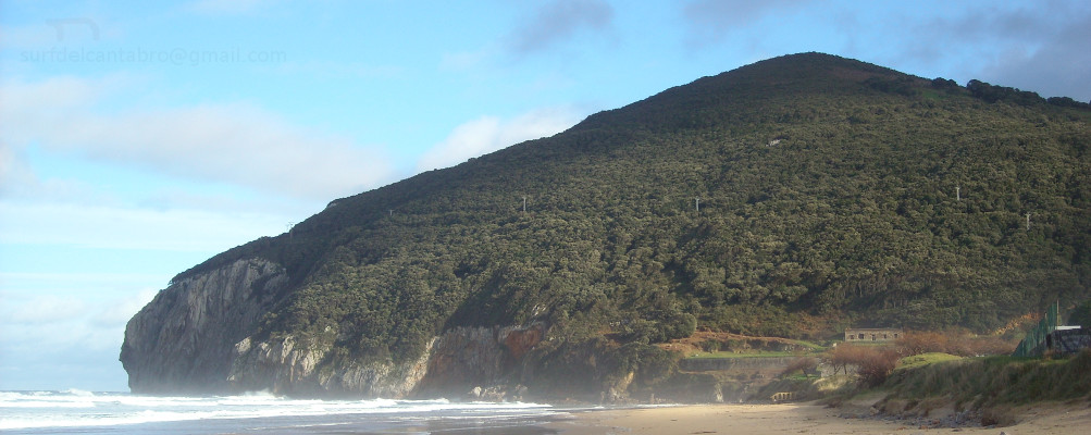
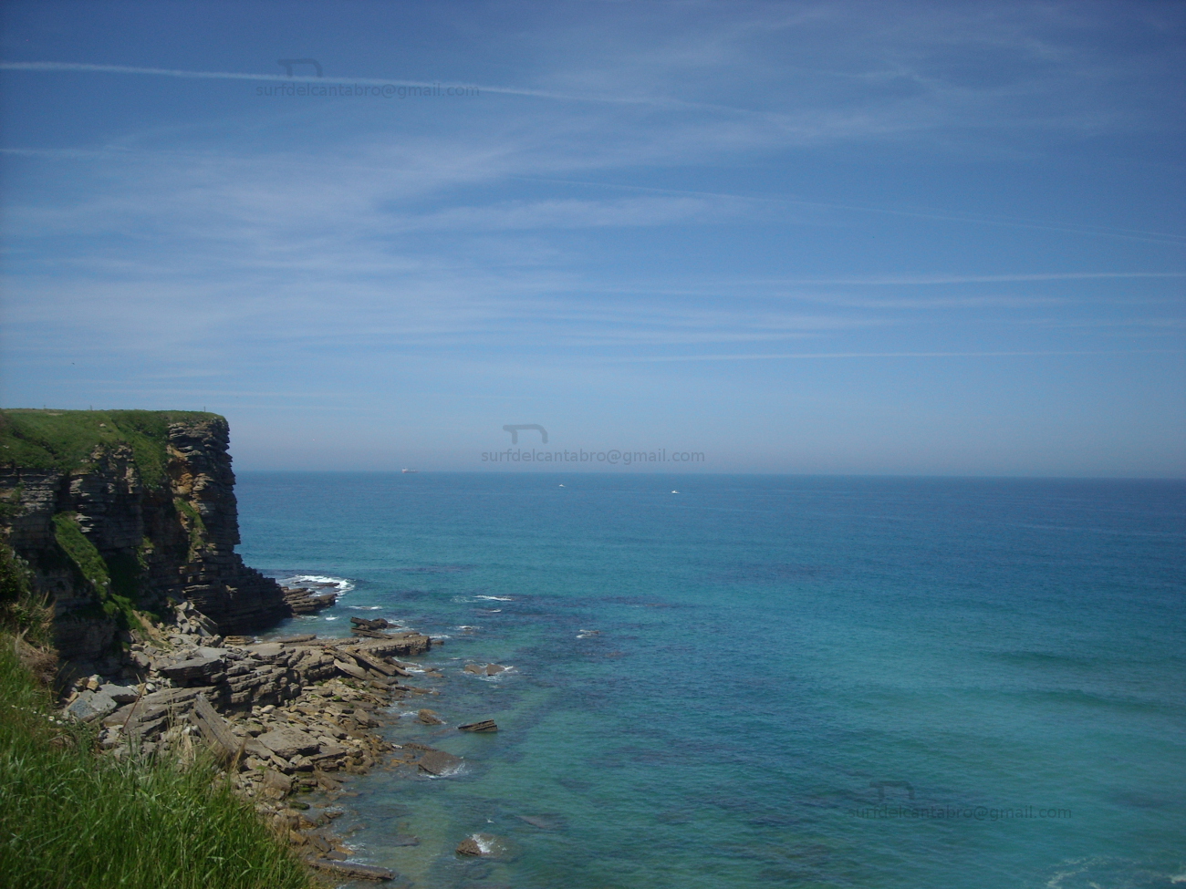
Liébana, natural area
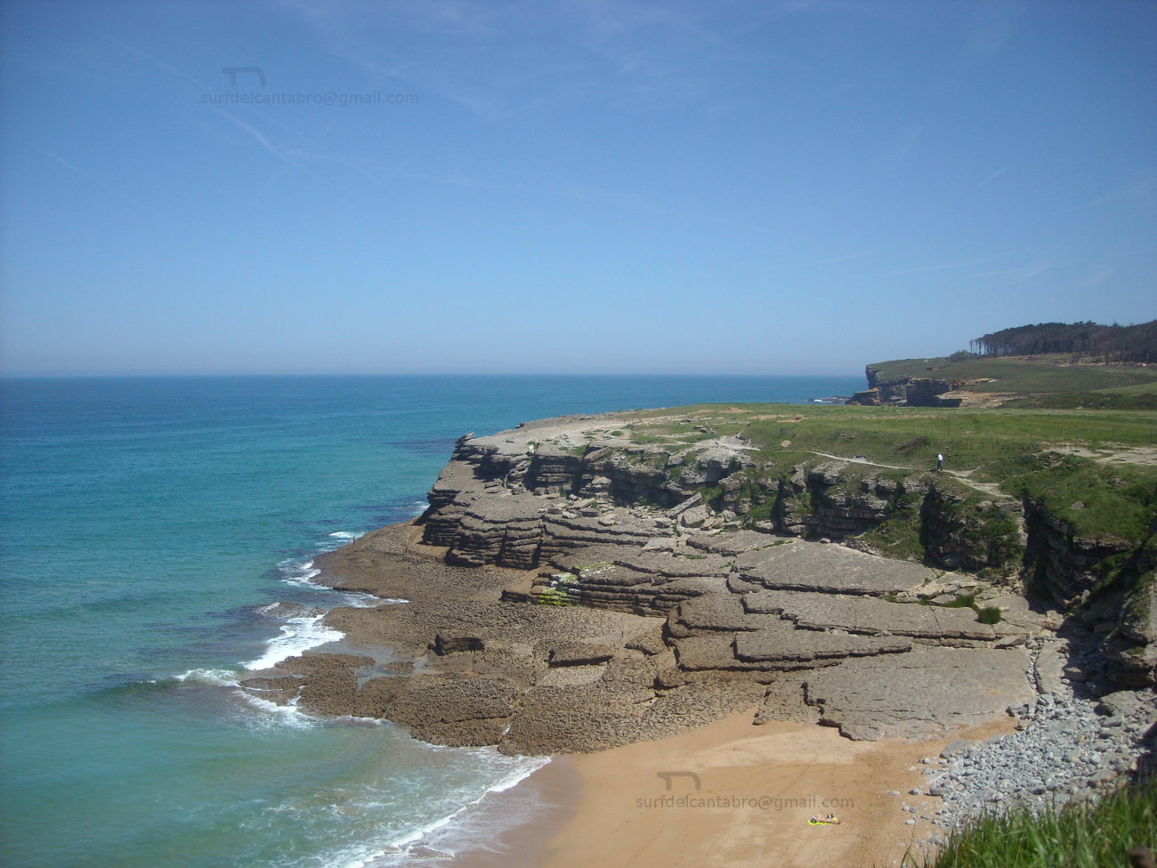
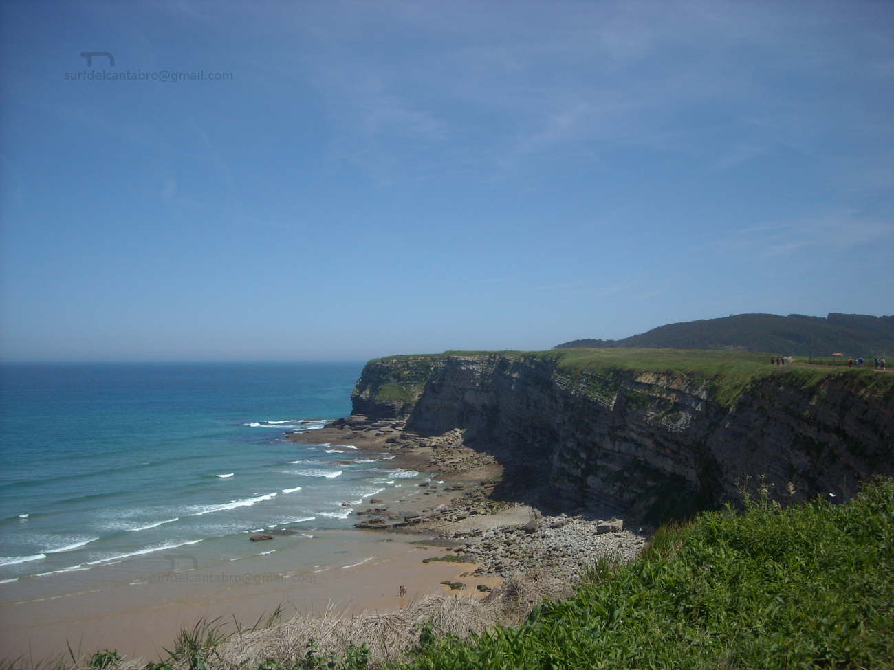
Playa de La Salvé, ruta
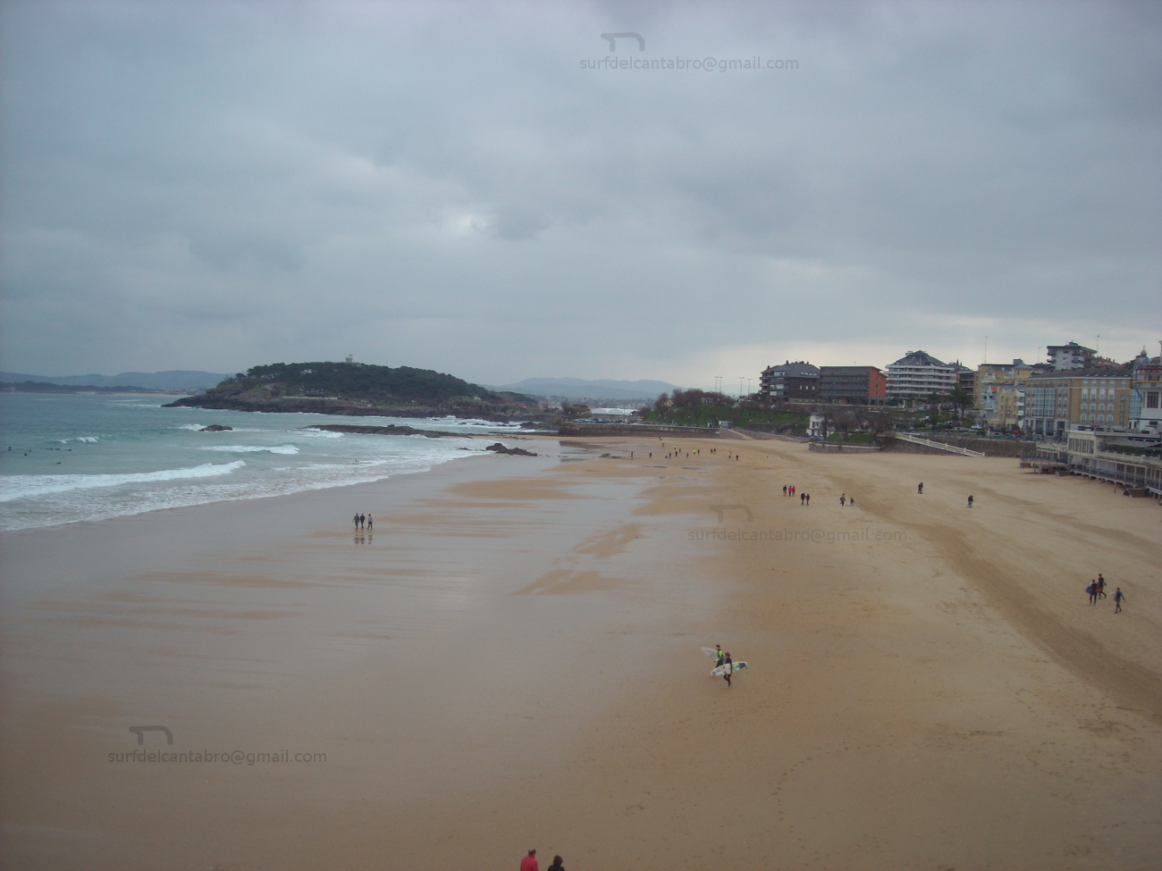
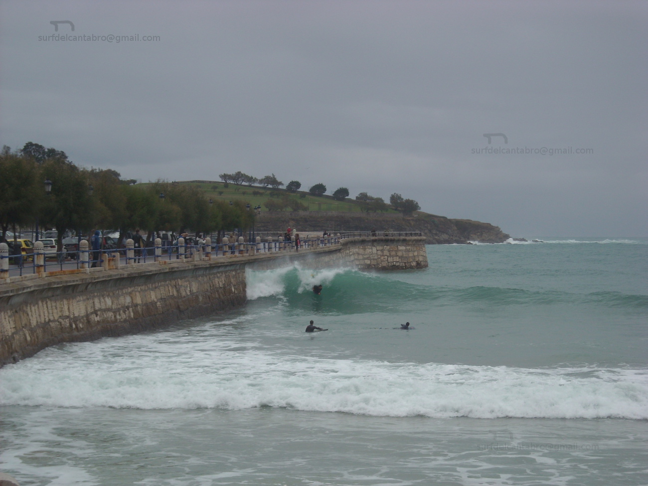
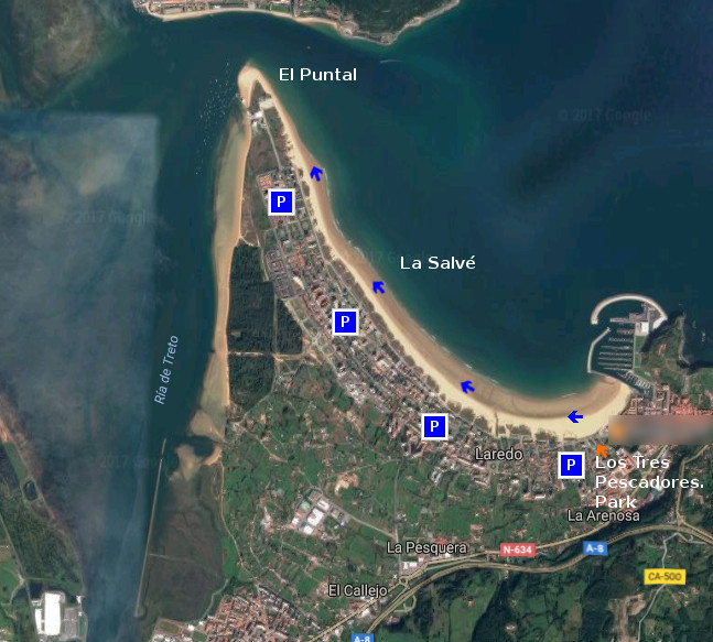
![]() La playa de La Salvé, situada en Laredo, es la playa más larga de Cantabria. Su longitud de 4250 metros y anchura media de 120 metros habilitan un extenso área cuya forma curvada acota parte de la localidad y su unión con el Mar Cantábrico. El recorrido es acompañado por un Paseo Marítimo que se prolonga hasta el Puntal, lengua de arena que delimita la entrada a la Bahía de Santoña en uno de sus extremos.
La playa de La Salvé, situada en Laredo, es la playa más larga de Cantabria. Su longitud de 4250 metros y anchura media de 120 metros habilitan un extenso área cuya forma curvada acota parte de la localidad y su unión con el Mar Cantábrico. El recorrido es acompañado por un Paseo Marítimo que se prolonga hasta el Puntal, lengua de arena que delimita la entrada a la Bahía de Santoña en uno de sus extremos.
Empezaremos la ruta en el Parque de los Tres Pescadores, zona ajardinada próxima al puerto deportivo y localizado en el extremo Este del recorrido. Desde allí, podemos elegir entrar al arenal o caminar por el Paseo Marítimo. El principio del recorrido posee el tramo más curvado, por lo que la aparición de edificios y dunas irán descubriendo los encantos sencillos de un simple paseo. A medida que avancemos, los pasos sobre la arena acumularán un tonificado desgaste. Es aconsejable caminar cerca de la orilla, donde la arena que abandonó el agua por las mareas permanece más dura y facilita el camino. Tras el comienzo, una recta alargada aparece. Acompañados por el sonido aleatorio y orquestral del océano conseguiremos dejar atrás el bullicio urbano. La brisa, presente en la zona, endulzará el viaje y proyectará la imaginación que el entorno disparó. Cualquier punto del recorrido es adecuado para terminar nuestro paseo, acorde a la condición física de cada uno y el tiempo disponible.
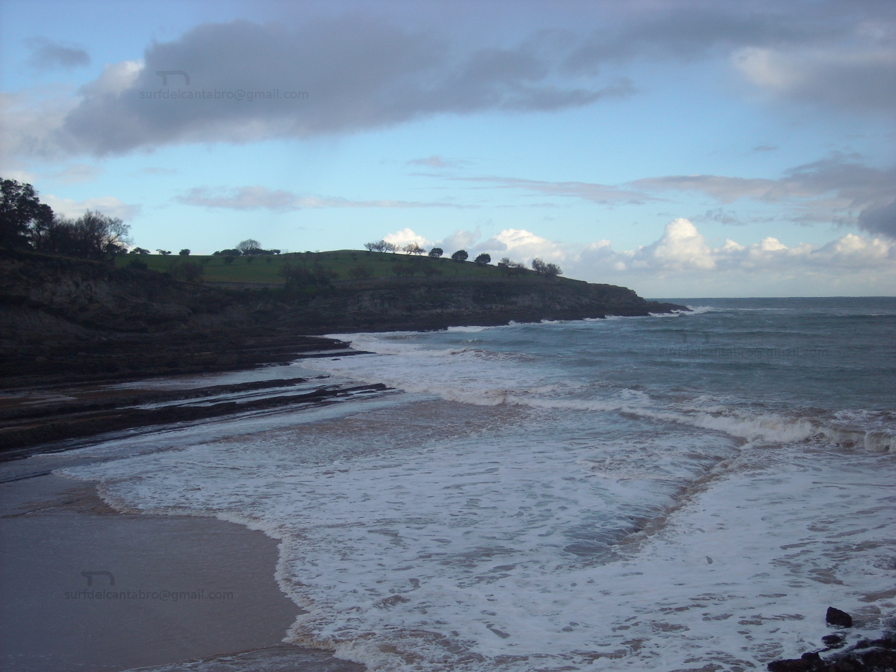
El final del trayecto hará aparecer El Puntal de Laredo. Península arenosa y dunar que sirve de bisagra a la entrada de la Bahía de Santoña. Este punto único, emplazamiento privilegiado de su entorno, proporciona una visión panorámica de un espacio singular creado por la naturaleza a través del tiempo. En ese momento es aconsejable buscar un pequeño espacio a modo de silla, reposar y degustar el final del trayecto.
![]()
![]()
![]()
Beach La Salvé, route
![]() The beach of La Salvé, placed in Laredo, it is the longest beach of Cantabria. Its length of 4250 meters and average width of 120 meters enable an extensively area which curled form annotates part of the locality and its union with the Cantabrian Sea. The tour is accompanied by a Maritime Promenade that prolongs up to El Puntal, language of sand that delimits the entry to Bay of Santoña in one of its ends.
The beach of La Salvé, placed in Laredo, it is the longest beach of Cantabria. Its length of 4250 meters and average width of 120 meters enable an extensively area which curled form annotates part of the locality and its union with the Cantabrian Sea. The tour is accompanied by a Maritime Promenade that prolongs up to El Puntal, language of sand that delimits the entry to Bay of Santoña in one of its ends.
We will begin the route in Los Tres Pescadores Park , landscaped zone next the yachting port and located in the East extreme of the tour. From there, we can choose enter to the sandbank or walk along the seafront. The beginning of the journey possesses the most curled section, so the appearance of buildings and dunes will discover the easier captivations of a simple walk. As we advance, the steps on the sand will accumulate a strengthened wear. It is advisable to go near the shore, where the sand that left behind the water by the tides remains harder and facilitates the way. After the beginning, an elongated straight line appears. Accompanied by the random and orquestral sound of the ocean we will manage to leave behind the urban hustle. The breeze, present in the zone, will sweeten the trip and will project the imagination that the environment shot. Any point of the tour is adapted to finish our tour, chord to the physical condition of each one and the available time.
The end of the distance will make appear El Puntal of Laredo. Sandy and dune peninsula, that runs as a hinge, at the entry of Bay of Santoña. Thisunique point, privileged emplacement of its environment, provides a panoramic vision of a singular space created by the nature across the time. In this moment it is advisable to look for an small space as a chair, to rest and to taste the end of the distance.
![]()