Monthly Archives: octubre 2016

Soto de la Marina, villa
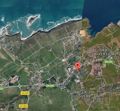
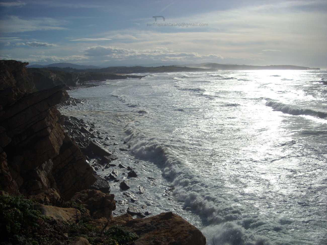
![]() Soto de la Marina es una localidad costera emplazada al noroeste de la ciudad de Santander. Perteneciente al municipio de Santa Cruz de Bezana, su población media de 3500 habitantes ocupa un extenso territorio comienza en la costa y se extiende hacia el interior; hasta el valle de Camargo.
Soto de la Marina es una localidad costera emplazada al noroeste de la ciudad de Santander. Perteneciente al municipio de Santa Cruz de Bezana, su población media de 3500 habitantes ocupa un extenso territorio comienza en la costa y se extiende hacia el interior; hasta el valle de Camargo.
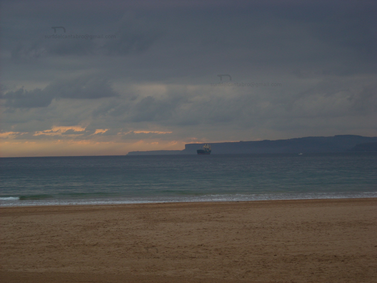
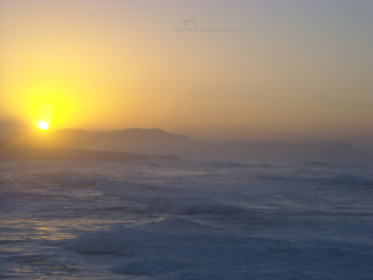
Esta particular villa es una zona residencial que conserva edificios antiguos como la Parroquia de San Salvador de Vivero y su torre. La carretera nacional que conecta la zona con la capital cántabra y el oeste, vertebra y condiciona la zona en sus nuevas construcciones. Las playas, San Juan de la Canal y Covachos, distan entre sí apenas 1,5 kilómetros. Dispuestas en mar abierto, ofrecen distintas panorámicas de la costa y configuración. La playa de Covachos alberga en su mitad un islote, conocido como Isla del Castro, que parte el arenal en dos mitades con la marea baja y es plenamente cubierta en marea alta; protegiendo la ensenada.
Soto de la Marina, village
![]() Soto de la Marina is a coastal locality placed to the northwest of the city of Santander. Belonging to the municipality of Santa Cruz de Bezana, its population of 3500 inhabitants occupies an extensive territory that begins on the coast and spreads towards the inland; up to Camargo’s valley.
Soto de la Marina is a coastal locality placed to the northwest of the city of Santander. Belonging to the municipality of Santa Cruz de Bezana, its population of 3500 inhabitants occupies an extensive territory that begins on the coast and spreads towards the inland; up to Camargo’s valley.
This peculiar villa is a residential zone that preserves ancient buildings as the Parish of San Salvador of Vivero and its tower. The national road that connects the zone with the Cantabrian capital and the west, organises and determines the zone in its new constructions. The beaches, San Juan de la Canal and Covachos, are at a distance of scarcely 1,5 kilometres between them. Arranged on the open sea, them offer different panoramic of the coast and configuration. Covachos’s beach shelters in its half an island known as Island of the Castro, which divides the sandbank in two halves with the low tide and is fullly covered in high tide; protecting the inlet.
![]()

 Soto de la Marina, village

Santander, ciudad
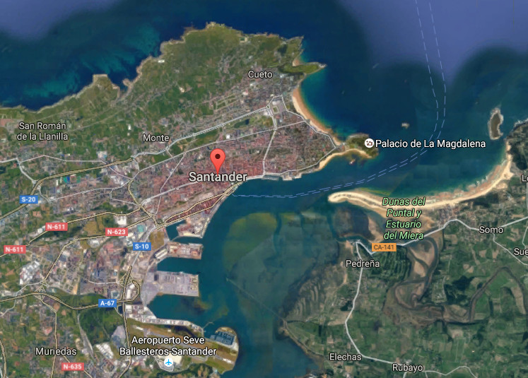
![]() Santander, ciudad emplazada en la costa central de Cantabria, es la capital cántabra. Su contorno habita con el Mar Cántabrico por el norte,este y sur. Su morfología y entorno configuran la ciudad a través de la bahía ,el mar y el puerto; ampliando su extensión hacia el oeste e interior.
Santander, ciudad emplazada en la costa central de Cantabria, es la capital cántabra. Su contorno habita con el Mar Cántabrico por el norte,este y sur. Su morfología y entorno configuran la ciudad a través de la bahía ,el mar y el puerto; ampliando su extensión hacia el oeste e interior.
La arquitectura de la ciudad va desde el gótico, destacando en la Catedral de Santander, hasta el siglo XXI,con los edificios de nueva construcción presentes. La Iglesia de la Anunciación perteneciente al Barroco, El Mercado de la Esperanza del siglo XIX… El edificio del Ayuntamiento articula su espacio entrono a una plaza que sitúa a sus pies, en las proximidades del centro y la artería principal de la ciudad. Más construcciones, barrios y calles la esculpen y hablan de su historia y carácter.
El Paseo marítimo y costero de la ciudad comienza en el puerto, prolongando su recorrido hasta el Palacio de la Magdalena y el Sardinero. El norte, accesible desde los barrios de Cueto y Monte, dispone de sendas que avanzan paralelas a la costa y son hábiles en ciertos tramos del recorrido. Desde el Faro de Cabo Mayor, punto más septentrional con acceso habilitado,se dispone de una perspectiva que dirige su atención hacia el mar y el oeste de Cantabria atravesando la entrada de la bahía que embellece y sustancia su esencia. La Isla de Mouro, a la entrada de la bahía, da testimonio del transito portuario y pesquero; ofreciendo un espectáculo singular con mar fuerte.
Santander, city
![]() Santander, city located in the central coast of Cantabria, is the Cantabrian capital. Its contour lives with the Cantabrian Sea for the north, east and south. Its morphology and environment form the city across the bay, the sea and the port; increasing its extension towards the west and inland.
Santander, city located in the central coast of Cantabria, is the Cantabrian capital. Its contour lives with the Cantabrian Sea for the north, east and south. Its morphology and environment form the city across the bay, the sea and the port; increasing its extension towards the west and inland.
The architecture of the city goes from the Gothic, standing out in the Cathedral of Santander, up to the 21st century, with the buildings of new construction that are present. The Church of the Annunciation belonging to the Baroque, The Market of the Hope of the 19th century… The building of the City hall articulates its space arround an square that is places to its feet, in the proximities of the center and the principal artery of the city. More constructions, neighborhoods and streets sculpt it and talk about its history and character.
The maritime and coastal promenade of the city begins in the port, prolonging its tour up to the La Magdalena Palace and the Sardinero. The north, accessible from the neighborhoods of Cueto and Monte, has paths that advance parallel to the coast and are skilful in certain sections of the tour. From the Lighthouse of Cape Mayor , the most north point with available access, is arranged of a perspective that directs its attention to the sea and the west of Cantabria, crossing the entry of the bay that it embellishes and substance its essence. Mouro’s Island, at the entry of the bay, gives testimony of the port and fishing traffic; offering a singular spectacle with strong sea.
![]()

Santander, city
Pedreña, villa
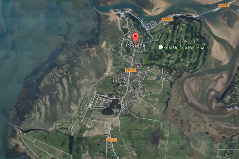
![]() Pedreña es una villa ubicada en la cara sur de la Bahía de Santander y perteneciente al municipio de Marina de Cudeyo. Su núcleo de población apenas alcanza los 1500 habitantes y ocupa un extenso territorio que contiene la carretera nacional que recorre el sur de la bahía, a la que se asoma, y conecta con el resto de villas costeras del entorno.
Pedreña es una villa ubicada en la cara sur de la Bahía de Santander y perteneciente al municipio de Marina de Cudeyo. Su núcleo de población apenas alcanza los 1500 habitantes y ocupa un extenso territorio que contiene la carretera nacional que recorre el sur de la bahía, a la que se asoma, y conecta con el resto de villas costeras del entorno.
El trazado sencillo de la villa descansa sobre casas de piedra, barrios, urbanizaciones de nueva construcción, prados y bosques. Su Paseo Marítimo descubre un trayecto de mediana extensión que conecta el muelle con el puerto deportivo. Ambos lados acompañan y lustran el camino. En una parte, un singular campo de golf; cuna de campeones. El otro lado recibe la brisa de la bahía acompañada de un paisaje único de Santander, el puerto y la bahía. EL final del paseo termina en el puente que une la localidad con Somo. Desde allí, podemos contemplar el final de la Ría de Cubas, una pequeña bahía de singular belleza por su forma y entorno poético que la rodea.
La parte oeste transita por barriadas de casas antiguas y edificios, servidos por una acera que acompaña todo el trayecto. Un campo de golf municipal cuyo contorno posee un camino que cuenta con bancos y enclaves desde donde disfrutar una nueva perspectiva de la capital cántabra acompañada del ancestral trabajo de las mariscadoras de Pedreña que faenan con la bajamar.
Pedreña, village
![]() Pedreña is a locality placed in the south face of the Bay of Santander and belonging to the municipality of Marina de Cudeyo. Its core of population scarcely reaches 1500 inhabitants and occupies an extensive territory that contains the national road that crosses the south of the bay, to which it appears, and connects with the rest of coastal villages of the surroundings.
Pedreña is a locality placed in the south face of the Bay of Santander and belonging to the municipality of Marina de Cudeyo. Its core of population scarcely reaches 1500 inhabitants and occupies an extensive territory that contains the national road that crosses the south of the bay, to which it appears, and connects with the rest of coastal villages of the surroundings.
The simple tracing of the villa rests on houses of stone, neighborhoods, urbanizations of new construction, meadows and forests. Its Maritime Promenade discovers a route of medium extension that connects the dock with the marina. Both sides accompany and shine the way. In a part, a singular golf course; champions’ cradle. Another side receives the breeze of the bay accompanied of the unique landscape of Santander, the port and the bay. The end of the walk finishes in the bridge that links the locality with Somo. From there, we can contemplate the Rivermouth of Cubas , an small bay of singular beauty for its form and poetical environment that surrounds it.
The part west passes along ancient attached houses and buildings, served by a sidewalk that accompanies the whole distance. A municipal golf course which contour possesses a way that has banks and enclaves from where enjoying a new perspective of the Cantabrian capital accompanied with the ancestral work of the gatherer of shellfish that labour with the low tide.
![]()

Pedreña, village