Playa El Puntal, localización

Icono Español. Icon Spanish. El Puntal, localización La playa El Puntal, perteneciente al municipio de Ribamontán al Mar, es accesible desde la localidad de Somo. Se muestran a continuación las rutas desde Oviedo, Palencia, Santander ó Bilbao. Comenzando el viaje por autovía y finalizando el recorrido por carretera nacional en todos los trayectos.

El Puntal beach, localization

Icono Inglés. Icon English. El Puntal, localization El Puntal beach, belonging to the municipality of Ribamontán al Mar, is accessible from the locality of Somo. Are shown the routes from: Oviedo, Palencia, Santander or Bilbao. Beginning the trip through highway and finishing it by national road in all the journeys.

Icono Español-Inglés. Icon Spanish-English Localización/Localization

Oviedo, El Puntal, LocalizationPalencia, El Puntal, LocalizationBilbao, El Puntal, localizationSantander, El Puntal, localizacion

Icon close Sponsor

Share

El Puntal, acceso

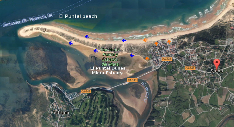
Icono Español. Icon Spanish. La playa El Puntal, emplazada en la entrada de la Bahía de Santander, esta rodeada parcialmente por mar y comunicada con tierra firme a través de un extenso arenal. Los accesos a la playa se realizan desde la localidad de Somo, contanto con múltiples puntos de entrada. Los caminos que conducen al Puntal se encuentra al norte y sur de la lengua de arena.

El Puntal, access

Icono Inglés. Icon English. El Puntal, access The beach El Puntal, located in the entry of the Bay of Santander, is partially surrounded by sea and communicated with mainland across an extensive sandbank. The accesses to the beach are realized from the locality of Somo, with multiple entry points. The paths that lead to the Puntal is in the northern part and south of the sand tongue.

Icono Español-Inglés. Icon Spanish-English. El Puntal, access Acceso/Beach Access

El Puntal, access

Icon close Sponsor

Share

Pedreña, villa

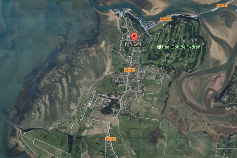
Icono Español. Icon Spanish. Pedreña, villa village Pedreña es una villa ubicada en la cara sur de la Bahía de Santander y perteneciente al municipio de Marina de Cudeyo. Su núcleo de población apenas alcanza los 1500 habitantes y ocupa un extenso territorio que contiene la carretera nacional que recorre el sur de la bahía, a la que se asoma, y conecta con el resto de villas costeras del entorno.

El trazado sencillo de la villa descansa sobre casas de piedra, barrios, urbanizaciones de nueva construcción, prados y bosques. Su Paseo Marítimo descubre un trayecto de mediana extensión que conecta el muelle con el puerto deportivo. Ambos lados acompañan y lustran el camino. En una parte, un singular campo de golf; cuna de campeones. El otro lado recibe la brisa de la bahía acompañada de un paisaje único de Santander, el puerto y la bahía. EL final del paseo termina en el puente que une la localidad con Somo. Desde allí, podemos contemplar el final de la Ría de Cubas, una pequeña bahía de singular belleza por su forma y entorno poético que la rodea.

La parte oeste transita por barriadas de casas antiguas y edificios, servidos por una acera que acompaña todo el trayecto. Un campo de golf municipal cuyo contorno posee un camino que cuenta con bancos y enclaves desde donde disfrutar una nueva perspectiva de la capital cántabra acompañada del ancestral trabajo de las mariscadoras de Pedreña que faenan con la bajamar.

Pedreña, village

Icono Inglés. Icon English. Pedreña, villa, village Pedreña is a locality placed in the south face of the Bay of Santander and belonging to the municipality of Marina de Cudeyo. Its core of population scarcely reaches 1500 inhabitants and occupies an extensive territory that contains the national road that crosses the south of the bay, to which it appears, and connects with the rest of coastal villages of the surroundings.

The simple tracing of the villa rests on houses of stone, neighborhoods, urbanizations of new construction, meadows and forests. Its Maritime Promenade discovers a route of medium extension that connects the dock with the marina. Both sides accompany and shine the way. In a part, a singular golf course; champions’ cradle. Another side receives the breeze of the bay accompanied of the unique landscape of Santander, the port and the bay. The end of the walk finishes in the bridge that links the locality with Somo. From there, we can contemplate the Rivermouth of Cubas , an small bay of singular beauty for its form and poetical environment that surrounds it.

The part west passes along ancient attached houses and buildings, served by a sidewalk that accompanies the whole distance. A municipal golf course which contour possesses a way that has banks and enclaves from where enjoying a new perspective of the Cantabrian capital accompanied with the ancestral work of the gatherer of shellfish that labour with the low tide.

Pedreña, villa village. Icon text divider

pedrena, routes

Icono español-inglés. Icon Spanish-English. Pedreña, villa, village. Map Pedreña, village

Pedreña, map

Pedreña, villa, village. icon close cities

Share

Pedreña, playa

Icono Español. Icon Spanish. Pedreña, playa La playa de Pedreña, ubicada en la localidad del mismo nombre, se encuentra en el municipio de Marina de Cudeyo. Emplazada en la orilla sur-oeste de la Bahía de Santander, dispone de un acceso acondicionado que da entrada a varios parajes situados en el sur de la bahía.

La playa ocupa 200 metros de longitud y 25 metros de ancho. La marea baja descubre una extensa llanura que puede ser recorrida hasta 1 kilómetro desde la línea de costa. El flanco derecho cuenta con un espigón separa el muelle de la zona y aleja la Ensenada de la Barquería que sirve de canal de navegación para los barcos que cruzan la bahía en dirección a Somo y la Ría de Cubas. El flanco izquierdo habilita mayor extensión hasta finalmente encontrarse con el Pantalán de Calatraba.

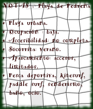
La ausencia de olas y el suave trasiego de las mareas convierte a Pedreña en lugar ideal para practicar pesca deportiva, paddle sup y kitesurf. Existe un sendero que recorre esta cara menos conocida de la Bahía de Santander, paralelo al mar y con 2 metros de anchura, finaliza en la localidad vecina Elechas. El paseante podrá disfrutar de distintas vistas panorámicas a lo largo de su recorrido.

Cabecera Cities Place Beaches . Pedreña, playa
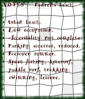
Pedreña, playa . Notas

Pedreña, beach

Icono Inglés. Icon English. Pedreña, beach The beach of Pedreña, located in the locality of the same name, is in the municipality of Marina de Cudeyo. Situated in the side southwest of the Bay of Santander, it has an equipped access that gives entry to several places placed in the south of the bay.

The beach occupies 200 meters of length and 25 meters of width. The low tide discovers an extensive plain that can be crossed up to 1 kilometre from the line of coast. The right flank possesses a breakwater that separates the wharf of the zone and removes it from the Inlet of the Barquería that uses as channel of navigation for the ships that cross the bay towards Somo and the Rivermouth of Cubas. The left flank enables major extension up to finally meeting the Gateway of Calatraba.

The absence of waves and the soft decanting of the tides turn Pedreña in an ideal place to practise sports fishing, paddle sup and kitesurf. There exists a path that crosses this face less known about the Bay of Santander, parallel to the sea and with 2 meters of width, finishes in the neighboring locality of Elechas. The walker will be able to enjoy different panoramic views along the tour.

Cabecera Cities Place Beaches. Pedreña, beach
Pedreña, beach. Notes

Share

Somo, playa

Icono Español. Icon Spanish. Somo beach Somo es una localidad emplazada en el sur de la Bahía de Santander, que pertenece al municipio de Ribamontán al Mar. Comunicada con Pedreña por el Puente de Somo y con Loredo por carretera nacional, tiene además un servicio regular de lanchas que lo conecta con Santander.

La playa de Somo, con una longitud de 3,5 kilómetros, es una de las playas más grandes de Cantabria. Su arenal se prolonga a través de la playa de Loredo, acotado en su extremo derecho por la Isla de Santa Marina, ocupa una basta extensión de 5 kilómetros de recorrido. En el extremo izquierdo existe un amplia área dunar, que se introduce en la centro de la bahía. Esta parte de la playa se llama El Puntal. La cara sur de esta lengua de arena y vegetación tiene una longitud de tres kilómetros, finalizando en el embarcadero de Somo. Se abre, en esta parte, una zona protegida del contacto directo con el oleaje; existiendo así un área idónea para la practica del windsurf y kitesurf.

La playa contiene varias zonas diferenciadas con distintos tipos de ola. La parte más cercana al Puntal dibuja su trazado con una ligera curva, que propicia la aparición de olas que abren a derechas; cuando las condiciones del mar son favorables. La segunda zona, conocida como El Barco, recibe su nombre por existir el casco de un barco naufragado y parcialmente hundido en el fondo de arena. Este lugar presenta corrientes cambiantes y remolinos, además del peligro que supone practicar surf en las cercanías de los restos. Tiene buenas olas, que abren a ambos lados, siendo adecuado el espacio emplazado a 100 metros por detrás del barco. El tercer punto se coloca a la derecha. Conocido como el camping, abarca una extensión mayor y por ello acoge varios tipos de ola que abren a ambos lados, según su proximidad a la zona del Barco o La Curva.

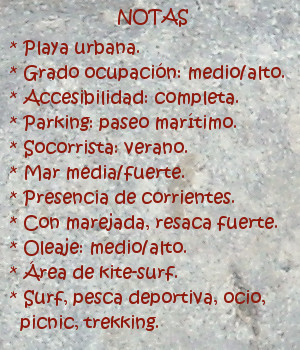
Aquí se recogen algunos datos, junto con una breve descripción de la Playa de Somo. La percepción y conocimiento de sus aguas y olas, de su fondo arenoso, del entorno verde que la acompaña, … deben ser vividos.

comic, mountain
Somo beach, notas

Somo, beach

Icono Inglés. Icon English. Somo beach Somo is a locality placed in the south of the Bay of Santander, which belongs to the municipality of Ribamontán al Mar. Communicated with Pedreña through The Bridge of Somo and Loredo by national road; it also has a regular service of boats that connects it with Santander.

Somo’s beach, with a length of 3,5 kilometres, is one of the biggest beach of Cantabria. Its sandbank extends across Loredo’s beach, annotated in its right wing for the Island of Santa Marina, occupies an extension of 5 kilometres of tour. In the left wing, exists a wide dune area, which has introduced in the center of the bay. This part of the beach is called El Puntal. The south face of this language of sand and vegetation has a length of three kilometres, that finishes in Somo’s pier. There is , in this part, a zone protected from the direct contact with the surge; that creates a suitable area for the practice of windsurfing and kitesurf.

The beach contains several zones differentiated with different types of wave. The nearest part to El Puntal draws its tracing with a light curve, which propitiates the appearance of waves that open to right; when the conditions of the sea are favorable. The second zone known as El Barco, receives its name due to exists the hull of a ship wreck and partially sunk in the back of sand. This place presents changeable currents and whirlpools, besides the danger that supposes practising surf in the surroundings of the remains. It has good waves, which open to both sides, being suitable the space located to 100 meters behind the ship. The third point is placed to the right. Acquaintance as El Camping, it includes a major extension and that is the reason to receive several types of wave that they open for both sides, according to his proximity for the zone of El Barco or La Curva.

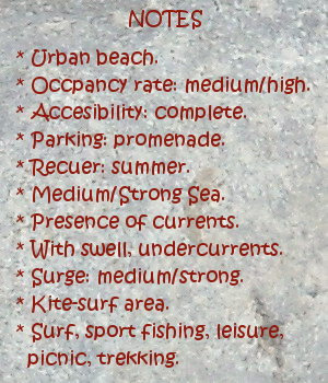
Here is gathered some information, together with a brief description of Somo’s Beach. The perception and knowledge of its waters and waves, of its sandy bottom, of the green environment that accompanies it, … must be lived.

comic, mountain
Somo beach, notes

Share

Pedreña, acceso

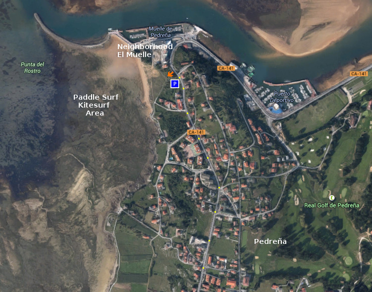
Icono Español. Icon Spanish. Pedreña, acceso surf area Pedreña es una localidad situada en la parte sur de la Bahia de Santander, perteneciente al municipio de Marina de Cudeyo. Cuenta con una nueva zona habilitada para practicar Paddle surf y Kitesurf. Dispone de un pequeño aparcamiento a la entrada del área.

Pedreña, access

Icono. Icon. Pedreña, access surf area Pedreña is a locality placed in the south part of the Bay of Santander, belonging to the municipality of Marina de Cudeyo. It possesses a new zone enabled to practise Paddle surf and Kitesurf. There is an small parking at the entry of the area.

Icono Español-Inglés. Icon Spanish-English. Pedreña, access surf area Acceso/Access

Pedreña, access

Share

Pedreña, localización

Icono Español. Icon Spanish Pedreña es una localidad costera cántabra, perteneciente al municipio de Marina de Cudeyo; y situada en la parte sur de la Bahía de Santander. Desde la localidad se accede a una zona habilitada por el ayuntamiento para practicar paddle surf y kitesurf. Debido a que el acceso a este circuito es de nueva construcción no aparece aún en las guías oficiales, por ello continuaremos el viaje hacia el Barrio El Muelle; siguiendo la carretera. A cincuenta metros del Barrio El Muelle y en el lado izquierdo de la vía, donde la carretera gira a la derecha 180 grados para seguir hasta Somo, está la entrada al circuito. Se muestran a continuación como puntos de partida: Oviedo, Palencia, Santander y Bilbao. Comenzando el viaje por autovía y finalizando el recorrido por la misma carretera nacional en todos los trayectos.

Pedreña, localization

Icono Inglés. Icon English Pedreña is a Cantabrian coastal locality, belonging to the municipality of Marina de Cudeyo; and placed in the south part of the Bay of Santander. From the locality you can access to a zone enabled by the town hall to practise paddle surf and kitesurf. Due to the fact that the access to this circuit is of new construction it does not appear still in the official guides, so we will continue the trip towards the Neighborhood El Muelle; following the road. To fifty meters of that neighborhood and in the left side of the route, where the road turns to the right 180 degrees to continue up to Somo, is the entry to the circuit. Shown below as starting points: Oviedo , Palencia , Santander and Bilbao . Beginning the trip for motorway and finishing the tour for the same national road in all the options.

Icono Español-Inglés. Icon Spanish-English Localización/Localization

Oviedo, Pedreña: LocalizationPalencia, Pedreña: LocalizationBilbao, Pedreña: LocalizationSantander, Pedreña: localization

Share