El Rosal, playa
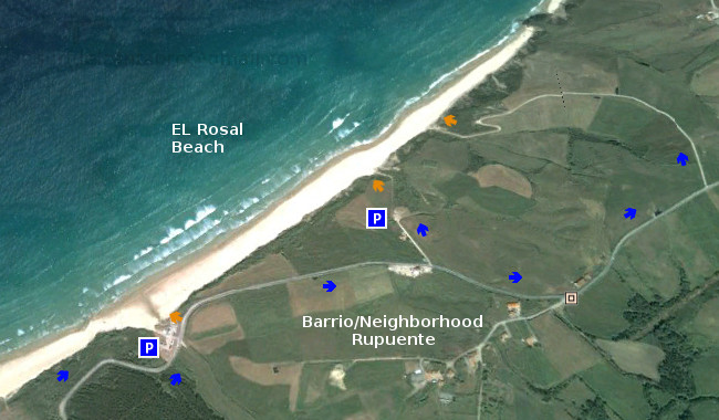
![]() La playa El Rosal, también conocida como Tostadero, está situada en el municipio de San Vicente de la Barquera, en la costa occidental de Cantabria. Delimitada en su lado izquierdo por un espigón que separa el arenal de la Ría de San Vicente de la Barquera. Su longitud de 360 metros y anchura media de 60 metros disponen una pequeña área parcialmente protegida del oleaje.
La playa El Rosal, también conocida como Tostadero, está situada en el municipio de San Vicente de la Barquera, en la costa occidental de Cantabria. Delimitada en su lado izquierdo por un espigón que separa el arenal de la Ría de San Vicente de la Barquera. Su longitud de 360 metros y anchura media de 60 metros disponen una pequeña área parcialmente protegida del oleaje.
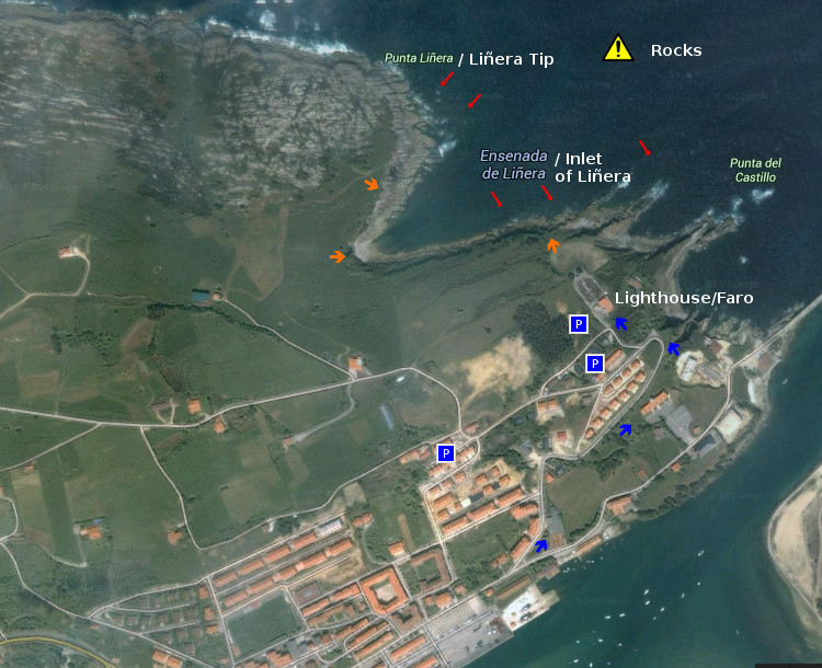
Cuenta, su espigón, con un pequeño faro en el extremo final. Este punto, situado a 150 metros de la orilla, es conocido como el Farolillo. La zona dispone de otro malecón natural, el Islote de Peña Menor, que cubre totalmente al primero. Estas barreras naturales que preservan a la zona del Mar Cantábrico y filtran el oleaje que hasta allí llega, junto con las características del entorno ayudan a producir unas ondas especiales que abren sus alas a lo ancho para llegar posteriormente hasta el arenal.
Cuando las series de olas salvan los espigones, nace una ola que abre a ambos lados. De pendiente suave y prolongada, aparecen recorridos medios a derechas. Sí las condiciones son favorables la apertura izquierda de la onda puede alcanzar un trayecto mayor. La superficie pulida del agua, el rizamiento de la ola y el desplazamiento prolongado de las elevaciones que transportan las ondas consiguen crear olas cuyos parámetros son sólo valores que, en conjunto y después de surfear, hablan de la naturaleza del Cantábrico en esta parte de Cantabria.

El Rosal, playa
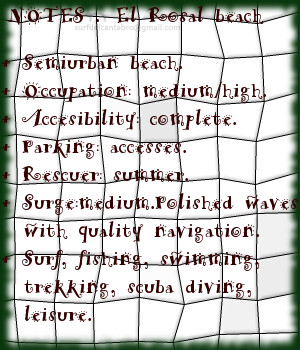
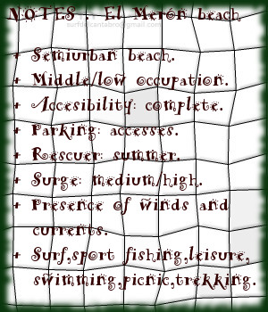
![]() The beach El Rosal, also known as Tostadero, is placed in the municipality of San Vicente de la Barquera, in the western coast of Cantabria. Delimited in its left side for a breakwater that separates the sandbank of the Stuary of San Vicente de la Barquera. Its length of 360 meters and average width of 60 meters arrange an small area partially protected from the surge.
The beach El Rosal, also known as Tostadero, is placed in the municipality of San Vicente de la Barquera, in the western coast of Cantabria. Delimited in its left side for a breakwater that separates the sandbank of the Stuary of San Vicente de la Barquera. Its length of 360 meters and average width of 60 meters arrange an small area partially protected from the surge.
It counts,its dyke,with an small beacon in the final end. This point placed to 150 meters of the shore, is known as el farolillo. The zone has another natural levee, Peña Menor Islet, which covers totally to the first one. These natural barriers that preserve to the zone of the Cantabrian Sea and leak the surge that comes up to there, together with the characteristics of the environment help to produce a few special waves that open its wings widthways; and will arrive later up to the sandbank.
When the series of waves overcomes the levees, there is born a wave that opens to both sides. Of soft and long slope, a medium distance tours that open to the right appear. If the conditions are favorable the left opening of the wave can reach a major distance. The polished surface of the water, the curling of the wave and the long displacement of the elevations that transport the waves manage to create waves which parameters are only values that as a whole and after surfing speak about the nature of the Cantabrian Sea in this part of Cantabria.