Monthly Archives: octubre 2015

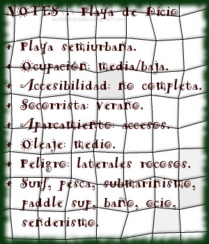
Dício. Mioño, playa
![]() La playa de Dício está ubicada en la localidad de Mioño, perteneciente al municipio de Castro Urdiales, en la costa oriental de Cantabria. Su longitud de 350 metros y 40 metros de anchura media, abren la escarpada y condensada costa de Mioño al Mar Cantábrico.
La playa de Dício está ubicada en la localidad de Mioño, perteneciente al municipio de Castro Urdiales, en la costa oriental de Cantabria. Su longitud de 350 metros y 40 metros de anchura media, abren la escarpada y condensada costa de Mioño al Mar Cantábrico.
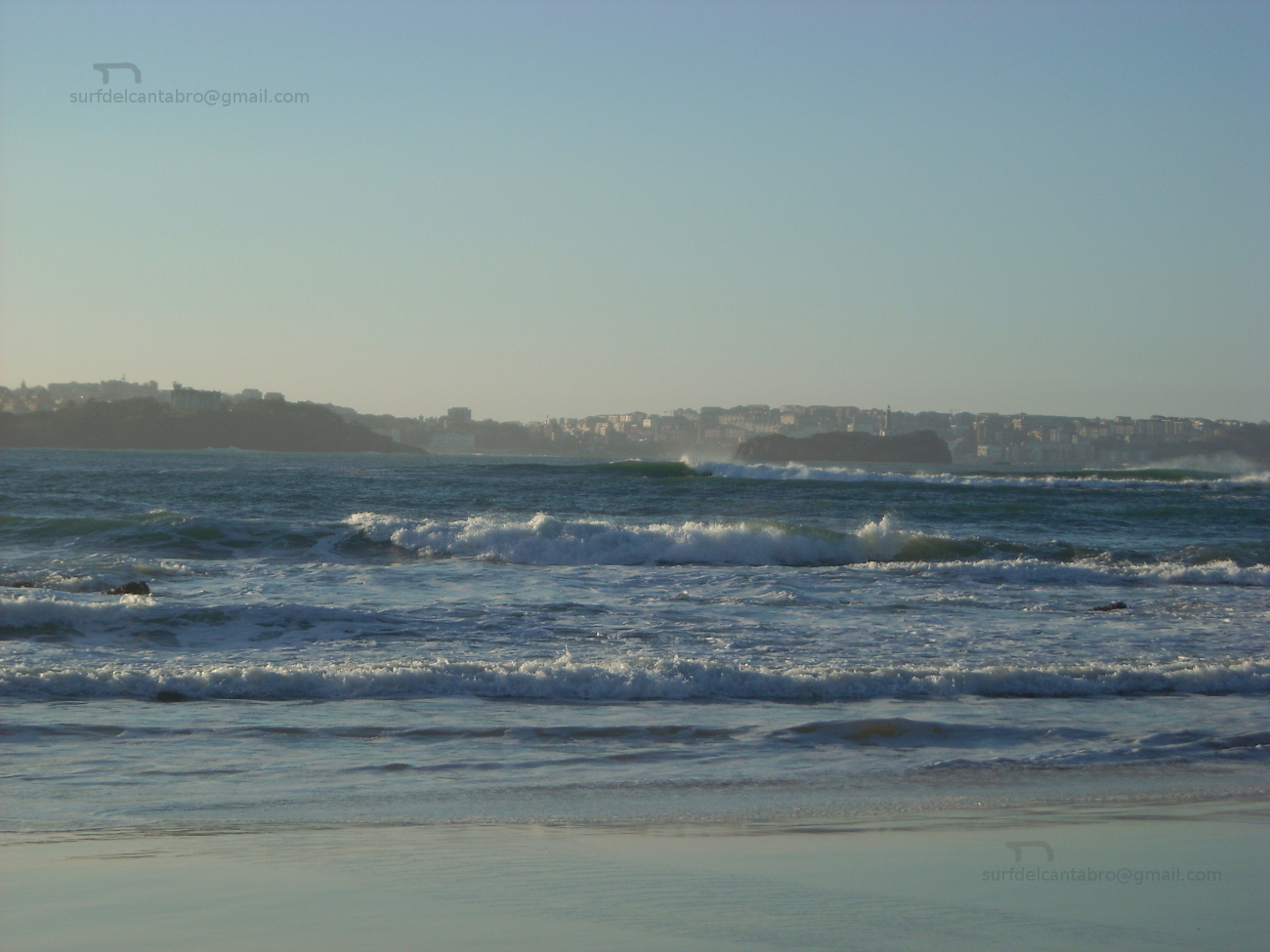
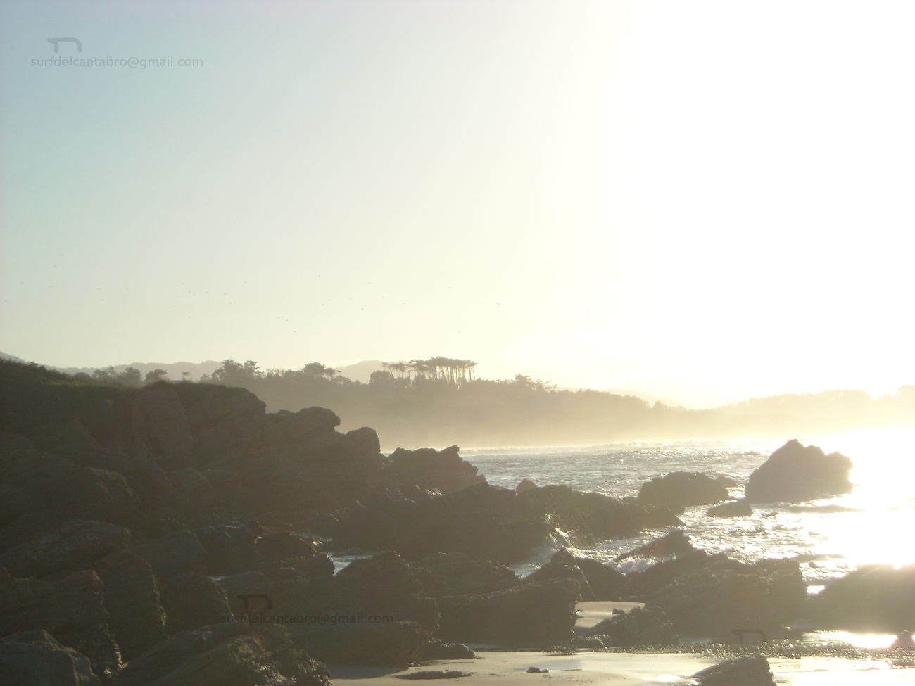
El entorno rocoso que contiene a la playa se extiende desde la Punta de Saltacaballos hasta la Punta de Mioño; próxima a Castro Urdiales. Albergando varias calas en su recorrido, es Dício la más grande de todas ellas. La desembocadura del Río Mioño da forma al litoral creando un recodo entre el arenal y la costa, parcialmente protegido por un pequeño espigón que tiene 40 metros de longitud. La carretera que da acceso a la playa se prolonga a través de un camino peatonal que llega hasta un antiguo cargadero de mineral. Este trayecto constituye un singular paseo marítimo que posibilita el descubrimiento de una parte del Mar Cantábrico nunca antes imaginada.
Las dimensiones de la playa reducen el recorrido de las ondas. Abriendo a ambos lados, favorecen las maniobras y exigen un alto nivel de surf. El oleaje en Dício registra un tamaño menor que en las playas colindantes, representando una opción cuando el estado de la mar es fuerte. Sin embargo, las características de la playa, la abundante presencia de rocas y el estado del mar en esos días, la hacen sólo apta para profesionales y surfers experimentados conscientes de los riesgos.
Las jornadas con menor tamaño descubren una zona con abundantes olas, ideales para practicar: maniobras, paddle sup… disfrutando del entorno sencillo y único de Mioño.

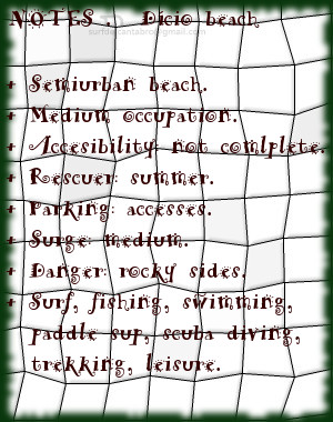
Dício. Mioño, playa
![]() The beach of Dício is located in the locality of Mioño, belonging to the municipality of Castro Urdiales, on the oriental coast of Cantabria. Its length of 350 meters and 40 meters of average width opens the steep and condensed coast of Mioño to the Cantabrian Sea.
The beach of Dício is located in the locality of Mioño, belonging to the municipality of Castro Urdiales, on the oriental coast of Cantabria. Its length of 350 meters and 40 meters of average width opens the steep and condensed coast of Mioño to the Cantabrian Sea.
The rocky environment that it contains to the beach spreads from Saltacaballos’s Tip up to Mioño’s Tip; next to Castro Urdiales. Sheltering several coves in its tour, it is Dício the biggest of them. The river mouth of the River Mioño gives form to the littoral creating a bend between the sandbank and the coast, partially protected by an small pier that has 40 meters of length. The road that leads to the beach extends across a pedestrian way that comes up to a former loading/unloading platform of mineral. This distance constitutes a singular and natural promenade that makes possible the discovery of a part of the Cantabrian Sea never before imagined.
The dimensions of the beach reduce the length of the waves. Opening to both sides, them favor the maneuvers and demand a high level of surf. The surge in Dício registers a minor size that in the adjacent beaches, representing an option when the condition of the sea is strong. Nevertheless, the characteristics of the beach, the abundant presence of rocks and the condition of the sea in these days, make it only suitable for professionals and surfers experienced conscious of the risks.
The days with minor size discover a zone with abundant waves, ideal to practise maneuvers, paddle sup … enjoying the Mioño’s simple and unique environment.
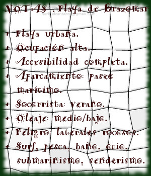
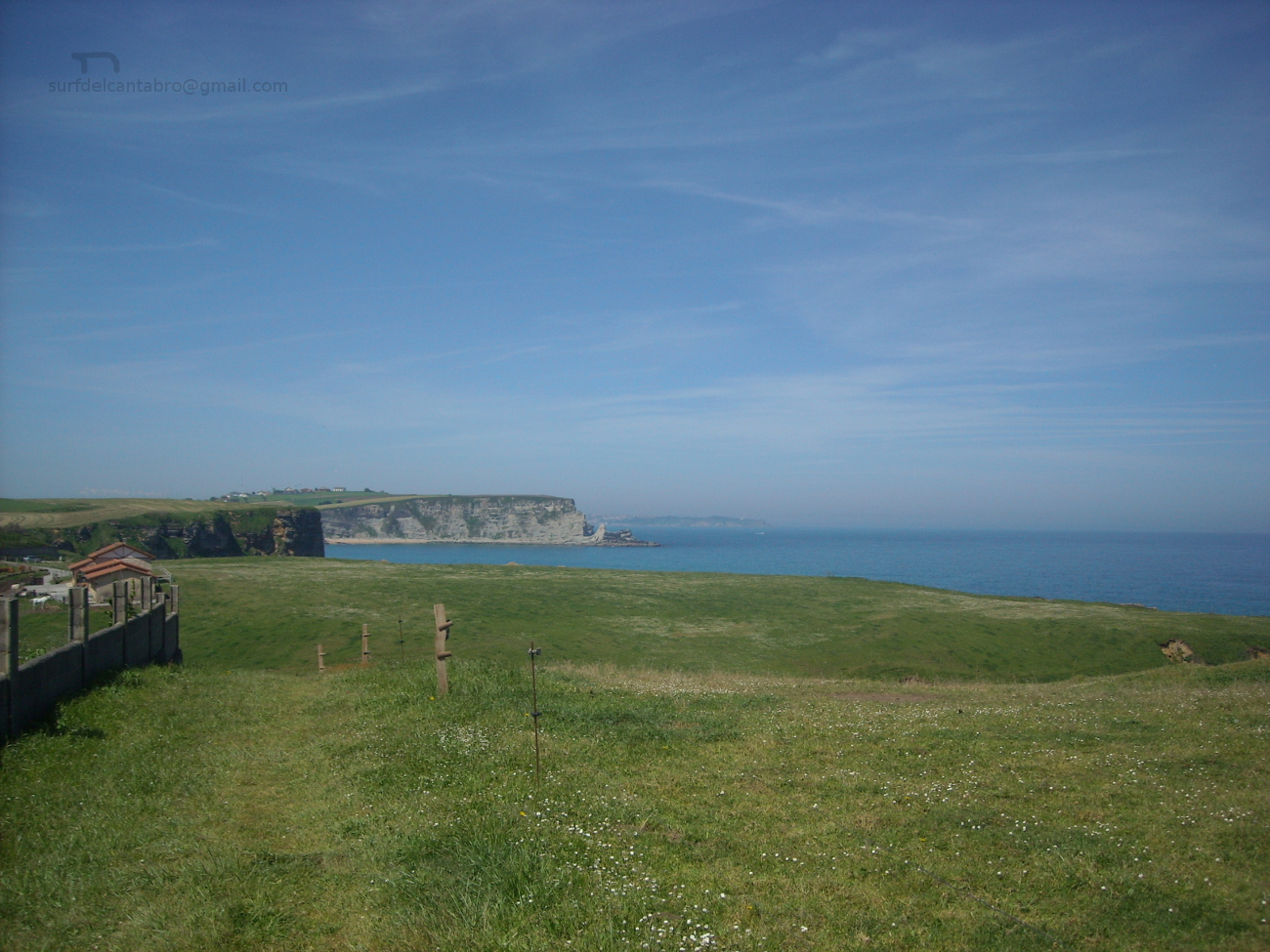
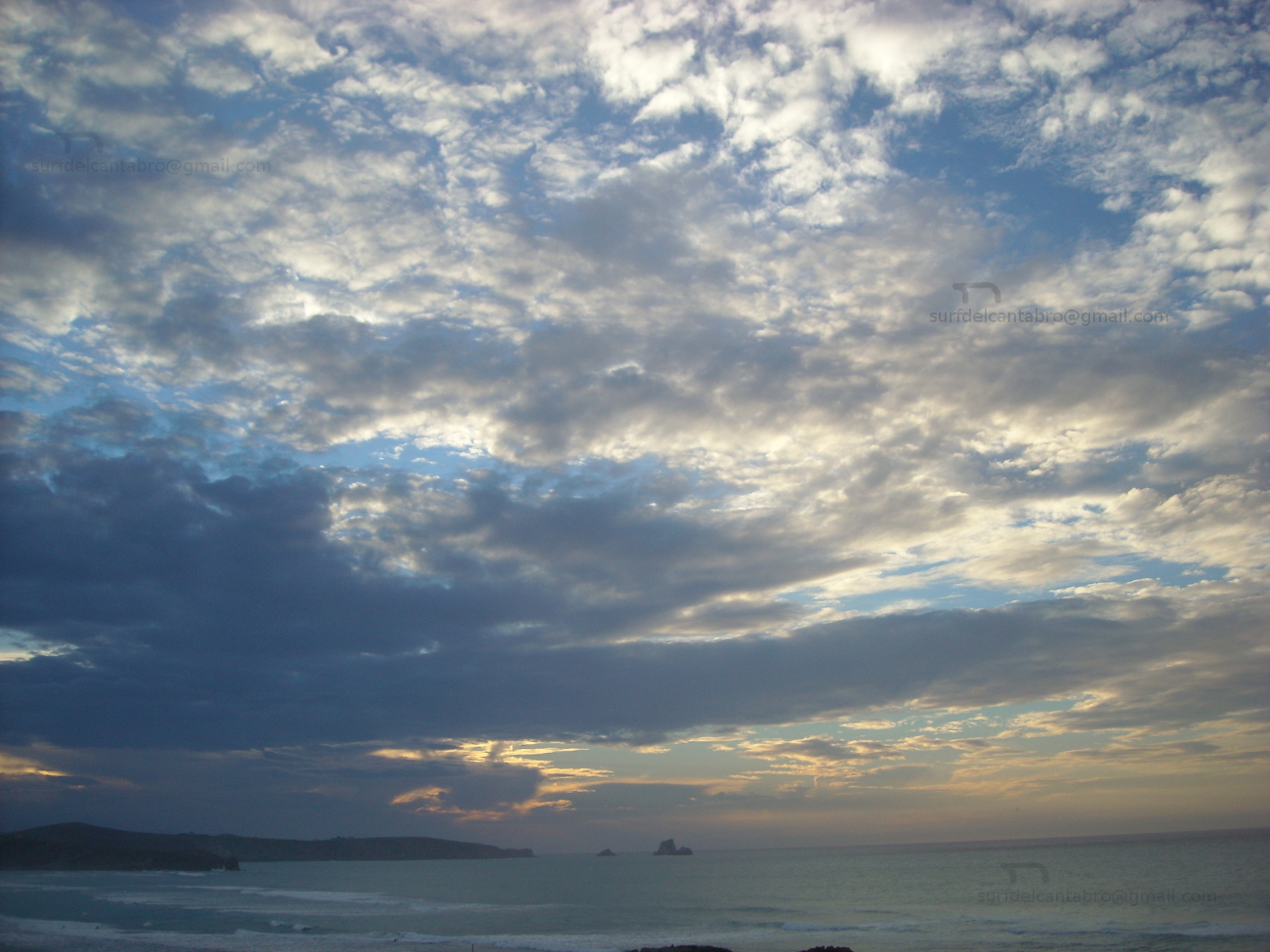
Brazomar, playa
![]() La playa de Brazomar está ubicada en la ciudad de Castro Urdiales, en la costa oriental de Cantabria. Esta playa situada dentro de la ciudad, de 400 metros de longitud y 40 metros de anchura media, disfruta de todos los servicios; destacando su paseo marítimo que se prolonga a través de la localidad.
La playa de Brazomar está ubicada en la ciudad de Castro Urdiales, en la costa oriental de Cantabria. Esta playa situada dentro de la ciudad, de 400 metros de longitud y 40 metros de anchura media, disfruta de todos los servicios; destacando su paseo marítimo que se prolonga a través de la localidad.
El muelle de Don Luis, acota la playa en su ala izquierda, recibe el oleaje del Mar Cantábrico que se agolpa sobre el muro para cambiar la dirección de las olas y alcanzar el resto de la ensenada. Ambos laterales del arenal tienen fondo rocoso, parcialmente visible con la bajamar. Sus olas de tamaño medio abren a ambos lados, siendo hábiles cerca de la orilla. El pequeño recorrido que alcanzan las ondas, entre 50 metros y 150 metros, favorece las maniobras.
La dirección del oleaje determina el comportamiento de las olas que llegan a Brazomar. Puede arribar casi recto hasta la ensenada o proveniente del este u oeste; para proyectar las olas al lado opuesto de la playa. Comienzan las masas de agua a formar pequeñas colinas que entuban con rápidez. La pared de agua que abre el rizo es fragmentada, por el fondo rocoso, exigiendo concentración y destreza en su navegación. Cuando la Mar lo propicia, las olas hábiles se alejan considerablemente de la orilla, situando la línea de surf en los laterales y disponiendo de un recorrido considerablemente mayor, ofreciendo a surfistas y caminantes su mejor espectáculo.
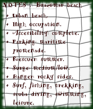
Brazomar, beach
![]() The beach of Brazomar is in the city of Castro Urdiales, in the oriental coast of Cantabria. This beach is placed inside the city, with 400 meters of length and 40 meters of average aproximately width, enjoys all the services; emphasizing its maritime walk that extends across the city.
The beach of Brazomar is in the city of Castro Urdiales, in the oriental coast of Cantabria. This beach is placed inside the city, with 400 meters of length and 40 meters of average aproximately width, enjoys all the services; emphasizing its maritime walk that extends across the city.
The Wharf of Don Luis, it annotates the beach in its left wing, receives the surge of the Cantabrian Sea that accumulates on the wall to change the direction of the waves and to reach the rest of the inlet. Both wings of the sandbank have rocky bottom, which are partially visible with the low tide. Its medium size waves open to both sides, being suitable near the shore. The small tour that the waves reach, between 50 meters and 150 meters, favors the maneuvers.
The surge direction determines the behavior of the waves that come to Brazomar. It can arrive almost straightly up to the inlet or from: East or West; to project the waves to the opposite side of the beach. Them begin, the water masses, to form small hills that curl quickly. The water wall that opens the curl is fragmented, by the rocky bottom, demanding concentration and skill in its navigation. When the Sea propitiates the best conditions to navigate, the skilful waves move away considerably from the shore, placing the line of surf in the wings and having a considerably major tour, offering to surfers and wayfarers its better spectacle.
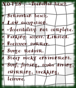
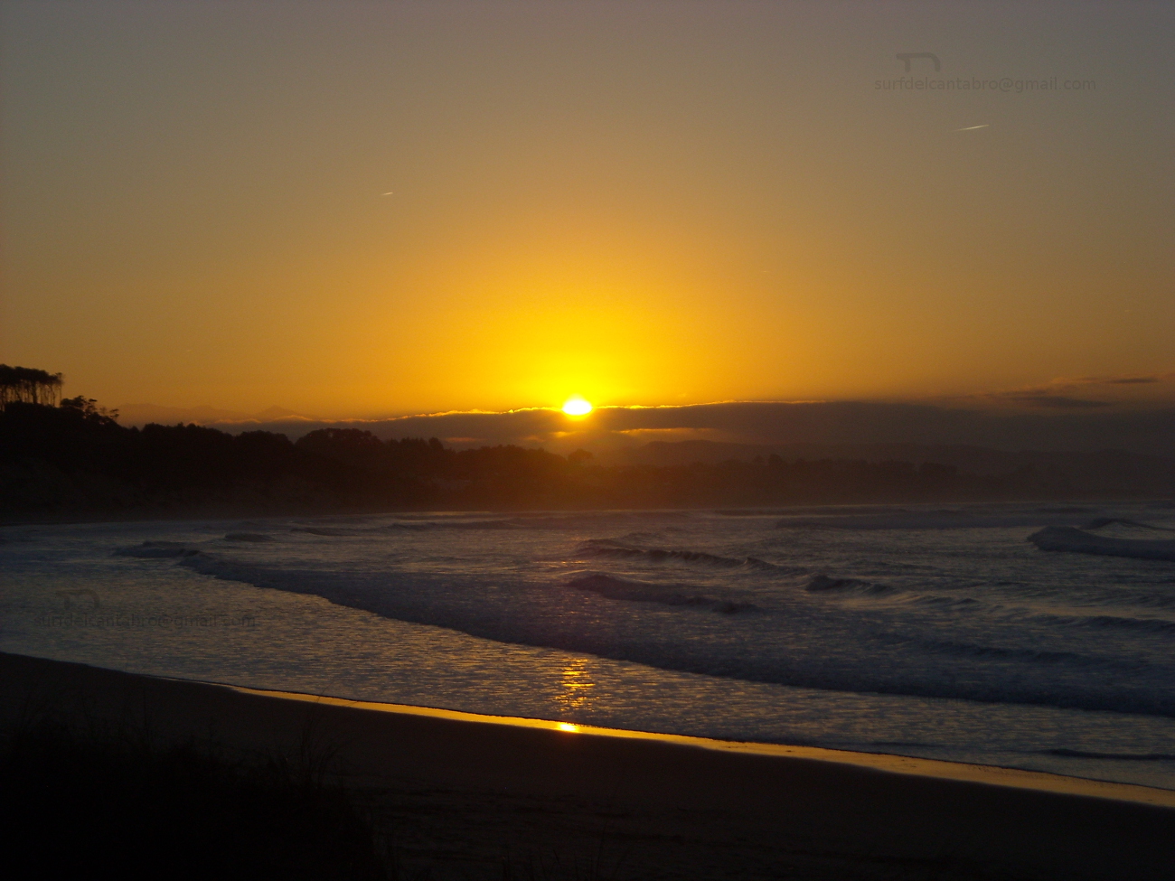
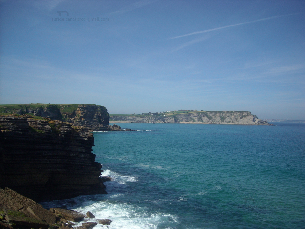
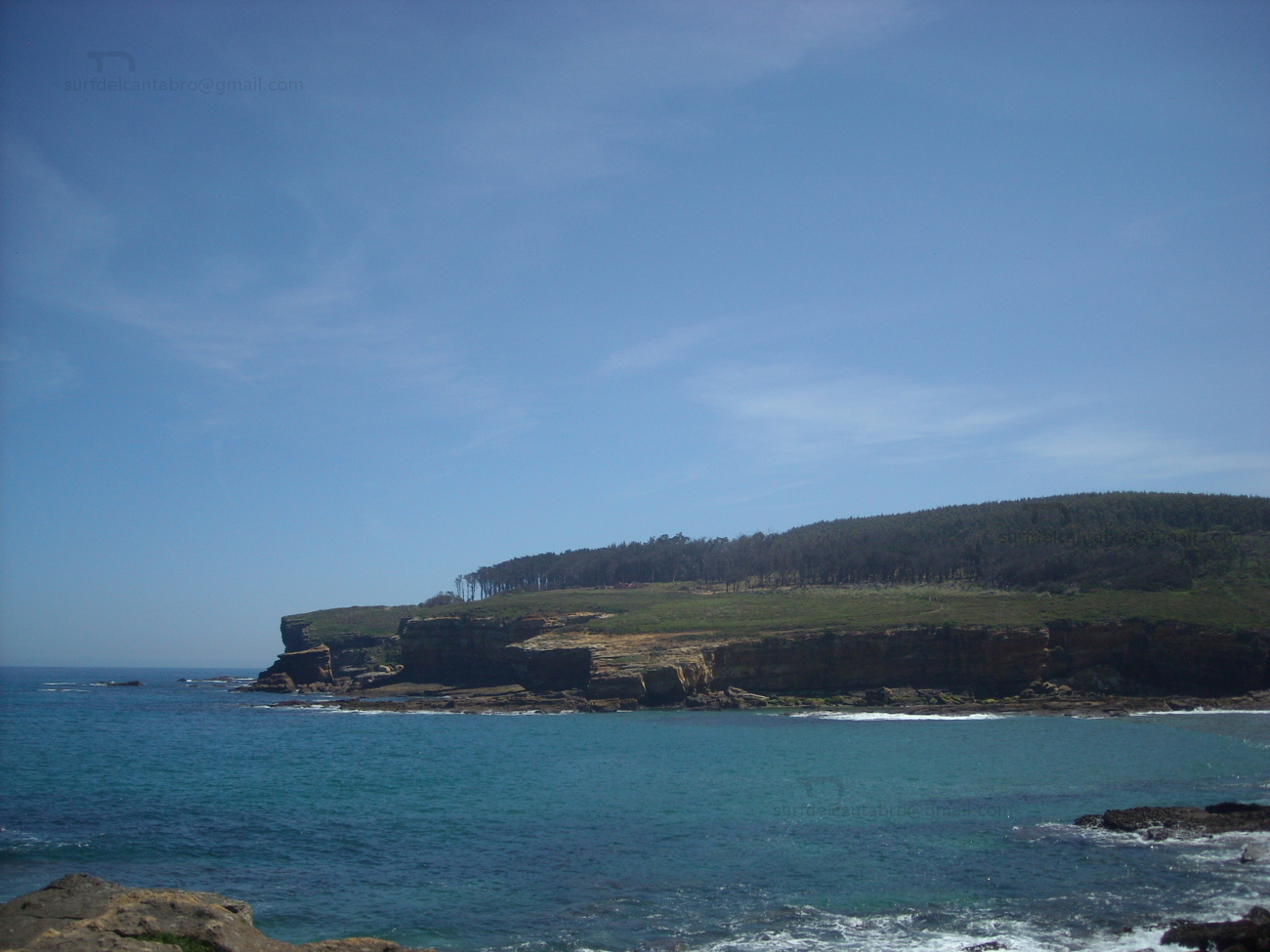
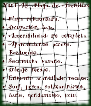
Playa de Arenillas. Islares
![]() La Playa de Arenillas está situada en la localidad de Islares, perteneciente al municipio de Castro Urdiales, en la costa oriental de Cantabria. Es una pequeña cala de 50 metros de longitud y anchura media aproximada de 15 metros que prácticamente queda cubierta con la marea alta.
La Playa de Arenillas está situada en la localidad de Islares, perteneciente al municipio de Castro Urdiales, en la costa oriental de Cantabria. Es una pequeña cala de 50 metros de longitud y anchura media aproximada de 15 metros que prácticamente queda cubierta con la marea alta.
Sus tranquilas aguas bañan el lado izquierdo de la Ensenada de Oriñón. El agua cristalina y su contorno rocoso hacen de la Playa de Arenillas una zona ideal para practicar submarinismo, cuando las condiciones del oleaje lo permiten. Recogida entre formaciones rocosas y protegida parcialmente, recibe las olas que llegan a la playa de Oriñón. El oleaje, ligeramente suavizado; respecto de la playa grande, mantiene una cadencia optima. Olas de menor tamaño, equilibradas y pulidas llegan a su orilla. Las ondas en Islares están condicionadas por Isla Cercada, que rompe las grandes masas de agua que entran a la ensenada, para reconstruir una forma reducida posteriormente. Con su fuerza limitada y pequeño recorrido favorecen las maniobras. Abren su avance hacia la derecha, teniendo los acantilados en frente, disponiendo la navegación a ambos lados. El lado derecho de la onda se extiende en dirección hacia Oriñón, acotado por la desembocadura del Río Agüera, interrumpe su recorrido a la entrada del arenal grande.
Localizada a los pies del macizo Cerredo, al cobijo de la curva rocosa que la contiene, se dispone la Playa de Arenillas. Un pequeño aparcamiento campestre hace de antesala a la pequeña cala que ofrece y regala ella sus aguas, sus olas, la vista panorámica del entorno espectacular y único en Cantabria. Caminantes y surfistas; al encuentro de la belleza que en ella comienza.
Arenillas beach. Islares
![]() The Beach of Arenillas is placed in the locality of Islares, belonging to the municiplaity of Castro Urdiales, in the oriental coast of Cantabria. It is a small cove with 50 meters of length and average approximate width of 15 meters that practically remains covered with the high tide.
The Beach of Arenillas is placed in the locality of Islares, belonging to the municiplaity of Castro Urdiales, in the oriental coast of Cantabria. It is a small cove with 50 meters of length and average approximate width of 15 meters that practically remains covered with the high tide.
Its calm waters surround the left side of Oriñón’s Inlet. The crystalline water and its rocky contour do of the Beach of Arenillas an ideal zone to practise scuba diving, when the conditions of the surge allow it. Gathered between rocky formations and partially protected, it receives the waves that come to Oriñón’s beach. The surge, lightly smoothed; in relation to the big beach, it endures an ideal cadence. Waves of minor size, balanced and polished come to its shore. The waves in Islares are determined by Cercada Island, which breaks the big masses of water that enter to the inlet, to reconstruct a limited form later. With its limited force and small tour, them are suitable for the maneuvers. Them head its advance for the right, having the cliffs in front of them and opening the navigation to both sides. The right side of the wave spreads in direction towards Oriñón, annotated by the Agüera river mouth, interrupts its tour at the entrance of the big sandbank.
Located to the feet of the massif Cerredo, in the cover up of the rocky curve that contains it, arranges the Beach of Arenillas. An small rural parking does of anteroom to the small cove that offers and gives its waters, its waves, the panoramic sight of the spectacular and unique environment in Cantabria. Wayfarers and surfers; to the meeting of the beauty that in it begins.