
Somo, villa
![]() Somo es una localidad perteneciente al municipio de Ribamontán al Mar. Emplazada al sur de la Bahía de Santander, en la costa central de Cantabria, es por sus extensos arenales y entorno un lugar ideal para la práctica del surf y deportes acuáticos.
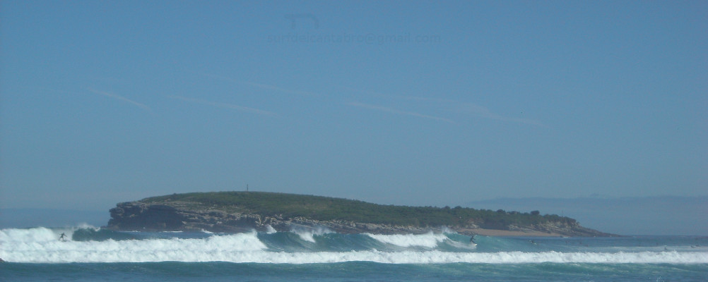
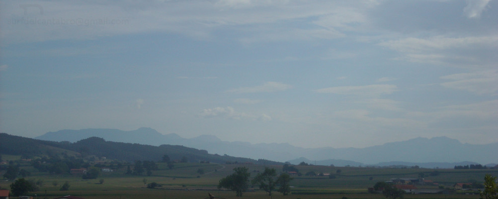
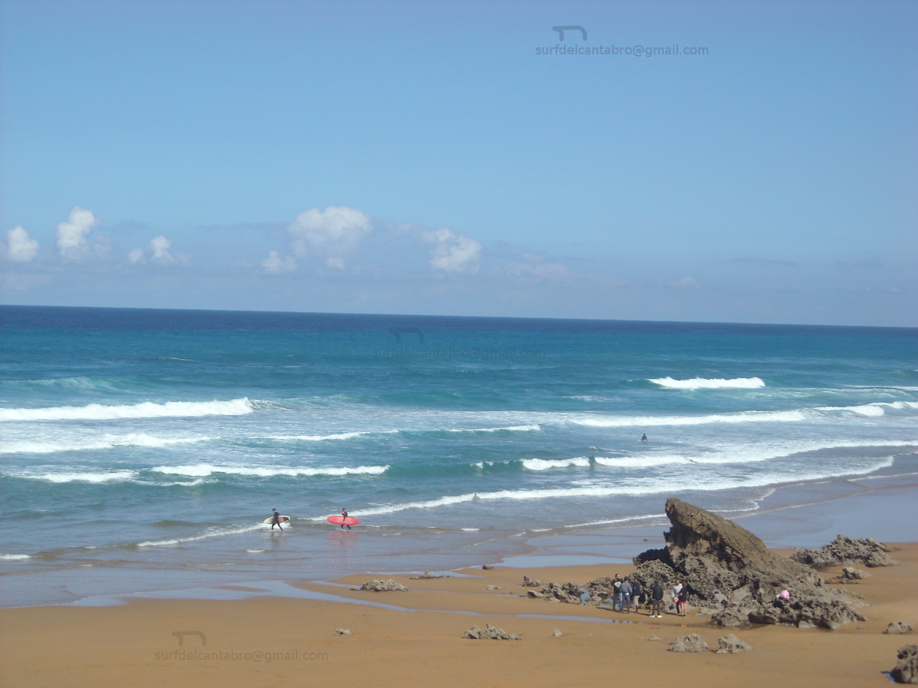
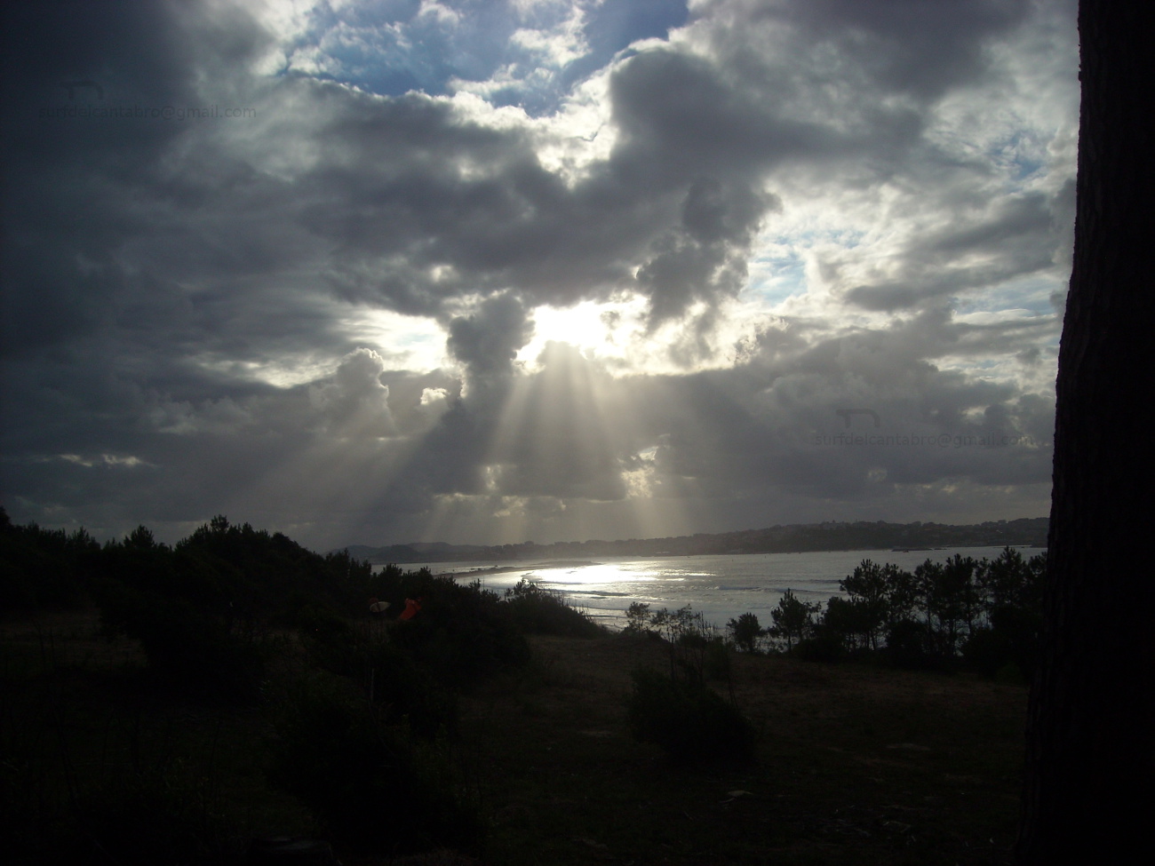
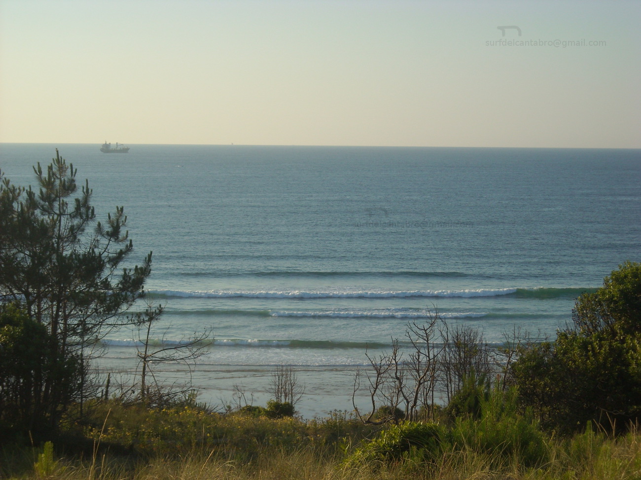
Somo es una localidad perteneciente al municipio de Ribamontán al Mar. Emplazada al sur de la Bahía de Santander, en la costa central de Cantabria, es por sus extensos arenales y entorno un lugar ideal para la práctica del surf y deportes acuáticos.
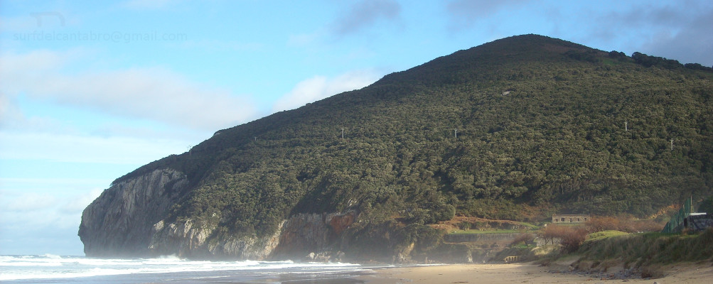
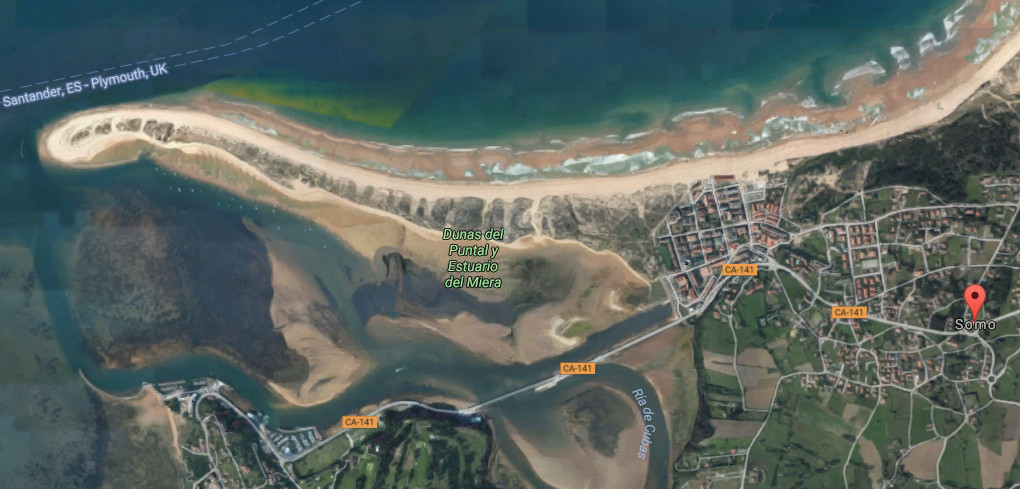
El acceso a la población se puede realizar por carretera ó barco. Un servicio regular de lanchas lo comunica con Santander, con parada en el puerto de Pedreña o destino directo a la playa El Puntal desde los meses de Mayo a Septiembre. El gran arenal de Somo tiene una longitud que sobrepasa los cuatro kilómetros. Ocupando su área sobre una lengua de arena que recoge el frontal de la bahía y la desembocadura de la Ría de Cubas. Las Dunas del Puntal enmarcan la cara sur y destacan las sustanciales diferencias entre las distintas zonas.
El paseo marítimo de Somo se inicia en el centro de la villa extendiendo su ruta hacia el oeste. Presentando sus playas, dunas y bosques. La ciudad de Santander se divisa al noroeste através de la Isla de Mouro, la Península de la Magdalena y el puerto. El Mar Cantábrico habitando el frente y llenando todo el espacio, seduce y embellece todo lugar sobre el que posemos la vista. El final del paseo, tras dos kilómetros, desemboca en el embarcadero. Espacio este que recoge el transporte marítimo y un sin fin de pequeñas barcas de recreo y pesca. Más allá el Puente de Somo que supone la delimitación de la villa y la continuación del camino hacia otras singulares partes de Cantabria.
Somo, village
![]() Somo is a locality belonging to the municipality of Ribamontán al Mar. Located to the south of the Bay of Santander, on the central coast of Cantabria, it is for its extensive sandbanks and enviroment an ideal place for the practice of surf and aquatic sports.
Somo is a locality belonging to the municipality of Ribamontán al Mar. Located to the south of the Bay of Santander, on the central coast of Cantabria, it is for its extensive sandbanks and enviroment an ideal place for the practice of surf and aquatic sports.
The access to the population can be realized by road or ship. A regular service of boats communicates it with Santander, with stop in the port of Pedreña or direct destination to the beach El Puntal from May to September. The great sandbank of Somo has a length that exceeds four kilometres. Occupying its area on a tongue of sand that gathers the frontal of the bay and the Stuary of Cubas. The Dunes of El Puntal frame the south face and stand out the substantial differences between the different zones.
The Maritime Promenade of Somo begins in the center of the villa extending its route towards the west. Presenting its beaches, dunes and forests. The city of Santander is spied to the northwest through the Island of Mouro, the Peninsula of La Magdalena and the port. The Cantabrian Sea living in the front and fills the whole space, it seduces and embellishes any place on which we put the glance. The end of the boardwalk, after two kilometres, ends in the pier. This space gathers maritime transport and an inumerable quantity of small boats of playtime and fishing. Beyond, the Bridge of Somo that supposes the delimiting of the villa and the continuation of the way towards other singular parts of Cantabria.
![]()

 Somo, village

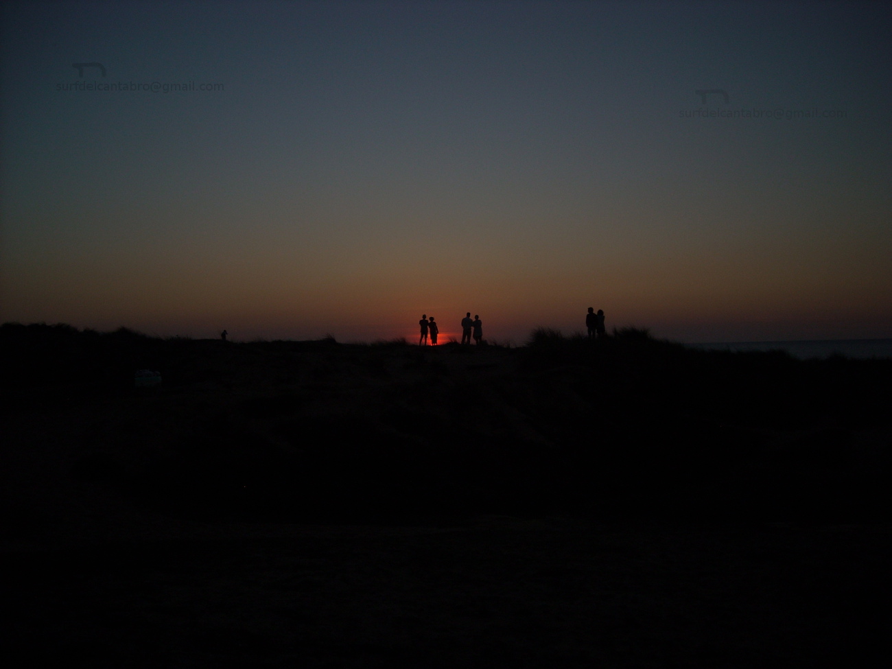
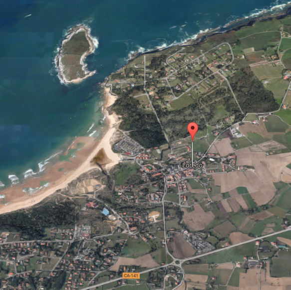
Loredo, villa
![]()
Loredo, pequeña villa costera perteneciente al municipio de Ribamontán al Mar, está situado en la costa central de Cantabria. Su baja densidad de población, apenas cuenta con 700 habitantes, puebla la gran extensión de Loredo entorno a su costa y playas.
Las casas de piedra que pueblan la zona, los verdes prados, sus dunas y bosques, ofrecen sensaciones que entretienen la vista, susurran al oído melodías que trae el mar y aderezan el olfato con recuerdos o nuevas sensaciones. Todos estos atractivos lucen en las fiestas de la localidad, en cualquier visita a la zona y en una carrera internacional de caballos que se celebra en sus arenales.
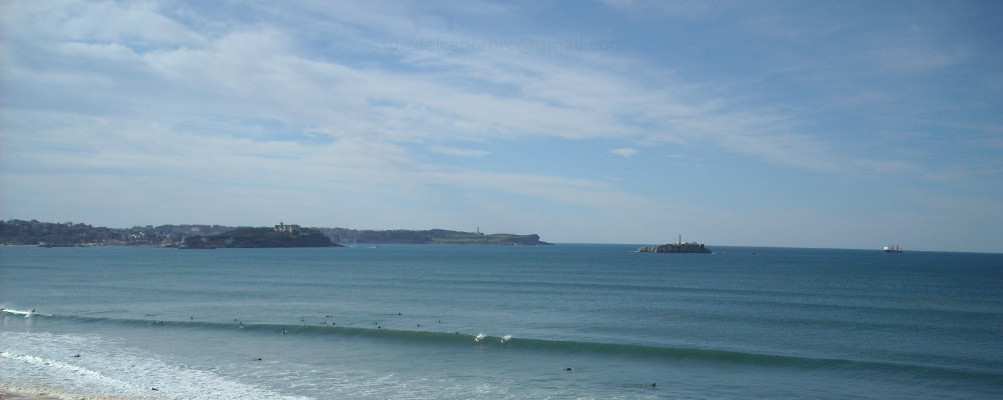
El trazado de la localidad está condicionado por la curva que dibuja su costa a través de sus arenales. Destaca la Isla de Santa Marina, en la parte central de Loredo y separada de tierra firme por una distancia de 50 metros. Cuando el Mar Cantábrico lanza su fuerza la isla recibe olas de grandes dimensiones que puede superar los 10 metros de altura. Conocida como zona de grandes olas, sus fondos de roca, la fuerza del mar y su lejanía la convierten en un lugar solo apto para profesionales y surfers experimentados. Otro lugar importante, conocido como La Curva, que por su fisonomía registra oleaje prácticamente durante todo el año y ofrece rutas y disfrute desde su arena y entorno.
Loredo, village
![]() Loredo, small coastal villa belonging to the municipality of Ribamontán al Mar, is placed on the central coast of Cantabria. Its low density of population, scarcely it possesses 700 inhabitants, populates the great extension of Loredo around to its coast and beaches.
Loredo, small coastal villa belonging to the municipality of Ribamontán al Mar, is placed on the central coast of Cantabria. Its low density of population, scarcely it possesses 700 inhabitants, populates the great extension of Loredo around to its coast and beaches.
The houses of stone that are in the zone, the green meadows, its dunes and forests, offer sensations that entertain the sight, whisper to the ear melodies that the sea brings and season the smell with recollections or new sensations. All these attractions shine in the holidays of the locality, in any visit to the zone and in an international career of horses that is celebrated in its sandbanks.
The tracing of the locality is determined by the curve that draws its coast across its sandbanks. Stand out the Island of Santa Marina, in the central part of Loredo, which is separated from firm land for a distance of 50 meters. When the Cantabrian Sea throws its force the island receives waves of big dimensions that can overcome 10 meters of height. Known as big waves zone, its funds of rock, the force of the sea and distance turn it into a place only suitable for professionals and experienced surfers. Another important place; known as The Curve, which for his physiognomy allows surge practically all the year round and offers routes and enjoyment through its sand and environment.
![]()

Loredo, village
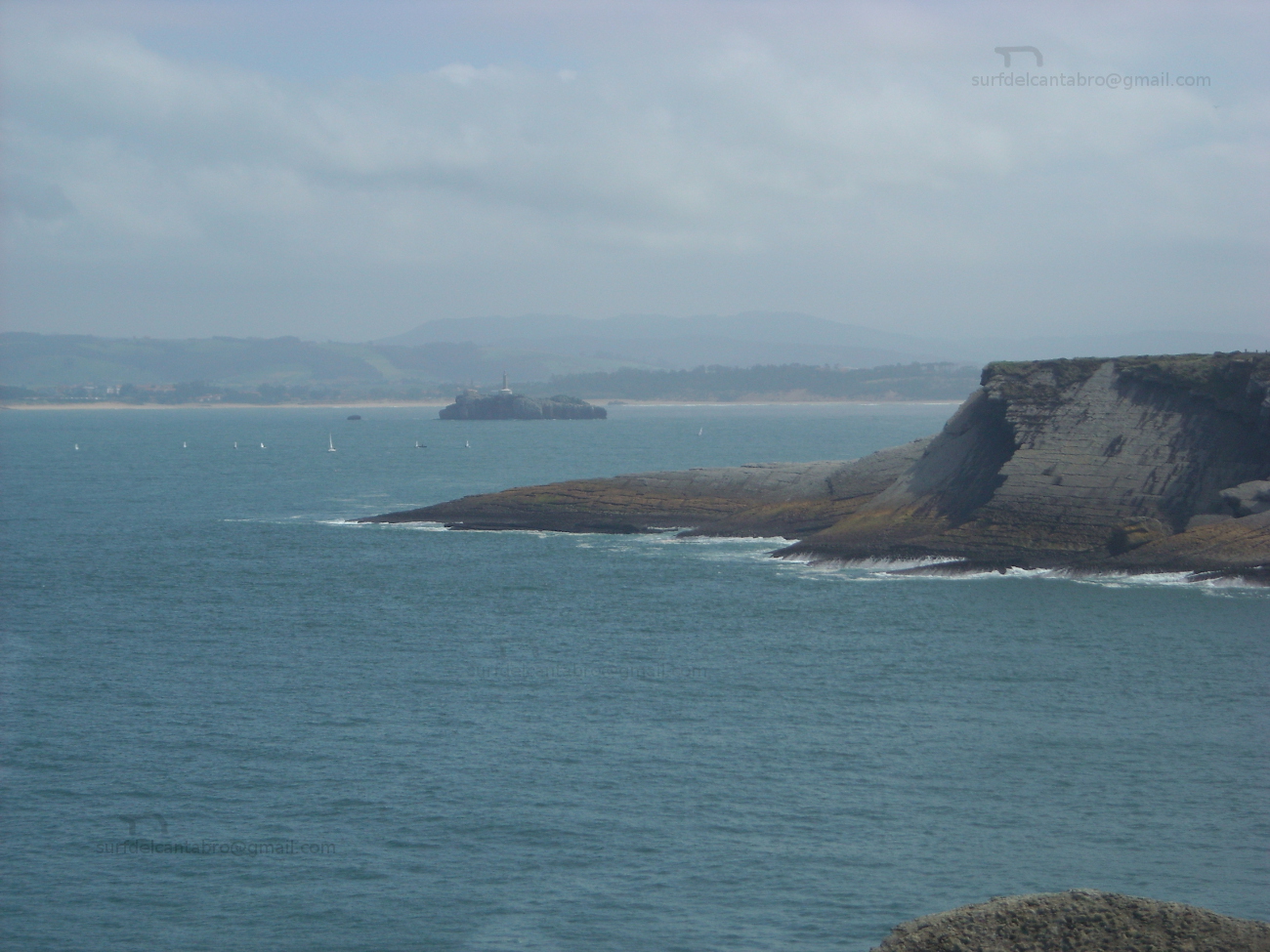
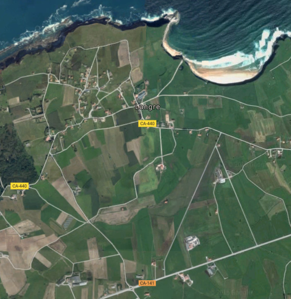
Langre, villa
![]() Langre es una pequeño pueblo costero situado en la costa central de Cantabria y perteneciente al municipio de Ribamontán al Mar. Emplazado al sureste de la Bahía de Santander, toda su costa se encuentra en mar abierto que cimenta parte de la esencia de la localidad.
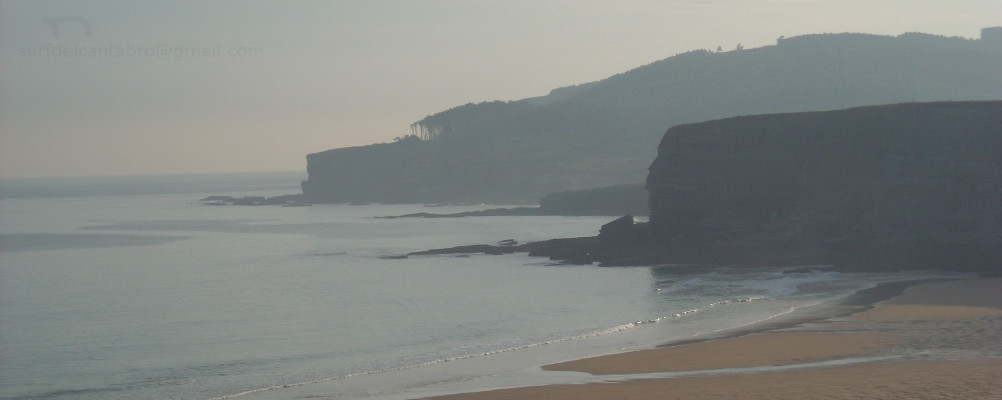
Langre es una pequeño pueblo costero situado en la costa central de Cantabria y perteneciente al municipio de Ribamontán al Mar. Emplazado al sureste de la Bahía de Santander, toda su costa se encuentra en mar abierto que cimenta parte de la esencia de la localidad.
El acceso a Langre se hace a través de carretera nacional la cual recorre y permite descubrir la villa. Campos de siembra, estabulaciones ganaderas y casas de piedra acompañan el camino que cose la tierra de forma irregular conectando barrios y casas. La Iglesia de San Félix, construida en el siglo XVII, es el mejor ejemplo de construcciones de manpostería existentes en la zona.
Los acantilados de Langre reúnen altura, geología y belleza. Moldeados por el Mar Cantábrico, existen formaciones geológicas diferenciadas. Desde el Mirador de Llaranza podemos disfrutar de una vista panorámica del océano, la capital cántabra y la rasa mareal situada a sus pies. El Mirador de Langre, que posibilita la entrada a la playa, descubre una vista completa del arenal y sus acantilados. EL paso por su arenal nos transportará a otro tiempo a través de los sonidos del mar, su espacio, rincones y múltiples sensaciones.
Langre, village
![]() Langre is an small coastal village placed in the central coast of Cantabria and belonging to the municipality of Ribamontán al Mar. Sited to the south-east of the Bay of Santander, all its coast meets with the open sea that confers part of the essence of the locality.
Langre is an small coastal village placed in the central coast of Cantabria and belonging to the municipality of Ribamontán al Mar. Sited to the south-east of the Bay of Santander, all its coast meets with the open sea that confers part of the essence of the locality.
The access to Langre is done across national road which crosses and allows to discover the village. Fields, farmsteads and houses of stone accompany the way that sews the land with irregular form, connecting neighborhoods and houses. San Félix’s Church, constructed in the 17th century, is the best example of constructions of masonry existing in the zone.
The cliffs of Langre have height, geology and beauty. Molded by the Cantabrian Sea, there exist differentiated geological formations. From Llaranza’s Viewing-point we can enjoy a panoramic sight of the ocean, the Cantabrian capital and tidal plain placed to its bottom. Langre’s Viewing-point, which makes possible the entry to the beach, discovers a complete sight of the sandbank and its cliffs. The walk along its sandbank will transport us to another time across the sounds of the sea, its space, corners and multiple sensations.
![]()

Langre, village