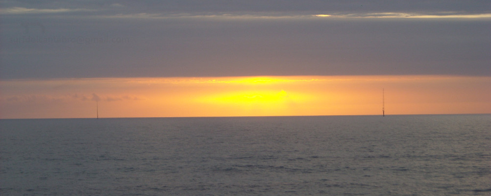
La borrasca, con el paso de los días, se desplazó hacia la costa cantábrica. El temporal, que habitaba en alta mar, mantuvo a la flota pesquera amarrada a puerto. Sobre Cantabria arreciaban las lluvias con tal intensidad que daba la impresión de no tener final. El jueves el clima descansó, apareciendo nubes bajas y claras. El día permaneció nublado. En las noticias predecían la llegada de un anticiclón.
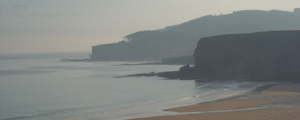
Habíamos quedado a las nueve de la mañana en la segunda Playa del Sardinero. Después de cargar el equipo, me dirigí hacia las playas. La entrada a Santander registraba el transito habitual de un día laboral. Llegando a la rotonda, que se encuentra contigua al Parque de la Marga, iba apareciendo la Darsena de Maliaño; ocultada parcialmente por los edificios de entrada a la capital. Los barcos pesqueros, atracados en el puerto, se disponían en fila. Juntos, entre ellos y el balanceo provocado por el estado del mar, formaban un todo con sus partes. Movimiento rítmico y libre que evocaba en mi cabeza antiguas historias de pescadores disfrutadas en la infancia. Gente yendo hacia la lonja de pescado, marineros revisando los equipos, y un movimiento de algunas personas que desperezadas parecían ansiar recuperar los días inhábiles que causó el temporal. Avanzando por la carretera, dejando atrás la Biblioteca Central de Cantabria, apareció la parada del Ferry que llega de Playmouth; a su izquierda los Jardines de Pereda continuaban en obras. Atajando por el Túnel de Tetúan, llegué al Sardinero.
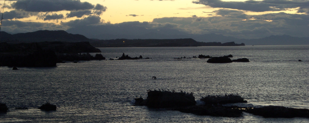
El final de la carretera, es esta zona, termina en una rotonda que da acceso a los restaurantes y hoteles que con ella se anexan. Comienza aquí un paseo que se prolonga a lo largo de unos kilómetros, siendo la primer parada el Palacio de la Magdalena. El oleaje sufrido los días previos causo desperfectos en negocios y bajos cercanos. El arenal moldeado por la tempestad cambio su forma, reduciendo el volumen de arena en la playa que fue dispersado en las zonas próximas. La policía local había acordonado las áreas devastadas. Charcos de agua cubrían la carretera y el adoquinado. Las ramas rotas de los árboles hablaban de las dimensiones de la borrasca. Bajé del coche con cara de perplejidad. Un señor, que regresaba con su periódico, comentó: «niño, la fuerza del cantábrico, esto siempre ha ocurrido. Tan antiguo como el mundo». Se fue alejando con una sonrisa, yo asentí con una mueca.
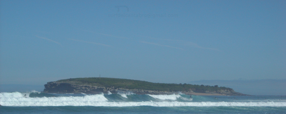
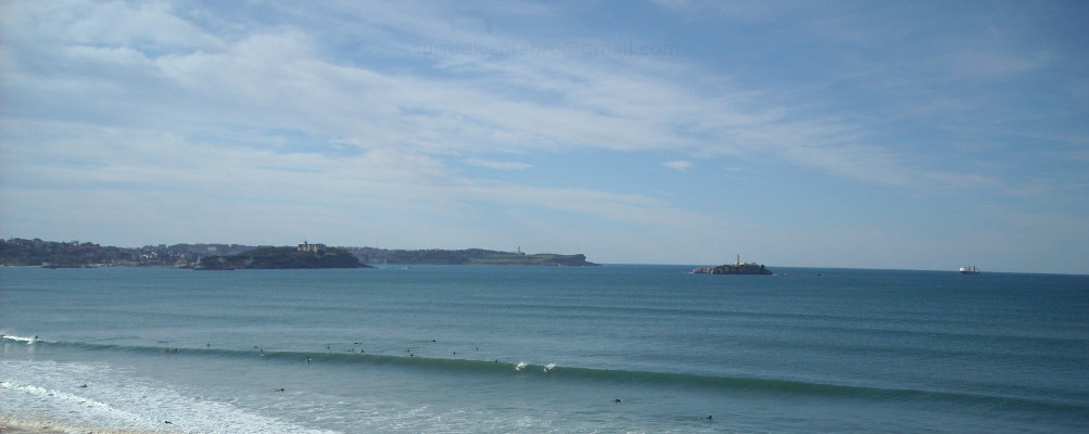
Junto a un banco, apoyados, estaban los colegas Dani e Irne. Después de saludarnos, permanecimos en silencio durante unos minutos. Tiempo después llegó un camión, con personal del ayuntamiento, para retirar los desperfectos. En Cabo Menor las olas chocaban contra las rocas proyectando una columna de agua blanca que se elevaba varios metros. En la playa las olas que llegaban rompían irregularmente cubriendo con un manto de espuma las zonas útiles para practicar surf. Al mediodía, con la pleamar, las condiciones iban a mejorar. Después de charlar un buen rato y vivir las sensaciones del entorno, fuimos a desayunar.
Coast Highway. I
 The tempest, with the nature of the days, moved towards the Cantabrian coast. The temporary, which was living far from the coast, forced the fishing vessels to remain docked at port. On Cantabria the rains were growing worse with such an intensity that was giving the impression of not having end. On Thursday the climate rested, appearing low and clear clouds. The day remained cloudy. In the news it was predicting the arrival of an anticyclone.
We had stayed at nine o’clock in the morning in the second Beach of the Sardinero. After loading the equipment, I went towards the beaches. The entry to Santander was registering the habitual traffic of a labor day. Coming to the roundabout, which is contiguous to La Marga Park, Maliaño’s Dock was appearing; concealed partially by the buildings of entry to the capital. The fishing ships, were in row. Together, between them and the balancing provoked by the condition of the sea, forming a single thing with its parts. Rhythmic and free movement that evoked fishermen’s former histories that I enjoyed when I was a child. People were going to the fish market, sailors were checking the equipments, and a movement of some persons who seemed to desire and recover the non-working days that the temporary caused. Advancing through the road, leaving behind the Central Library of Cantabria, there appeared the season of the Ferry that comes from Playmouth; to its left side the Pereda Gardens was continuing in works. Taking a short cut by Tetúan’s Tunnel, I came to the Sardinero.
The final of the road, it is this zone, ends in a roundabout that leads to the restaurants and hotels that with it are annexed. It begins here a avenue that extends along some kilometres, being its first point the Palace of La Magdalena. The waves that were lived the previous days caused damages in business and mezzanines. The sandbank molded by the tempest changed its form, reducing the volume of sand in the beach that was dispersed in the next zones. The city police had sealed the devastated areas. Water puddles were covering the road and the paved one. The torn branches of the trees were speaking about the dimensions of the tempest. I went down the car with face of perplexity. A gentleman, who was returning with his newspaper, commented: » kid, the force of the Cantabrian Sea, this always has happened. So ancient as the world «. He was moving away with a smile, I answered with a grimace.
Close to a bank, supported, there were the colleagues Dani and Irne. After greeting ourselves, we remained silently during a few minutes. Time later came a truck, with personnel of the town hall, to withdraw the damages. In Cabo Menor, the waves were hitting against the rocks; projecting a column of white water that was rising several meters. In the beach the waves that were coming were breaking irregularly, covering with a mantle of foam the useful zones to practise surf. To the midday, with the high tide, the conditions were going to improve. After chatting a good moment and living the sensations of the environment, we went to have breakfast.

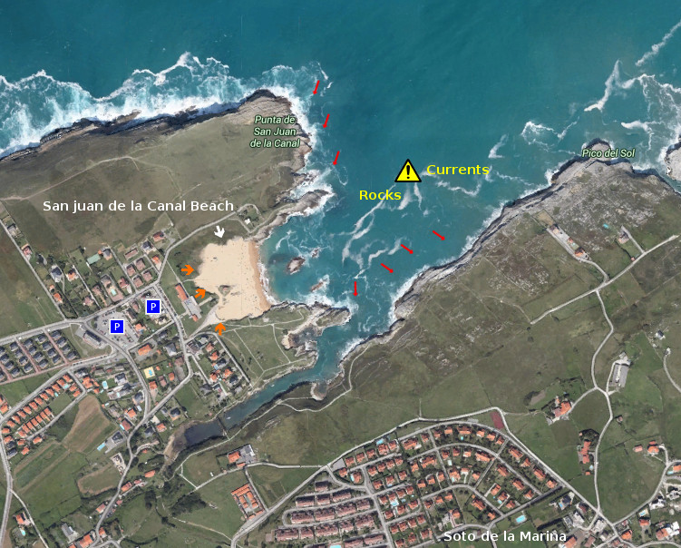
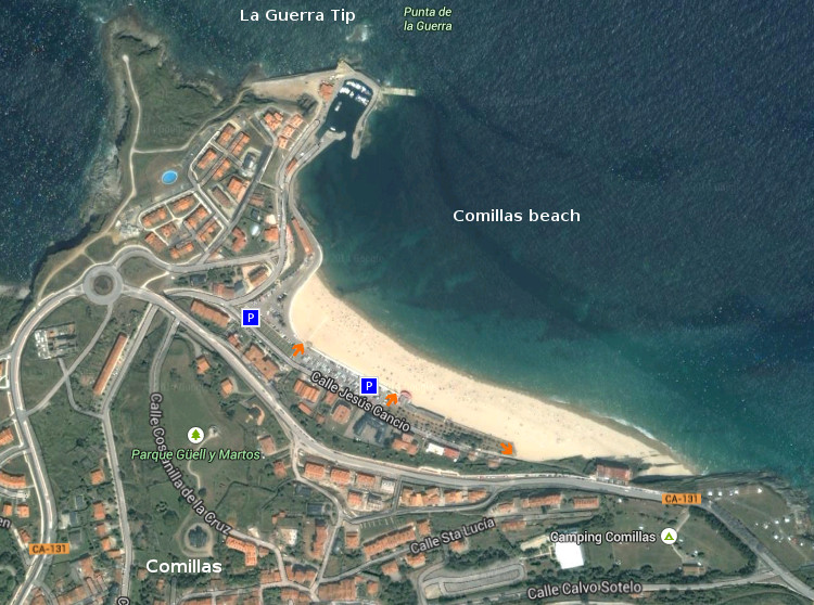
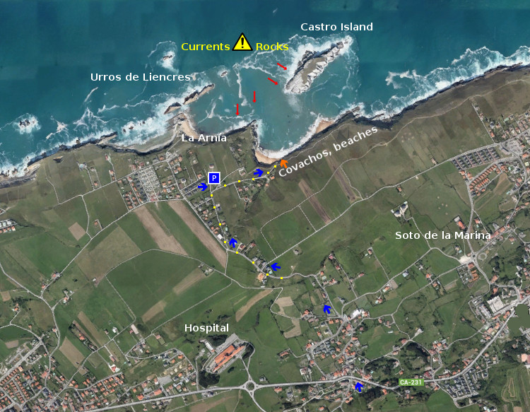
 Localización/Localization