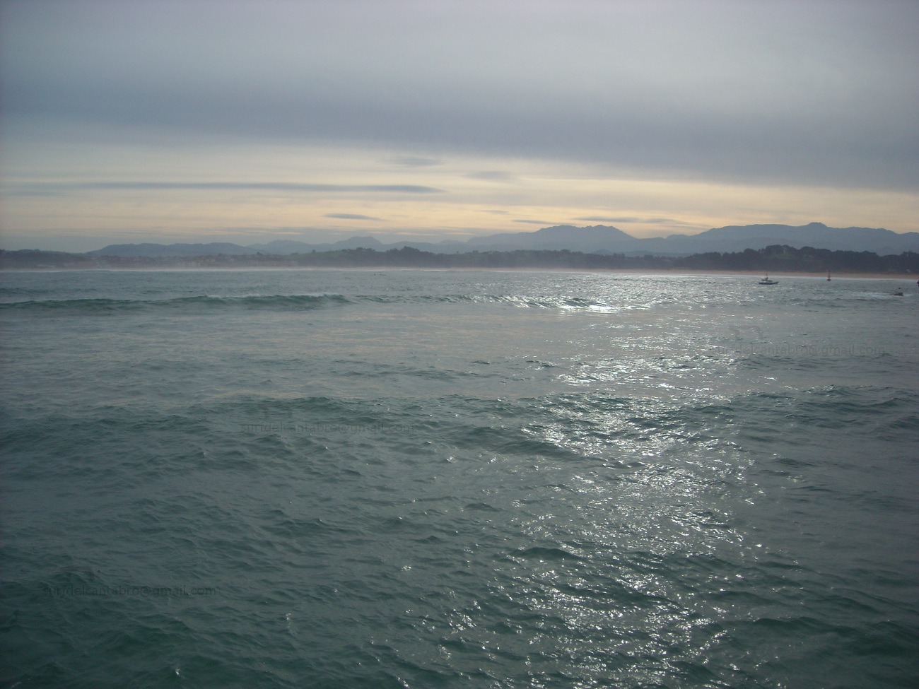
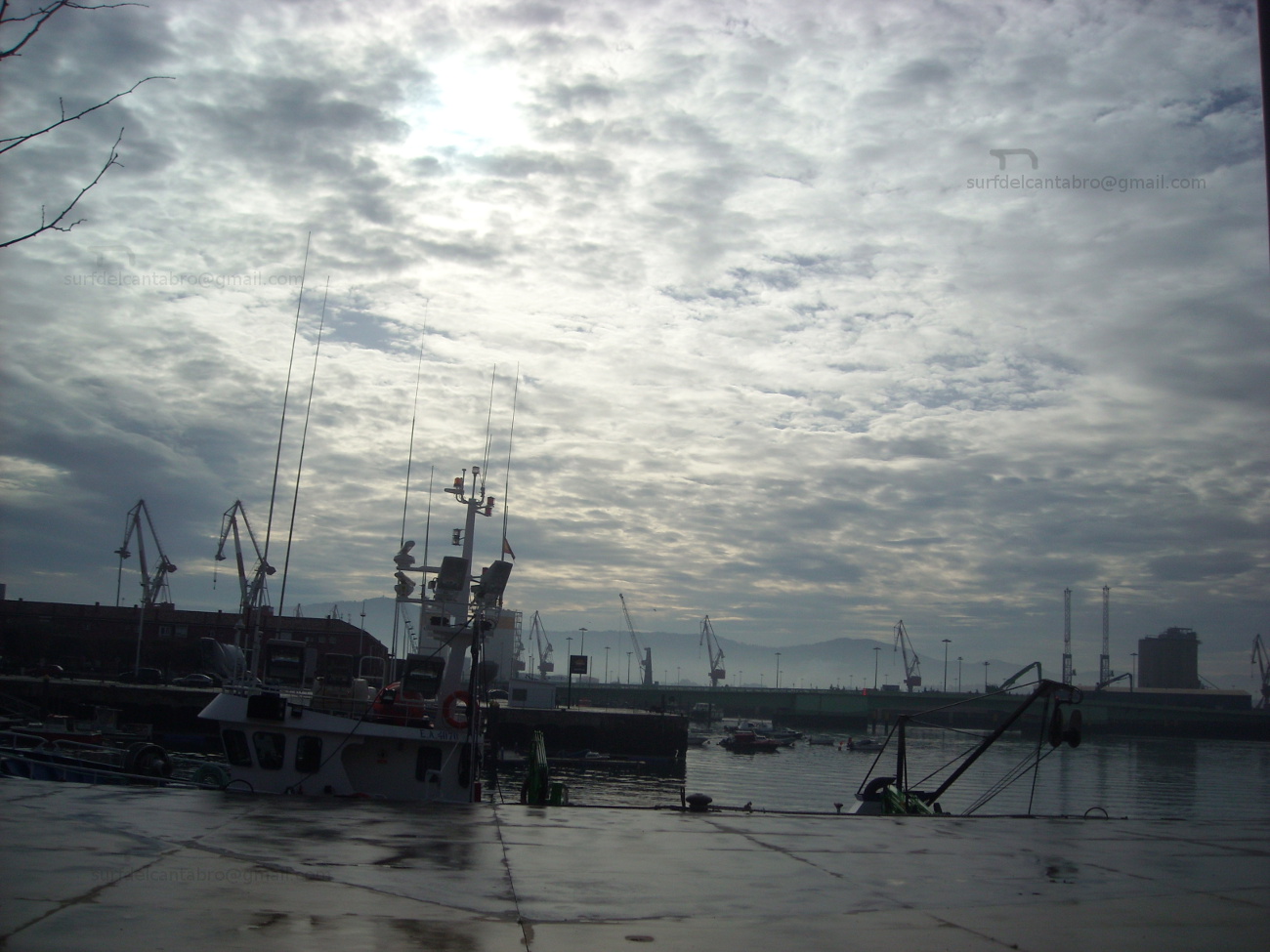
El Camello, playa

Icono Español. Icon Spanish. El Camello, playa 
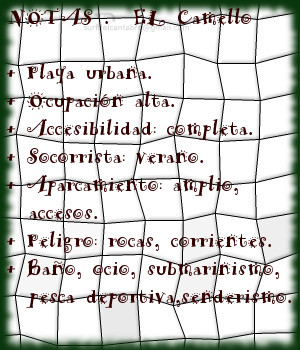
El Camello es una pequeña y emblemática playa situada en Santander. Sus reducidas dimensiones, 200 metros de largo y 50 metros de ancho, no reflejan la singularidad del pequeño arenal.

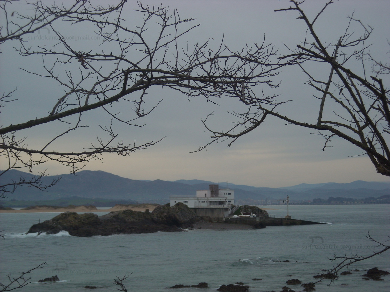
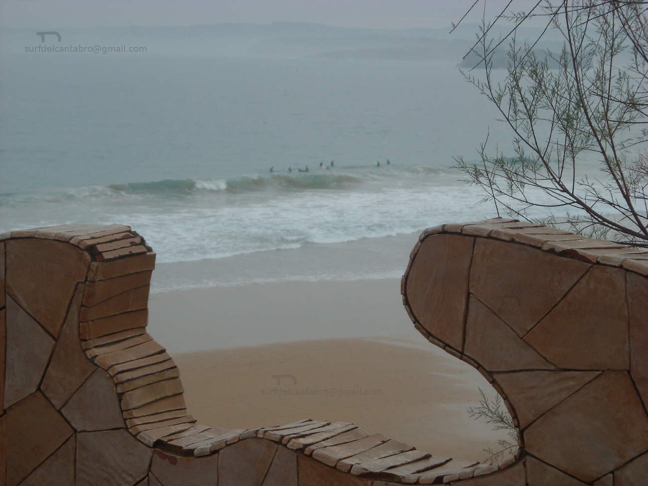
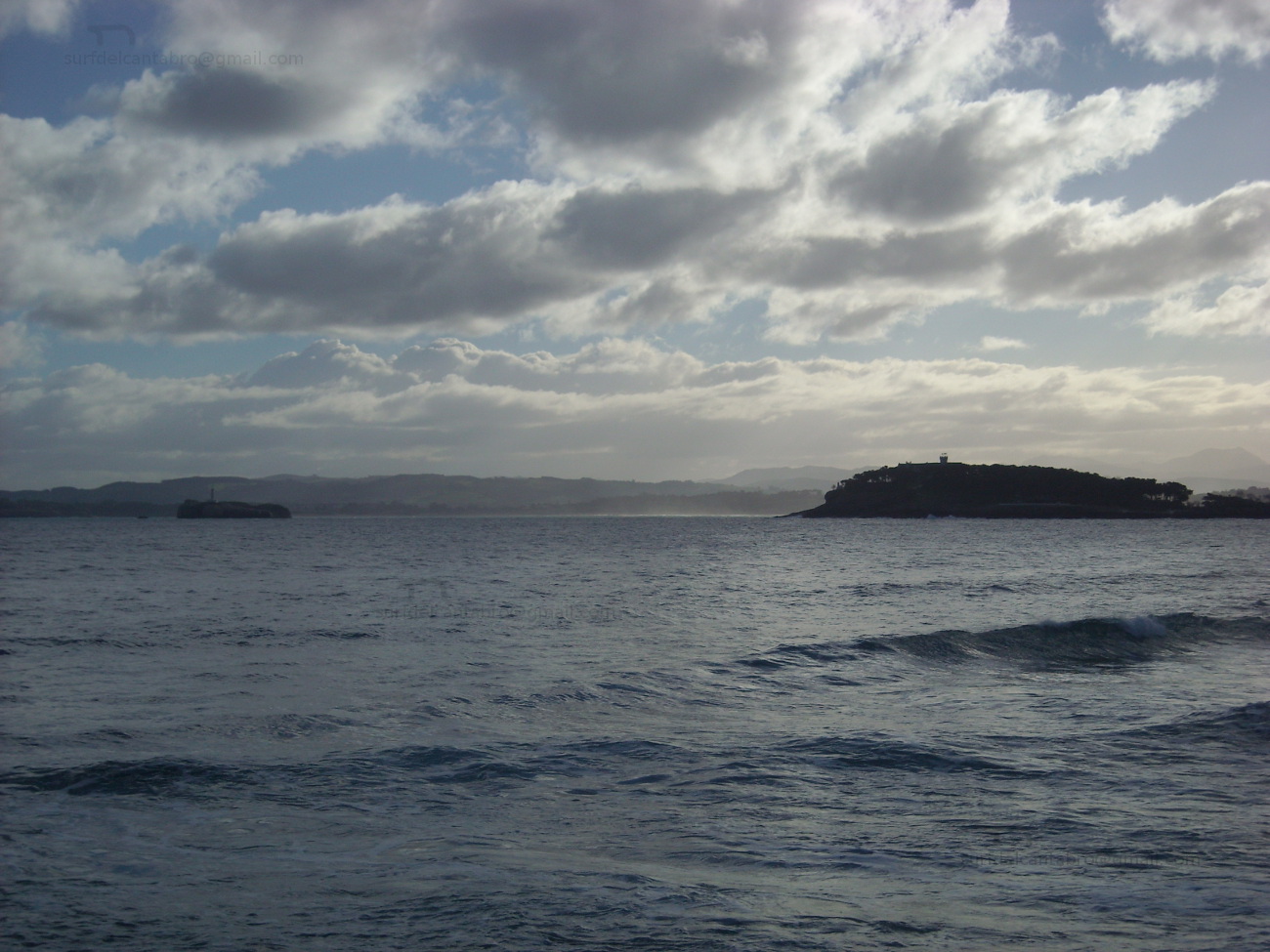
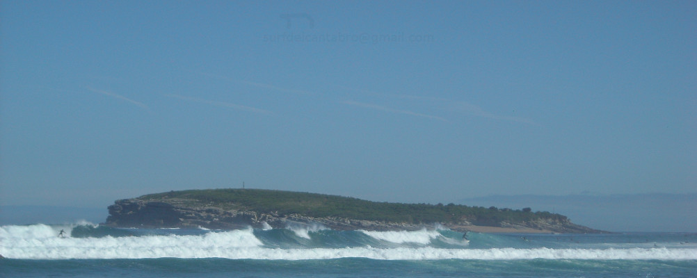
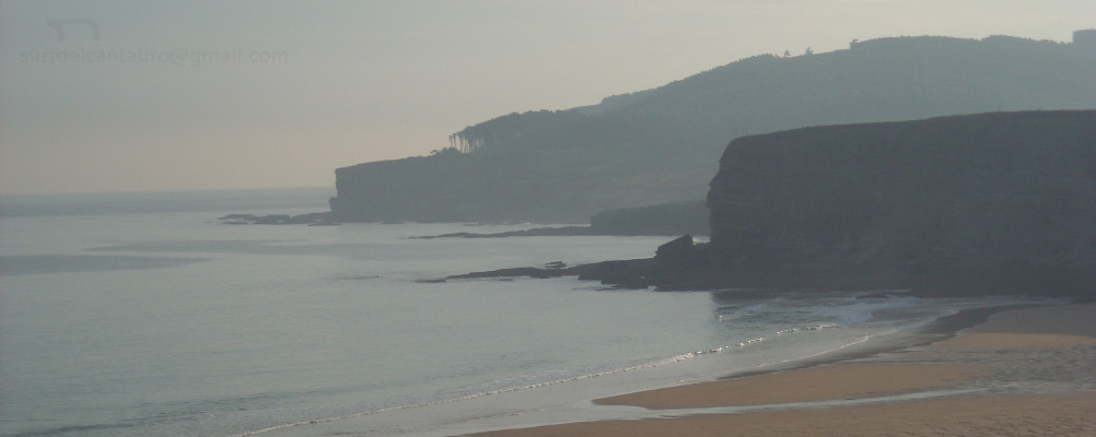
Ubicada entre la Primera playa del Sardinero y la Península de la Magdalena, posee abundantes rocas diseminadas por sus aguas y fondo con pendiente notable. Una de sus formaciones rocosas, con forma de camello, da nombre a la playa. Cuando las condiciones lo permiten, es una zona ideal para practicar submarinismo debido a la riqueza de su arrecife. Destaca también la pesca deportiva y deportes de playa. Los fines de semana y verano se organizan de forma amateur competiciones de palas. La naturaleza de la playa, su fisonomía y limitadas dimensiones descartan la práctica del surf.

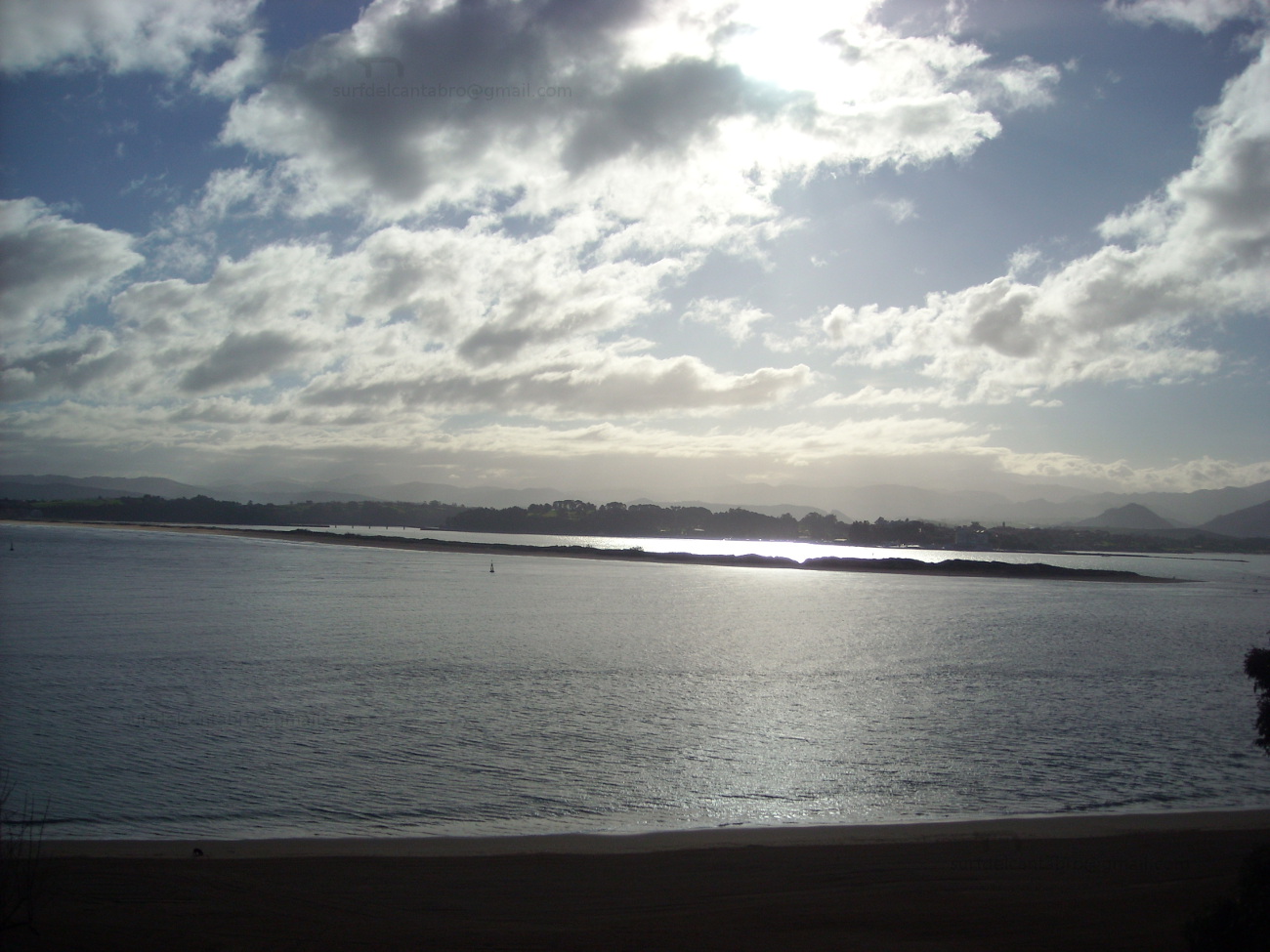
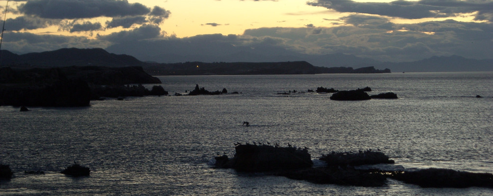
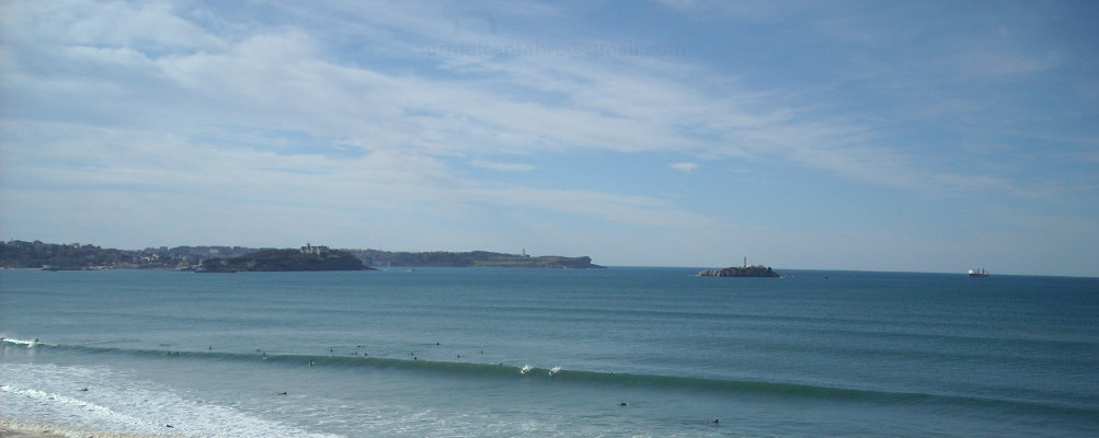
Este pequeño rincón de descanso multiplica sus posibilidades a través de sus aguas y la perspectiva que abre de la costa central santanderina. Las playas del Sardinero y Mataleñas a la izquierda, junto con la cara oeste de la Península de la Magdalena, forman una postal que completa la línea del horizonte.
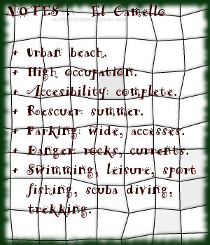
Cabecera Cities Place Beaches . El Camello, playa
El Camello, notas

El Camello, beach

Icono Inglés. Icon English. El Camello, beach El Camello is an small and emblematic beach placed in Santander. Its limited dimensions, 200 meters of length and 50 meters of width, do not reflect the singularity of the small sandbank.

Located between the First beach of the Sardinero and the Peninsula of the Magdalena, it possesses abundant rocks spread by its waters and bottom with notable earring. One of its rocky formations, with form of camel, gives name to the beach. When the conditions allow it, it is an ideal zone to practise scuba diving due to the wealth of its reef. It also the sports fishing and beach sports stand out. The weekends and summer,amateur competitions with ball and raquets on the beach are organized. The nature of the beach, its physiognomy and limited dimensions reject the practice of surf.

This small corner of rest multiplies its possibilities across its waters and the perspective that opens of the central coast of Santander. The beaches of the Sardinero and Mataleñas to the left side, together with the west face of the Peninsula of the Magdalena, form a postcard that completes the line of the horizon.

Cabecera Cities Place Beaches. El Camello, beach
EL Camello, notes

Share

La Fuente, playa

Icono Español. Icon Spanish. La Fuente, playa La playa La Fuente, ubicada en San Vicente de las Barquera; en la costa occidental de Cantabria, es una pequeña cala de 150 metros de longitud y 20 metros de anchura media. Conservada prácticamente en estado natural, presenta baja ocupación y no dispone de ningún servicio.

La Punta de África, a la izquierda, y la Punta del Fraile, a la derecha, contienen la ensenada y delimitan el arenal. Sus reducidas dimensiones y orografia descubren un entorno singular. Abierta al mar, recibe la fuerza del Cantánbrico que baña la costa y es modulado por los acantilados de la zona. El fuerte oleaje que llega a La Fuente abre a ambos lados. El corto recorrido que alcanzan las ondas favorece las maniobras. La profundidad de la Ensenada de Fuentes proporciona varios picos de olas, a diferentes distancias de la orilla. A medida que avanzamos hacia mar abierto las corrientes, ya presentes, aumentan su fuerza. Por este motivo, adentrarse a los picos alejados es sólo recomendable para surfers experimentados y conscientes de los riesgos.

La apartada localización, las dimensiones, rocas y corrientes son características que definen a esta cala y proyectan virtudes que ayudan a desconectar mientras se surfea y disfruta de su diferente navegación.

Cabecera Cities Place Beaches . La Fuente, playa
La Fuente, notas

La Fuente, beach

Icono Inglés. Icon English. La Fuente, beach The beach of La Fuente, located in San Vicente de la Barquera; on the western coast of Cantabria, it is a small cove with 150 meters of length and 20 meters of average width. Preserved practically in natural condition, it presents low occupation and has not any service.

The Tip of Africa, to the left side, and the Tip of El Fraile, to the right, contain the inlet and delimit the sandbank. Its limited dimensions and orography discover a singular environment. Opened the sea, it receives the force of the Cantánbrico that washes the coast and is modulated by the cliffs of the zone. The strong surge that comes to La Fuente opens to both sides. The short tour that the waves reach favors the maneuvers. The depth of the Inlet of Fuentes provides several beaks of waves, to different distances of the shore. As we advance towards open sea the currents, already present, increases its force. Due to this motive, to enter to the remote beaks, is only advisable for experienced surfers and conscious of the risks.

The isolated location, the dimensions, rocks and currents are features that define to this cove and project virtues that help to disconnect while you are surfing and enjoying its different navigation.

Cabecera Cities Place Beaches. La Fuente, beach
La Fuente, notes

Share

Punta Liñera, playa

Icono Español. Icon Spanish. Punta Liñera, playa Punta Liñera es un pequeña cala emplazada en San Vicente de la Barquera, en la costa oriental de Cantabria. Sus reducidas dimensiones, apenas 150 metros en un parte más ancha; con la arena sólo visible en marea baja, sirven de acceso a un entorno que ofrece múltiples posibilidades.

Punta Liñera, nombre que recibe el cabo que protege y bautiza la cala, forma una ensenada que es acotada en su extremo derecho por la Punta del Castillo. La rasa mareal que cimenta sus fondos contribuye a crear un rico ecosistema y contribuye a la biodiversidad de sus aguas. Fondos de roca pulida y erosionada por efecto del Mar Cantábrico a lo largo del tiempo habitan cerca de la costa. Más allá, el Mar arriba libre recorriendo la costa y formando una ola característica de izquierdas, rápida y tubera.

EL paseo por los acantilados descubre la amplitud del entorno y su riqueza paisajística. Hacia el Oeste la costa de Pechón, al Este la costa de San Vicente de la Barquera. Refulgente visión que fusionará el espacio con la imaginación

Cabecera Cities Place Beaches . Punta Liñera, playa
Punta Liñera, notas

Liñera Tip, beach

Icono Inglés. Icon English. Liñera Tip, beach Liñera Tip is an small cove located in San Vicente de la Barquera, on the oriental coast of Cantabria. Its limited dimensions, no more than 150 meters in its width; with the sand only visible in low tide, is used as access to an environment that offers multiple possibilities.

Liñera Tip, name that receives the end that protects and baptizes the cove, forms an inlet that is annotated in its right wing by El Castillo Tip. The tidal plain that establishes its funds helps to create a rich ecosystem and the biodiversity of its waters. Funds of polished and eroded rock by effect of the Cantabrian Sea throughout the time are near the coast. Beyond, the Sea arrives freely crossing the coastline and forming a characteristic wave that open to left sides, with speed and pipes.

The promenade along the cliffs discovers the extent of the environment and its landscape wealth. Towards the West Pechón’s coast, in the eastern part San Vicente de la Barquera coast. Refulgent vision that would fuse the space with the imagination

Cabecera Cities Place Beaches. Liñera Tip, beach
PuntaLiñera, notes

Share

La Virgen del Mar, playa

Icono Español. Icon Spanish. La Virgen del Mar, playa La playa de la Virgen del Mar se ubica en la ciudad de Santander, en la costa central de Cantabria. En la península que contiene la Ermita que da nombre a la playa, el Mar Cantábrico baña su perímetro en marea alta. Un puente que habilita el acceso a la península desde la costa, configurando su dibujo, habilitando una zona con un pequeño arenal en su cara este.

Las reducidas dimensiones de la playa, 180 metros de longitud y 50 metros de anchura media, junto con la presencia de rocas y fuertes corrientes condicionan la practica de deportes acuáticos. Destaca la pesca deportiva y el submarinismo. La práctica del surf debido a las condiciones no es apta. Las olas sesgadas, de corto recorrido y baja calidad convierte el baño en una grata experiencia, respetando las indicaciones y cuando el mar lo permita.

El entorno formado por la Ermita, la playa, los arenales y la peninsula constituyen un lugar de descanso y contemplación a través de los pasos que crucen los múltiples senderos que el tiempo marcó sobre la tierra y el viento recorre cuando la brisa marina llega a su encuentro.

Cabecera Cities Place Beaches . La Virgen del Mar, playa
La Virgen del Mar, Notas

La Virgen del Mar, beach

Icono Inglés. Icon English. La Virgen del Mar, beach The beach of La Virgen del Mar is located in the city of Santander, on the central coast of Cantabria. In the peninsula that contains the Hermitage that gives name to the beach, the Cantabrian Sea soaks its perimeter in high tide. A bridge that enables the access to the peninsula from the coast, forming its drawing, contributes to create a zone with a small sandbank in its East face.

The limited dimensions of the beach, 180 meters of length and 50 meters of average width, adding the presence of rocks and strong currents determine the practice of aquatic sports. The sports fishing and the scuba diving stands out. The practice of surf due to the conditions is not suitable. The broken waves, with short tour and low quality turns the swimming into a pleasing experience, respecting the indications and sea conditions.

The environment formed by the Hermitage, the beach, the sandbanks and the peninsula constitute a place of rest and contemplation across the steps that cross the multiple paths that the time marked on the land and the wind crosses when the breeze marine comes to its meeting.

Cabecera Cities Place Beaches. La Virgen del Mar, playa
La Virgen del Mar , Notes

Share