Berria, localización

Icono Español. Icon Spanish Esta especial playa se ubica en el municipio de Santoña. Es una playa que se encuentra en el istmo que une la península que forma el monte Buciero (en Santoña) con el municipio de Argoños. A través de la carretera CA-907 se accede finalmente a la playa, tanto desde Santoña como desde Argoños.

Berria Beach, Localization

Icono Inglés. Icon English Berria beach is located in the town of Santoña. It is a beach which is placed in the isthmus that connects the peninsula forming the Buciero Mount (in Santoña) with the municipality of Argoños. Through the national road CA-907 you can finally access to the beach, from Santoña or Argoños.

Icono Español-Inglés. Icon Spanish-English Localización/Localization

Oviedo,Berria-beach: LocalizationPalencia,Berria-beach: LocalizationBilbao,Berria-beach: LocalizationSantander,Berria-beach: Localization

Icon close Sponsor

Share

Berria beach, acceso

Icono Español. Icon Spanish. Berria beach La Playa de Berria tiene dos accesos por la carretera nacional CA-907. El acceso oeste proviene de la localidad de Argoños. El acceso este proviene de la localidad de Santoña.

Berria beach, access

Icono Inglés. Icon English. Berria beach Berria Beach has two entrances from the national road CA-907. The west access comes from the village of Argoños. The east access comes from the town of Santoña.

Icono Español-Inglés. Icon Spanish-English. Berria beach Acceso/Beach Access

Acceso Playa de Berria. Berria beach access

Icon close Sponsor

Share

Somo,localización

Icono Español. Icon Spanish Este municipio de la costa cántabra pertenece al Ayuntamiento de Ribamontán al Mar. Desde la localidad se accede a las siguientes playas: Somo y El Puntal. Se llega a la villa desde Oviedo, Palencia, Santander o Bilbao. Comenzando el viaje por autovía y finalizando el recorrido por carretera nacional en todos los trayectos.

Somo, localization

Icono Inglés. Icon English This town of the Cantabrian coast, belongs to the municipality of Ribamontán al Mar. From the locality you can access at the following beaches: Somo beach and «El Puntal». You can arrive to this village from Oviedo, Palencia, Santander or Bilbao. The beginning of the journey is done by highway, the end of the travel runs through a national road in all the pathways.

Icono Español-Inglés. Icon Spanish-English Localización/Localization

OviedoaSomo: LocalizationPalencia,Somo: LocalizationBilbao,Somo: LocalizationSantanderaSomo: Localization

Icon close Sponsor

Share

Somo, acceso. Playas

Icono. Icon Somo tiene varios accesos a sus playas, ya que dispone de un paseo marítimo y dos puntos de entrada a la localidad. Por el oeste desde Santander, pasando el Puente de Somo; que conecta Pedreña con Somo, por la carretera nacional CA-141. Por el este desde Bilbao, por la carretera nacional CA-141. Los dos accesos comparten la misma carretera nacional.

Somo, access. Beaches

Icono. Icon Somo has multiple accesses to its beaches, as it has a promenade and two entry points to the locality. The west way from Santander, crossing the Bridge of Somo; that connects Pedreña with Somo, through the national road CA-141. The east way from Bilbao, also ending the travel through the national road CA-141.

Icono español-inglés. Icon Spanish-English Acceso/Beach Access

Acceso Somo

Icon close Sponsor

Share

Loredo, acceso. Playas

Icono. Icon. Loredo, acceso La playa de Loredo tiene dos accesos, ambos por la carretera nacional CA-440. El primer acceso nos sitúa en la mitad de la playa y se llega cogiendo la primera desviación, marcada en la imagen con color naranja. El segundo acceso nos lleva hasta el final de la playa de Loredo, y está marcada en la imagen con color amarillo y más extensa que la anterior.

Loredo, access. Beaches

Icono. Icon. Loredo, access The beach of Loredo has two entrances, both ways through the national road CA-440. The first access leaves you in the middle of the beach and can be reached by taking the first deviation, marked in the image with the orange line. The second access allows you to the end of the beach of Loredo, and is marked on the image with the yellow line and it is more extensive than the previous line.

Icono español-inglés. Icon Spanish-English. Loredo, acceso, access Acceso/Beach Access

Acceso playa de Loredo. Access to Loredo beach

Icon close Sponsor

Share

Loredo, localización

Icono Español. Icon Spanish La playa de Loredo está situada en la localidad del mismo nombre, perteneciente al municipio de Ribamontán al Mar; que se emplaza en la costa central de Cantabria. Se puede llegar a esta playa desde Oviedo, Palencia, Santander o Bilbao, finalizando todos los trayectos por la misma carretera nacional.

Loredo, Localization

Icono Inglés. Icon English The Loredo beach is placed in the locality of the same name, belonging to the municipality of Ribamontán al Mar; that is located in the central coast of Cantabria. It is possible to arrive to this beach from Oviedo, Palencia, Santander or Bilbao, finishing all the ways for the same national road.

Icono Español-Inglés. Icon Spanish-English Localización/Localization

Oviedo, Loredo: LocalizationPalencia, Loredo: LocalizationBilbao, Loredo: localizationSantander, Loredo: Localization

Icon close Sponsor

Share

Isla de Santa Marina. Un lugar tan especial como peligroso

Icono. Icon La Isla de Santa Marina, situada en el municipio de Loredo es un lugar ideal para realizar prácticamente cualquier deporte acuático. Son conocidas las grandes olas que azotan la isla en ciertos períodos del año lo que atrae a personas de todo el mundo para surfear olas que llegan a los 5 metros. El submarinismo también tiene en la isla su espacio, siendo una zona de mayor uso el canal que comunica la isla con el acantilado de Loredo. La pesca en esta zona es también otro disfrute. Sin embargo debido a todas las condiciones que la hacen ideal para el ocio también la convierten en un lugar de extremo peligro cuando la mar golpea a la Isla de Santa Marina con fuerza. Leer más … Icono. Icon

Separador. DividerIcono español-inglés. Icon Spanish-EnglishIcono. IconIcono separador. Icon divider

Santa Marina Island, a place as special as dangerous

Icono. Icon The Island of Santa Marina, placed in the municipality of Loredo, is an ideal place to realize practically all water sports. There are known the big waves that flog the island in certain periods of the year what attracts people all over the world for surfing waves that come to 5 meters. The diving also has in the island its space, being an area of major use the channel that communicates the island with the Loredo cliff. The fishing in this zone is also another enjoyment. Nevertheless due to all the conditions that make it ideal for free time also turn it into a place of extreme danger when the sea hits the Island of Santa Marina strongly. Read more … Icono. Icon

Icon close Sponsor

Share

Derby Internacional de Loredo . Annual turf competition

Icono. Icon El Derby de Loredo es una competición hípica que se celebra cada año en la playa de Loredo a finales del mes de Julio. Leer más …

Icono. Icon The Derby of Loredo is an annual turf competition that is held on the beach of Loredo at the end of the month of July. Read more …

Separador. DividerIcono español-inglés. Icon Spanish-English Leer más/Read more … Icono. Icon

Icono español-inglés. Icon Spanish-English Noticias Internacionales/International News … Icono. Icon

Video … Icono camara video. Icon video cameraIcono separador. Icon divider

Icon close Sponsor

Share

Somo, viaje hacia el surf

Icono. Icon 
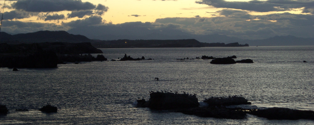
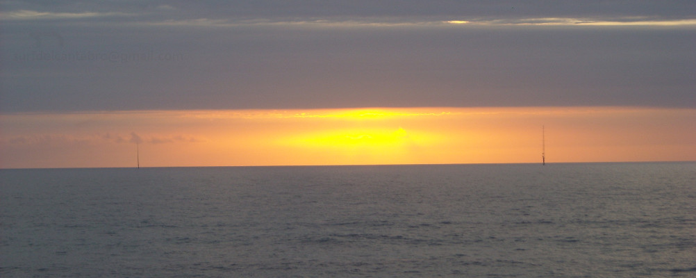
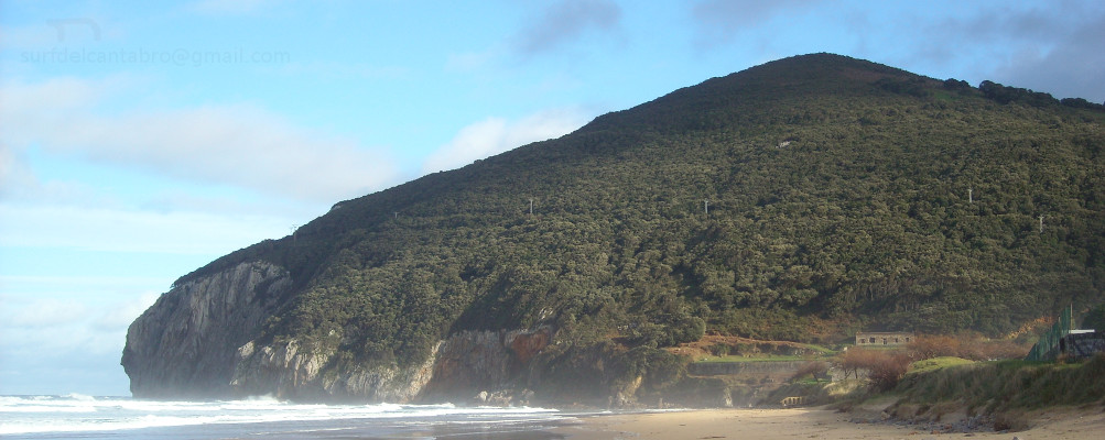
Este año el verano se prolongó hasta bien entrado el otoño. Fue un domingo por la tarde, a finales de Octubre, en que el día amaneció soleado y la temperatura a la hora de la comida rondaba los 23 grados centígrados. Esa tarde se organizaban en Somo unas jornadas sobre surf en el aparcamiento que se sitúa en la zona oriental. La predicción vaticinaba olas entre 1,5 y 2,5 metros desde el mediodía hasta las 7 de la tarde. Pasada esa hora la predicción se elevaba hasta los 4 metros. Después de habernos preparado, llegamos a Somo desde Santander; atravesando el Puente de Pedreña el cual estaba repleto de cañas de pescar. Pocos lugares había libres en el puente pues la mar ese día también era propicia para la pesca. Una chispa prendió en el estomago al ver aquello.

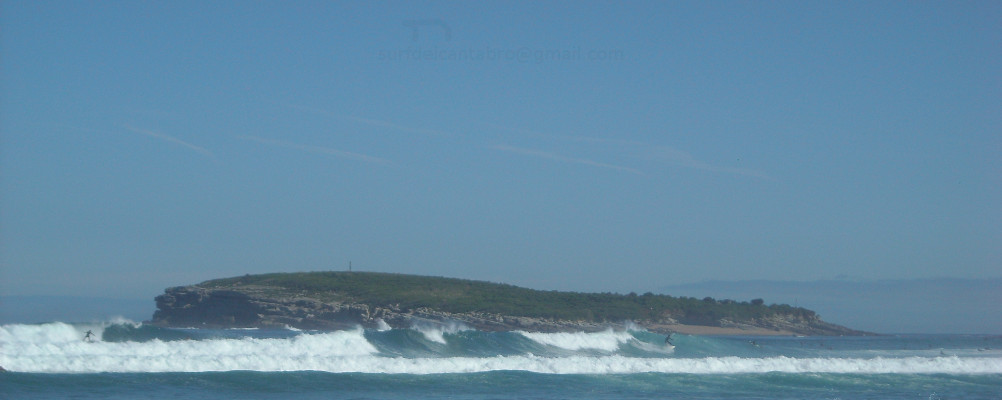
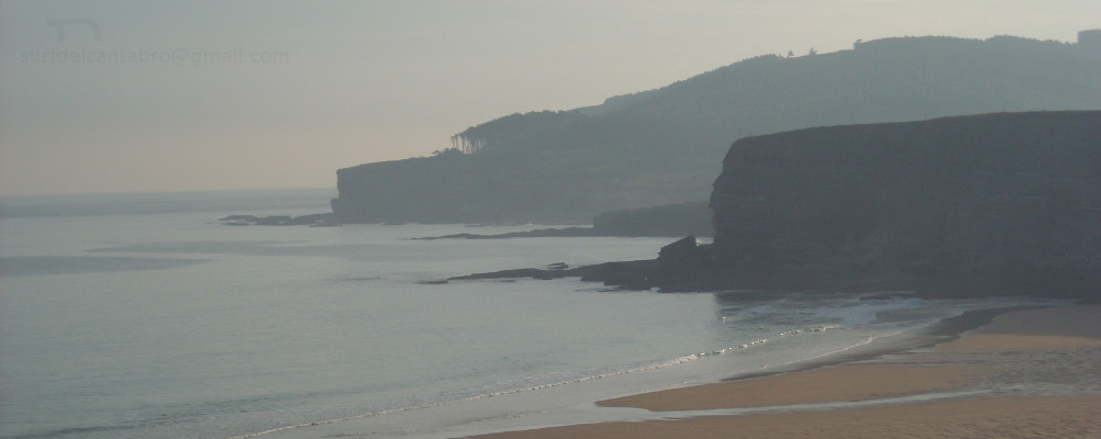
Después de aparcar el coche nos preparamos. Dimos una par de carreras por la arena y al agua. Pasada la serie de olas llegamos a una buena zona. Allí donde nacían las olas que se pueden coger o dejar pasar cómodamente. Al poco tiempo se fue acercando una ola que fue cogiendo tamaño. Me giré dejando el mar a mi espalda y reme con fuerza. De repente me vi subido en lo alto mirando hacia la base con cierta sensación de vértigo. Dos metros hacia abajo el agua se lanzaba hacia la cresta y el sonido me rodeaba. Abría la ola hacia la izquierda y por la altura que alcanzó me deslicé recto hacia adelante, cuando me dí cuenta estaba debajo de ella. Corté la ola y giré oblicuamente hacia la cresta de nuevo. Subí y baje sin llegar a la cima. Repetí la maniobra 3 o 4 veces hasta aterrizar en una zona repleta de gente y la ola perdió ya su fuerza. Una sonrisa me abofeteó la cara y al mirar a mi alrededor vi como la gente que allí estaba se movía con rapidez en dirección contraria a mi. Volví a la misma zona y esperando turno disfruté de más olas, de alegría y de perder la noción del tiempo. Sólo el cansancio me recordó que hacia ya dos horas que habíamos entrado, la última ola que cogí me acercó hasta la orilla.

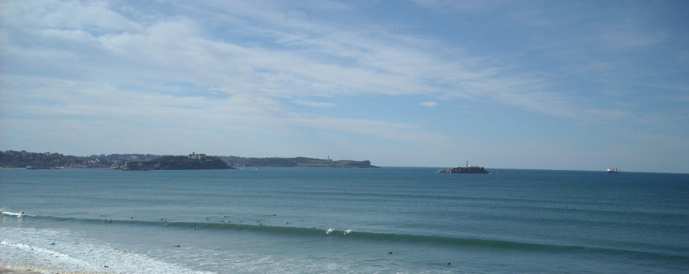
Como los niños patinan con base firme sobre las pistas así surfeaban los profesionales que se presentaron en Somo con motivo del campeonato aquella tarde después de las siete. Nosotros ya en la playa al calor de la toalla disfrutábamos aquel espectáculo de armonía y adrenalina.

Somo, Journey to the Surf

Icono. Icon This year the summer was part of the autumn. It was a Sunday afternoon, at the end of October, the day dawned bright and sunny and the temperature at midday was around 23 degrees celsius. That afternoon a Surf session was organized in the parking lot that is located in the eastern zone. The forecast reported waves between 1.5 and 2.5 meters from midday to 7 P.M. After this time the report was over 4 meters. After we have prepared, we arrived to Somo from Santander; crossing the Bridge of Pedreña which was filled with fishing rods. There were a few free places in the bridge, because the sea that day was also good for fishing. A spark ignited in the stomach when we saw that picture.

After parking the car we prepare. We ran along the beach. When we overcome the series of waves we arrived came in a good area. There were the waves were born and you can live it playing or waiting. In a few minutes a wave was coming to us and getting bigger. I turned to leaving the sea behind me and I rowed hard. Suddenly I met raised in the top looking at the base with certain sensation of dizziness. Two meters below the water was launched towards the ridge and the sound was surrounding me. The wave was opening towards the left side and due to its height I slipped rectum, when I realized I was under it. I cut the wave and turned towards to the ridge again. I went up and down without reaching the top. I repeated this 3 or 4 times up to landing in a zone replete with people and the wave lost already its power. A smile slapped my face and when I looked around I saw people who was there was moving quickly in the opposite direction to me. I returned to the same area and waiting for the shift I enjoyed more waves and moments. Only the fatigue remembered me that I had been surfing for two hours, the last wave I caught placed me in the shore.

As the children skate with firm base as the professionals that were in Somo by the championship that evening; after seven o’clock, surf the big waves . We were already out of the water. Enjoying that spectacle of harmony and adrenaline
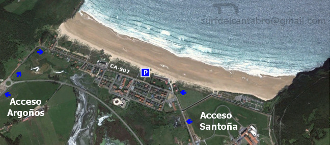
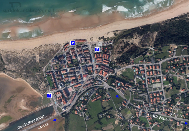
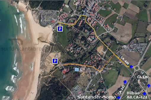
Icon close Sponsor

Share