La península de La Magdalena: submarinismo

Icono Español. Icon Spanish La península de La Magdalena se encuentra en la ciudad de Santander. Tiene una superficie de 24,5 hectáreas. En la actualidad la península es un parque público abierto durante el día. Su horario de verano es de 8:00 a 22:00, el resto del año de 9:00 a 20:30.

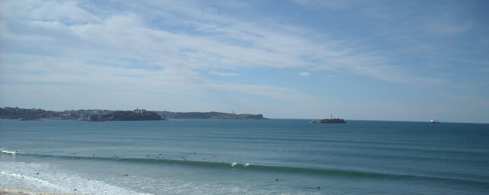
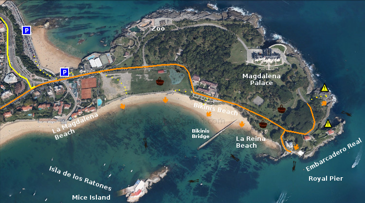
En ella, están la Playa de la Magdalena, la Playa de Bikinis y la Playa de la Reina. Son zonas de aguas claras y tranquilas. Generalmente tienen poca o nula presencia de olas y es por ello que son ideales para el baño, y el disfrute de la playa. Dentro del parque se puede hacer pícnic, habiendo varias zonas con mesas habilitadas para ello. Estas zonas además si sitúan al lado de la playa.

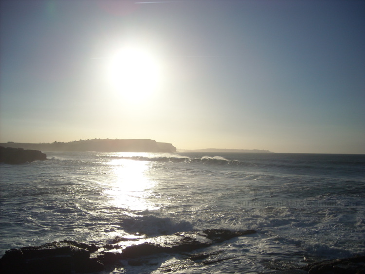
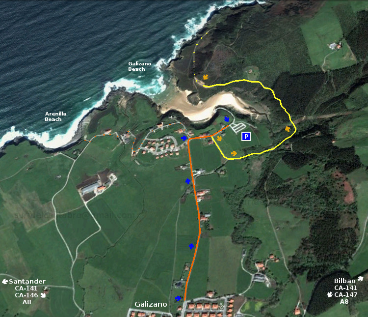
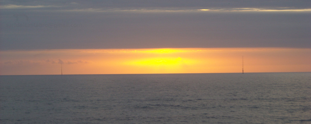
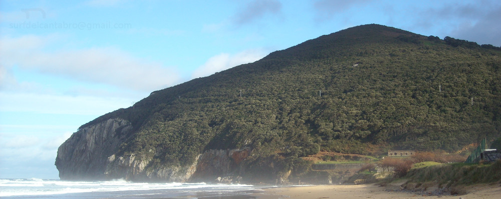
En la propia ciudad se encuentra esta pequeña joya de la naturaleza, la península de La Magdalena. Concebida en la actualidad para el uso mundano y el disfrute divino. Destaca en ella la practica del submarinismo. El rápido y fácil acceso al lugar. Las aguas claras. La tranquilidad del mar que baña la península por el interior de la bahía. Todos estos factores propician un buceo de calidad.

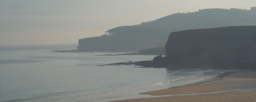
Varios son los puntos de entrada para hacer submarinismo. Desde las playas de La Magdalena y Bikinis se recorre la pequeña ensenada acotada por la Isla de los ratones y el Puente de Bikinis. Desde el puente podemos rodear la isla o acercarnos al Embarcadero Real. Desde el embarcadero se realiza la travesía hacía una parte de la cara norte de la península. Situados en el acceso noreste es posible elegir alguno de los puntos anteriores o conocer los fondos marinos próximos al punto de entrada y situados bajo el Palacio de la Magdalena.

A través del buceo se descubre un paisaje submarino difícil de imaginar desde tierra. Diversidad de peces, moluscos y crustáceos nadan y caminan conforme avanzamos la ruta elegida. Lubinas, doradas, cabrachos, salmonetes y jargos conviven con distintas especies de moluscos cefalópodos como la sepia y el magano (calamar pequeño). Ambos buscan su alimento entre mejillones, lapas, caracolillos de mar y varios tipos de crustáceos. El fondo de arena blanca se entremezcla con las rocas. Rocas que forman canales y figuras, modeladas por las condiciones meteorológicas y el paso del tiempo. Son un testimonio «vivo» del pasado geológico de La Península de la Magdalena.

Separador. DividerIcono Español-Inglés. Icon Spanish-EnglishAcceso, buceo: La MagdalenaIcono separador. Icon divider

The Magdalena peninsula: scuba diving

Icono Inglés. Icon English The Magdalena peninsula is located in the city of Santander. It has an area of 24.5 hectares. At present, the peninsula is a public park open during the day. Its summer opening hours are from 8:00 to 22:00, the rest of the year from 9:00 to 20:30.

In it, are the Magdalena Beach, Bikinis Beach and The beach of the Queen. All of them are areas of clear and calm waters. Generally have little or no presence of waves so it is an ideal place for the swimming, and the enjoyment of the beach. Within the park you can picnic, having several areas with tables set aside for this purpose. These tables are near the beach.

In the city is this little gem of the nature, the «peninsula de la Magdalena». Conceived today for use worldly and the divine enjoyment. It stands out in the practice of scuba diving. The quick and easy access to the site. The crystal clear waters. The tranquility of the sea, which washes the peninsula by the interior of the bay. All these factors contribute to a quality scuba diving.

There are several entry points for diving. From the beaches of La Magdalena and Bikinis you can go to the small bay delimited by the Mice Island and the Bikinis Bridge. From the bridge we can surround the island or go to the Royal Pier. From the jetty is performed the journey toward a part of the north face of the peninsula. Located in the northeast access is possible to choose any of the above points or know the seabed near the entry point and located under the Magdalena Palace.

Through the scuba diving here you are going to discover a submarine landscape hard to imagine from the ground. Diversity of fish, molluscs and crustaceans swim and walk as we go along the route chosen. Sea Bass, golden, scoprpion fish, red mullet and jargos coexist with various species of cephalopod mollusks such as sepia and the magano (small squid). Both are looking for its food between mussels, limpets and sea snails and several types of crustaceans. The seabed of white sand is intermingled with the rocks. Rocks that form channels and figures, modeled by the weather and the passage of time. Living witnesses in the geological past of the «Peninsula de la Magdalena».

Icon close Sponsor

Share

El sardinero, localización

Icono Español. Icon Spanish Las dos playas de El Sardinero están situadas en la ciudad de Santander. Ambas playas reciben el mismo nombre y se las conoce como: Primera Playa del Sardinero y Segunda Playa del Sardinero. Se accede a El Sardinero por múltiples vías una vez situados en Santander. Se puede llegar a Santander desde cualquier punto de la geografía española, compartiendo todos los trayectos cuatro localizaciones que pueden ser de partida o de transito. Estas son : Oviedo, Palencia, Bilbao y Burgos. Las tres primeros por autovía y la último por carretera nacional; atravesando el Puerto del Escudo. Ya emplazados en Santander o cercanías, hay dos opciones. Desde el oeste utilizando la S-20, llamada la Autovía del Sardinero. La otra opción es por medio de la S-10, atravesando la ciudad; pues la configuración de Santander se orienta hacia sus playas.

Nota: el trayecto por la S-20 ha sido selecionado con origen en el Barrio de La Albericia, para poder poder visualizar la autovía. Se puede partir desde cualquier otro punto que conduzca a la S-20.

El Sardinero, Localization

Icono Inglés. Icon English The two beaches of «El Sardinero» are located in the city of Santander. Both places are given the same name and are known as: First Sardinero Beach and Second Sardinero Beach. El Sardinero is accessed by multiple pathways once you have been located in Santander. You can reach Santander from any point of the Spanish geography. All the journeys share one of four possible locations that may be of heading or transit. These are: Oviedo, Palencia, Bilbao and Burgos. The first three by motorway and the last by national road; going through the port of «El Escudo«. When you already are in Santander or vicinity you can choose between two options. From the west using the S-20, called the Highway of «El Sardinero». The other option is through the S-10, which passes through the city. The configuration of Santander is oriented toward its beaches.

Note: the journey by the S-20 has been selected with origin in the district of La Albericia, in order to be able to display the dual carriageway. You can travel from any other point that is conected to the S-20.

Icono Español-Inglés. Icon Spanish-English Localización/Localization

Oviedo, El Sardinero: LocalizationPalencia, El Sardinero: LocalizationSantander, El Sardinero; S-10 : LocalizationBilbao, El Sardinero : Localization

Icon close Sponsor

Share

Segunda Playa del Sardinero, acceso

Icono Español. Icon Spanish. Segunda Playa del Sardinero. La Segunda Playa del Sardinero tiene varios accesos. Está rodeada por el Parque de Mesones y desde el parque se puede acceder a la playa por multitud de puntos. La entrada principal se localiza cerca del final del Parque de Mesones. Más a la izquierda, se encuentra ya el final del paseo y a la derecha de la playa, los Jardines de Piquío. Desde estos dos lugares se dispone de sendos accesos.

Second Sardinero Beach, access

Icono Inglés. Icon English. Second Sardinero Beach. The Second Sardinero Beach has several access. The beach is surrounded by the Mesones Park and from the park you can access to the beach by different points. The main entrance is located near the end of the Mesones Park. The left side is the end of the avenue and on the right hand of the beach, there are the Piquío Gardens. From these places are available another two accesses.

Icono Español-Inglés. Icon Spanish-English. Segunda Playa del Sardinero. Second Sardinero Beach. Acceso/Beach Access

Acceso: Segunda playa del Sardinero. Access: Second Sardinero Beach

Share

Primera Playa del Sardinero, acceso

Icono Español. Icon Spanish. Primera Playa del Sardinero. La Primera Playa del Sardinero tiene múltiples accesos pues un paseo ajardinado la flanquea. Los tres principales accesos son los que se comentan a continuación. Desde el parking de la playa del Camello, se accede directamente a la parte derecha de la playa. Desde la Plaza de Italia, donde se localizan la mayor parte de restaurantes, atravesando los bajos del Sardinero; se llega directamente al centro de la playa. Desde los Jardines de Piquío, bajando las escaleras se accede a la parte izquierda de la Primera Playa del Sardinero.

First Sardinero Beach, access

Icono Inglés. Icon English. First Sardinero Beach The First Sardinero Beach has multiple accesses through the garden that flanks the beach. The three main accesses are discussed below. From the parking area of «El Camello» beach, you can directly access the right side of the beach. From the Plaza of Italy, where are located most of the restaurants, going through Sardinero main access; you will arrive to the center of the beach. From the Piquío Gardens, down the stairs is accessed to the left side of the First Sardinero Beach.

Icono Español-Inglés. Icon Spanish-English. Primera Playa del Sardinero. First Sardinero Beach Acceso/Beach Access

Acceso: Primera Playa del Sardinero, acceso. First Sardinero Beach, access

Icon close Sponsor

Share

Sucesión de temporales en la costa Cantábrica

Icono Español. Icon Spanish. Sucesión de temporales. La sucesión de temporales y borrascas en la costa cantábrica en este invierno de 2014 y durante las últimas semanas es algo fuera de lo común. Leer más … Icono. Icon

Separador. DividerIcono Español-Inglés. Icon Spanish-English. Sucesión de temporales. Succession of stormsIcono. Icon. Sucesion de temporales. Succession of stormsIcono separador. Icon divider

Succession of storms on the Cantabrian coast

Icono Inglés. Icon English The succession of storms on the Cantabrian coast in this winter of 2014 and over the past few weeks is something out of the ordinary. Read more … Icono. Icon

Icon close Sponsor

Share

Playa de Galizano: surf, submarinismo, pesca, senderismo …

Icono Español. Icon Spanish Galizano es una localidad costera cántabra que pertenece al municipio de Ribamontán al Mar. Desde Galizano se accede a sus playas y acantilados.

La playa de Arenilla es una pequeña cala de apenas 150 metros de longitud, que desaparece prácticamente en marea alta y es accesible en marea baja. Situada a la izquierda en el mapa; es apta para el baño e ideal para hacer submarinismo los días con la mar en calma. Se puede llegar hasta Langre realizando una ruta de senderísmo que conecta ambas playas. Es una zona muy buena para la pesca a surfcasting, teniendo en cuenta que esta situada en mar abierto y tomando las debidas precauciones.

La playa de Galizano tiene una configuración en forma de embudo que hace que su longitud varíe. Su arenal ocupa aproximadamente 400 metros de profundidad y es accesible siempre. El surf aquí es en crudo, salvaje, sin aditivos y con toda la potencia que impregna la naturaleza. Es necesario tener cierta pericia y nivel avanzado para practicarlo. Las olas nacen a 200 metros de la playa, siendo esta localización la ideal para hacer surf. Alejado así de las rocas se encuentra uno suspendido en el agua y esperando las olas vírgenes que trae el Mar Cantábrico. Pues no hay nada entre el mar y la Playa de Galizano que filtre el oleaje. Esto también lo convierte en una zona muy buena para la pesca recreativa a surfcasting.

Los días de temporal o fuerte oleaje prohíben la practica de cualquier actividad al aire libre que suponga la cercanía del mar. Sin embargo es en esos días cuando más se puede disfrutar de los acantilados de Galizano. Se accede a los acantilados dirigiendonos a la derecha de la playa, por una carretera que se sitúa antes de su acceso. Disfrutando del paseo, si se avanza en el camino se llega al mirador de la Cueva de «Cucabrera».

Galizano beach: surfing, scuba diving, fishing, hiking …

Icono Inglés. Icon English Galizano is a Cantabrian coastal town that belongs to the municipality of Ribamontán al Mar. From the locality is accessed to its beaches and cliffs.

The Arenilla beach is a small cove of barely 150 meters in length, that practically disappears during high tide and is accessible at low tide. Located on the left hand side in the map. It is suitable for swimming and ideal for diving the day with calm sea. You can arrive to Langre through a trekking route that connects the two beaches. It is a very good area for fishing (surfcasting), taking into account that is located in the open sea and with the proper precautions.

The Galizano beach has a configuration in the shape of a funnel that makes your length may vary. Its arenal has approximately 400 meters in depth and is always accessible. The surf here is raw, wild, without additives and with all the power that permeates the nature. It is necessary to have some expertise and advanced level for surfing. The waves are born to 200 meters from the beach, being this the ideal location to enjoy safely. Away from the rocks. the surfer is suspended in the water and waits for the original waves that brings the Cantabrian Sea. Due to there is nothing between the sea and the beach of Galizano that filter the swell. This also makes it a very good area for recreational fishing to surfcasting.

The days with bad weather or strong waves not allow us to do any outdoor activity that involves the proximity of the sea. However these are the best days when we can enjoy the cliffs of Galizano. The access to the cliffs is in the right of the beach, through a road that is placed before the parking. Enjoying the ride, if you progress on the road you will arrive to the lookout of the Cave of «Cucabrera».

Separador. Divider

Icono Español-Inglés. Icon Spanish-English Fotogafías Playa de Galizano/Galizano beach. Photographs

Ola en Galizano
Ola en GalizanoIcono separador. Icon divider

Icon close Sponsor

Share

Olas grandes en Cantabria. Temporal

Icono Español. Icon Spanish. Olas grandes en Cantabria El fin de semana del 8 de febrero los servicios meteorológicos vaticinaban que una nueva ciclogenesis explosiva, denominada «Stephanie«, pasaría muy cerca de las costas Cantábrica y Atlántica de nuestro país. Leer más … Icono. Icon

Separador. DividerIcono Español-Inglés. Icon Spanish-English. Olas grandes en Cantabria. Big waves in CantabriaIcono. Icon. Olas grandes en Cantabria. Big waves in CantabriaIcono separador. Icon divider

Big waves in Cantabria. Storm

Icono Inglés. Icon English. Big waves in Cantabria The weekend of February 8 meteorological services had predicted that a new explosive cyclogenesis, called ‘Stephanie‘, would be very close to the Cantabrian and Atlantic coasts in our country. Read more… Icono. Icon

Icon close Sponsor

Share

Galizano, localización

Icono Español. Icon Spanish La Playa de Galizano se encuentra en la localidad de Galizano, que pertenece al municipio de Ribamontán al Mar. Desde Galizano se accede a la siguientes playas: Playa de Arenilla y Playa de Galizano. La primera de ellas es una pequeña cala de difícil acceso y rodeada por acantilados sobre mar abierta. Apta para el baño con precaución, pues tiene fuertes corrientes y puede ser peligrosa, es ideal para el disfrute apartado de la naturaleza. La segunda playa es de mayor extensión y presenta un fuerte oleaje, característico de esta parte de la costa cántabra. Buenas olas y un entorno que exige cierto nivel en la práctica del surf. Se puede llegar hasta la Playa de Galizano desde Oviedo, Palencia, Santander o Bilbao. Comenzando el viaje por autovía y finalizando por carretera nacional. Una vez situados en Galizano el camino de la playa esta bien indicado.

Galizano Beach, Localization

Icono Inglés. Icon English Galizano beach is located in the town of Galizano, which belongs to the municipality of «Ribamontán al Mar«. Galizano gives access to the following beaches: «Arenilla» beach and Galizano beach. The first of these is a small cove of difficult access and surrounded by cliffs on open sea. Suitable for bathing with caution, because it has strong currents and can be dangerous, it is ideal for the enjoyment of nature. The second Beach is largest and presents a strong swell, characteristic of this part of the Cantabrian coast. Good waves and an environment that requires a certain level in the practice of surfing. You can reach the beach of Galizano from Oviedo, Palencia, Santander or Bilbao. Starting the journey by motorway and ending by national road. Once placed in Galizano the way of the beach is well signposted .

Icono Español-Inglés. Icon Spanish-English Localización/Localization

Oviedo, Galizano: LocalizationPalencia, Galizano: LocalizationBilbao, Galizano: LocalizationSantander, Galizano: Localization

Icon close Sponsor

Share

Galizano. Acceso

Icono Español. Icon Spanish La Playa de Galizano tiene un único acceso a través de la localidad de Galizano. Se puede llegar a ella desde Santander por: la autovía A8, la carretera nacional CA-146 y la rotonda que enlaza esta última con la CA-141. Desde Bilbao por: A8,CA-147 y CA-141. Una vez en la localidad es fácil llegar al parking desde el que se puede acceder a las playas. La Playa de Arenilla está situada a la izquierda, adyacente, de la Playa de Galizano.

Nota: Aconsejo utilizar este acceso directo desde Galizano. Por las peculiaridades de esta parte de la costa cántabra. Pues es abundante en pequeñas fincas y carreteras anexas. Se puede convertir en un laberinto si no se conoce.

Galizano. Access

Icono Inglés. Icon English Galizano Beach has a unique access through the town of Galizano. You can reach it from Santander by: highway A8, CA-146 national road and the roundabout that connects with the CA-141. From Bilbao: A8, CA-147 and CA-141. Once in the village is easy to come to the parking from which you can access the beaches. «Arenilla» beach is located to the left, adjacent to Galizano beach.

Note: You can access from another ways, but I would advise to use this shortcut from Galizano. Due to the peculiarities of this part of the Cantabrian coast that is abundant on small farms and adjacent roads. If you don´t know it previously this place can become a maze.

Icono Español-Inglés. Icon Spanish-English Acceso/Beach Access

Acceso:Galizano

Icon close Sponsor

Share