Momentos de Liencres. Sabado, amanecer

icono bandera España A las siete de la mañana ya había amanecido. Unos rayos de sol entraban por la ventana, proporcionando un dulce despertar. El día para nuestra sesión de surf había llegado. Preparé el equipo y cargué todos los materiales en el coche. El día anterior nos citamos a las ocho en la Plaza de Numancia. Me dirigí al punto de encuentro. La ciudad a esas horas estaba con poca circulación. Santander vivía un día festivo, con todos los comercios cerrados.

De camino a la plaza, la ausencia de coches en las carreteras y el Sol posando sobre las calles, causaban unas sensaciones especiales que acompañaban el recorrido. Al llegar al lugar, dos colegas estaban esperando. Introducimos con destreza los materiales en el vehículo. Otra gente se acercaría a la playa más tarde. Con la música sonando en el coche y conversando de olas, atravesamos la ciudad. En la rotonda de Corbán se aglutinaban más vehículos, colapsando el cruce. Parecía que todo el mundo había pensado lo mismo, disfrutar del buen fin de semana que se presentaba. Al paso por la localidad de Liencres, el último semáforo de camino a la playa; se cerró. En una plaza, anexa a la carretera, había varias carpas y puestos de venta ya montados. La luz del día lucía la celebración de la festividad en la localidad. Una cola de vehículos esperábamos la luz verde del semáforo para continuar el trayecto. Varias caravanas y un par de furgonetas cerraban la hilera. La señal se abrió, continuamos ordenadamente, conformando una imagen bucólica incrustados en el paisaje y el ritmo de avance. A tres kilómetros de la playa, las emociones iban picoteando el estomago. La carretera que cruza el Pinar de la Dunas de Liencres, suponía el último paso antes de llegar a la playa.

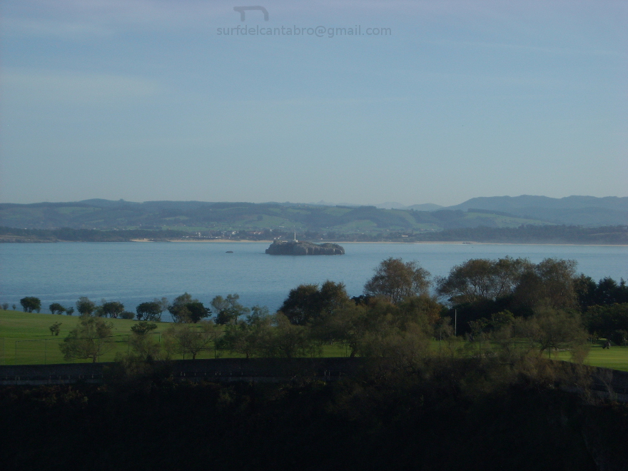
Entramos primero al aparcamiento de Canallave. Su media ocupación hacia pensar en un buen día de surf. Surfers vistiendo el traje de neopreno, otros de camino al agua y un numeroso grupo de riders ya en el mar. Imágenes que reflejaban la preparación hacia las olas. La bajamar sucedió a las seis de la mañana. La playa mostraba el fondo rocoso e irregular. Las ondas hábiles aparecían en un par de picos lejanos, situados a seiscientos metros de la entrada. Asomados a la punta que separa las dos playas, fuimos estudiando las posibilidades. A la izquierda Valdearenas mostraba varios picos de olas cercanos. Bajamos con el coche hasta el aparcamiento principal. Las plazas próximas a la entrada estaban ya ocupadas.Estacionamos el vehículo a media distancia. Mientras cada uno de nosotros preparaba su equipo, charlábamos sobre las mejores zonas. En la conversación apareció el tema de las corrientes fuertes, presentes en la zona. Hablábamos de evitar los lugares adyacentes al final del arenal y las rocas de la entrada.

De pies sobre la arena, mirando al Mar Cantábrico, imaginaba olas ideales a lo largo de la jornada. Olas definidas, largas, practicables y seguras. No pensaba en sus tamaños, sólo en la calidad. Sobre el agua, las series llegaban con ocho de período y metro y medio de altura. A lo lejos, en la parte izquierda, el mar golpeaba con fuerza las rocas de Robayera. El agua salía despedida en el aire, siendo visible a un kilómetro de distancia. Después de calentar los músculos, entramos al agua. El oleaje que llegaba hasta la orilla dificultaba el avance y hacia sentir en cada paso la fuerza de la corriente. Tras treinta metros, el agua cubría hasta la altura del cuello. Una ola rezagada se abalanzó sobre mí. Buceando, con la tabla a un lado, evité su elevación. Me moví hacia el lateral del pico de olas. Remando con fuerza y haciendo la cuchara, conseguí llegar hasta una zona tranquila; a la que habían llegado los demás.

Flotando sobre el agua, con los brazos extendidos, descansé durante unos minutos. Doscientos metros de agua hasta llegar a la arena, reducían la visión de los objetos a pequeñas figuras. En aquella posición, las olas nacían con apenas un metro. Corrían la mitad del trazado, aumentando progresivamente el tamaño. Unos instantes después aparecía un rizo sobre ellas que se desplazaba a izquierda o derecha. Terminaban estas su viaje a cincuenta metros de la orilla. Permanecimos sentados, esperando que llegara una ola más grande. Por lo visto hasta aquel momento, podía suponer un trayecto superior a cien metros. Subiendo y bajando a la cresta, maniobrando con tiempo y libres sobre el agua. El Sol se ocultaba detrás de unas nubes que dejaban pasar algún rayo de luz. La sombra que procuraban las dunas y el pinar, conservaban el agua aun fría que contrastaba con la excitación de los que estábamos en el mar.

Moments of Liencres. Saturday, dawn

English At seven o’clock in the morning already it had dawned. A few beams of the Sun were entering the window, providing a sweet to wake up. The day of our surf session had come. I prepared the equipment and loaded all the materials in the car. The previous day we arrange an appointment at eight o’clock, in the Square of Numantia. I went to the point of meeting. The city at those hours was with few traffic. Santander had a holiday, with all the closed trades.

On the way to the square, the absence of cars in the roads and the Sun posing on the streets; were causing special sensations that were accompanying the tour. On having come to the place, two colleagues were waiting. We introduce nimbly the materials in the vehicle. Another people would approach the beach later. With the music in the car and talking about waves, we cross the city. In roundabout of Corbán, more vehicles were arriving, collapsing the crossing. It seemed that the whole world had thought the same thing, to enjoy of the good weekend that one was presenting. Through Liencres’s locality, the last semaphore of way to the beach; was closed. In a small square that was near the road, there were several tents and already mounted market stalls. The daylight was illuminating the celebration of the festivity in the locality. A tail of vehicles were waiting for the green light of the semaphore to continue the travel. Several caravans and a couple of vans were closing the row. The sign was opened, we continue tidily, shaping a bucolic image incrusted in the landscape and the pace of advance. To three kilometres of the beach, the emotions were pecking the stomach. The road that crosses the Pinegrove of Liencres’s Dunas, supposed the last step before coming to the beach.

We enter first to Canallave’s parking. His half occupation towards thinking in the good day of surf. Some surfers were dressing the wetsuits, others were walking to the water and a numerous group of riders were already in the sea. All these Images were reflecting the preparation towards the waves. The low tide happened at six o’clock in the morning. The beach was showing the rocky and irregular bottom. The skilful waves were appearing in a couple of distant beaks, placed to six hundred meters of the entrance. Overlooking the top that separates both beaches, we were studying the possibilities. To the left side Valdearenas it was showing several nearby beaks of waves. We went down with the car up to the main parking. The parking spaces near the entry were already busy. We park the vehicle to half a distance. While each of us was preparing his equipment, we were chatting about the best zones. In the conversation there appeared the topic of the strong, present currents in the zone. We were speaking of avoiding the adjacent places at the end of the sandbank and the rocks of the entry.

On the sand, looking to the Cantabrian Sea, I was imagining ideal waves along the day. Definite, long, practicable and sure waves. He was not thinking about his sizes, only about the quality. On the water, the series were arriving with eight of period and meter and a half of height. In the distance, in the left part, the sea was striking strongly Robayera’s rocks. The water was shot and was dismissed in the air, being visible to a kilometre of distance. After warming the muscles, we enter to the water. The surge that was coming up to the shore was impeding the advance and had been making to feel its intensity in every step. After thirty meters, the water was covering up to the height of the neck. A lazy wave rushed on me. I dived, with the board aside, I avoided its elevation. I moved towards one wing of the beak of waves. I rowed hard and I did the duck, I managed to come up to a calm zone; to which the others had come.

Floating on the water, with the widespread arms, I rested during a few minutes. Two hundred meters of water up to coming to the sand, were reducing the vision of the objects to small figures in the sand. In that position, the waves were born with scarcely a meter. Them were traversing until the half of the tracing, increasing progressively the size. A few instants later a curl was appearing on them, that was been displacing sometimes to left side or right. Them were finishing his trip to fifty meters of the shore. We remained seated, hoping that a bigger wave would come. Apparently up to that moment, it could suppose a distance higher to hundred meters. Rising and going down to the comb, maneuvering with time and free on the water. The Sun was hiding itself behind a few clouds that were allowing to spend some beam of light. The shade that the dunes and the pinegrove were giving were preserving the cold temperatuee of the water, that was contrasting with the excitation that each one had in the sea.

Icon close Sponsor

Share

Playa de Arenilla, acceso

Icono Español. Icon Spanish La Playa de Arenilla está en Galizano. Situada entre la playas de Langre y Galizano, es una pequeña cala con un acceso escarpado. Tiene una ancha y pedregosa entrada utilizada a modo de aparcamiento. El fondo de roca, los acantilados y las fuertes corrientes; presentes en la zona la convierten en un lugar peligroso. Las rutas que llegan e la zona provienen del oeste ( Oviedo, Palencia, Santander ) y del este ( Bilbao ) deben atravesar la localidad de Galizano, cruzar el Barrio de Pedrosa y dirigirse hacia la costa en el primer cruce que aparece. Después la misma carretera nos conduce a la entrada de la Playa de Arenilla.

Beach of Arenilla, access

Icono. Icon The Beach of Arenilla is located in Galizano. Placed between the beaches of Langre and Galizano, it is a small cove with a craggy access. It has a broad and stony entry used like parking. The rocky bottom, the cliffs and the strong currents; presents in the zone turn her into a dangerous place. The routes that come from the west (Oviedo, Palencia, Santander) and from the east (Bilbao) must cross Galizano’s locality, through the Neighborhood of Pedrosa, to go towards the coast in the first crossing that appears. Later, the same road, leads us at the entrance of the Beach of Arenilla.

Icono Español-Inglés. Icon Spanish-English Acceso/Access

Access: Playa de Arenilla, acceso

Icon close Sponsor

Icon close Sponsor

Share

Playa de Arenilla, localización

Icono Español. Icon Spanish La Playa de Arenilla se encuentra en la localidad de Galizano, que pertenece al municipio de Ribamontán al Mar. Su localización no aparece en las guías oficiales, además la abundancia de caminos que dan acceso a las fincas de siembra de la zona, complican la situación de este punto. La playa es una pequeña cala de difícil acceso y rodeada por acantilados sobre mar abierta. Apta para el baño con precaución y la practica del surf, pues tiene fuertes corrientes y puede ser peligrosa. El viaje se hace por autovía y finaliza por carretera nacional y comarcal. Una vez situados en Galizano iremos hacia el Barrio de Pedrosa. Dejado atrás el barrio,tomamos el primer desvío a la derecha. Seguimos la carretera recta, sin coger ningún desvío más. Un kilometro después, veremos la cala, con un pequeño y pedregoso aparcamiento a su entrada. A continuación se muestra como puntos de partida: Oviedo, Palencia, Santander y Bilbao. Cualquier otro origen atraviesa uno de estos puntos.

Beach of Arenilla, Localization

Icono. Icon The Beach of Arenilla is placed in the locality of Galizano, that belongs to the municipality of Ribamontan al Mar. Its location does not appear in the official guides. In addition the abundance of roads that lead to the farm lands of the zone, it complicate the situation of this point. The beach is a small cove of difficult access and surrounded by cliffs and rocks on opened sea. Suitable for the bath with precaution and the practice of the surf, due to it has current forts and can be dangerous. The trip is done by highway and finishes by road nationally and regionally. Once placed in Galizano iremos towards the Neighborhood of Pedrosa. Leaving behind the neighborhood, we take the first detour to the right. We follow the straight road, without taking any other detour. A kilometre later, we will see the cove, with a small and stony parking at its entry. Shown below as starting points: Oviedo, Palencia, Santander and Bilbao. Any other origin crosses some of these points.

Icono Español-Inglés. Icon Spanish-English Localización/Localization

Oviedo, Playa de Arenilla:  LocalizationPalencia, Playa de Arenilla: localizationBilbao, Playa de Arenilla: localizationSantander, Playa de Arenilla: localization

Icon close Sponsor

Share

Momentos de Liencres. Viernes

icono bandera EspañaDurante la semana, las lluvias y el frío habían ocupado los días. Por las mañanas amanecía el cielo cubierto con un tono gris oscuro. Los chubascos se repartían durante la jornada y las olas aparecían dispersas a lo largo de la costa. Los servicios meteorológicos predecían buen tiempo a partir del sábado. La próxima semana llegaría cargada de olas.

El viernes por la tarde el cielo se despejó totalmente. El viento acompañó la jornada y al final del día una línea anaranjada se posó sobre el lejano horizonte. Después de charlar con unos amigos, nos acercamos a la playa de Valdearenas; para contemplar el atardecer y ver el estado del mar. Por la carretera que cruza el Pinar de las Dunas de Liencres, el viento avanzaba entre los árboles. El movimiento de las ramas y sus hojas producía un sonido melódico y natural que daba calidez al viaje. La conversación dentro del vehículo se centraba en el mar, las olas y las auto-caravanas que otros días habían ocupado el aparcamiento, que da acceso a la playa. Una brisa ligera atravesaba el interior del coche, animando la conversación. La última cuesta antes de llegar ocultó parte del paisaje. En dirección contraria venía una furgoneta. Por el cristal, de una ventanilla trasera, asomaba parte de una tabla de surf y el resto del equipaje, saltando al compás que marcaban los baches de la carretera. La curiosidad nos acompañó hasta que Llegamos al aparcamiento.

Las olas golpeaban contra las rocas de la entrada. Llegaban en una serie larga y reposada. Con un metro de altura aproximadamente, describían trazados limpios y medianos a lo ancho del mar. La contemplación de aquella imagen fue acompañada por un lúdico silencio, donde cada uno observó sus preferencias. Entre exclamaciones y comentarios salimos del coche. Varios surfers disfrutaban en el agua de los últimos trazados. A la derecha, otro colega, recogía su equipo. Un par de decenas de furgonetas ocupaban lugares alejados en el parking. La música sonaba distante en una de ellas. Sobre su maletero, levantado, colgaban trajes de surf. Parecía que el buen momento de olas se había adelantado. Descalzo sobre la arena, fui caminando paralelo a la orilla. Los otros jugaban con una pelota de tenis, a medida que avanzaban. La arena gruesa de Liencres sostenía cada paso, almohadillando el camino. Es en esta playa donde los granos de arena tienen un tamaño que revela su origen. Restos de conchas y caparazones troceados, juntos con otras partículas, se pueden ver al coger un puñado con la mano. Sobre el arenal corría el viento que llegaba del oleaje.

A dos horas de la pleamar, las olas tomaron cuerpo. Salpicaban su recorrido sobre la superficie y a distintos niveles de profundidad. Tras la curva inicial, la playa se extendía hasta el final, para encontrarse con la Ría de Mogro. En aquel punto las ondas se desmoronaban zozobradas por el agua que entraba y salía de la ría. Era una zona no practicable, sólo útil para el paseo y la distracción. Comentábamos la fuerza de las corrientes en esta playa, y la violencia que llevaba la mar en la zona de la desembocadura. A trescientos metros del comienzo nos sentamos sobre la arena con las piernas cruzadas. El olor a mar cargaba cada respiración. Grupos de personas venían de vuelta de la punta. Haciendo ejercicio, con la mascota, o simplemente de paseo. A pesar de la hora, la pequeña algarabía, recordaba lejano el bullicio de la ciudad, que se perdía en el olvido con cada pisada.

Sentados debajo de las dunas, divisábamos toda la playa. Tres picos de olas había en el mar. Al fondo aparecían otras zonas donde nacían olas. Sobre la mitad de la playa, a ciento cincuenta metros de la orilla, llegaba con regularidad una serie de olas de un tamaño algo mayor. Abriendo a izquierdas, desplazaba un rizo similar a la caída de fichas de domino. El espectáculo relajante hacia pensar en los viajes y maniobras sobre aquellas masas de agua. Recostados sobre la base de las dunas, hablábamos de otros momentos de surf en la zona. La noche se acercaba ya. Antes de volver, subimos a la cima de la duna, para ampliar la panorámica. Las vistas, ya oscurecidas, mostraban las siluetas lejanas de los islotes que salpican esta parte de la costa cántabra.

Regresamos al coche, haciendo planes para madrugar al día siguiente. Alternativas, horas, materiales, y demás temas se discutían y entrelazaban en el camino de regreso a la ciudad. Al llegar, fijamos un horario y nos despedimos hasta el día siguiente.

Moments of Liencres. Friday

EnglishDuring the week, the rains and the cold had occupied the days. In the mornings, at dawn, the sky was covered with a dark gray tone. The storms were happening during the day and the waves were dispersed along the coast. The meteorological services were predicting good weather from Saturday. Next week would come loaded of waves.

On Friday evening the sky cleared totally. The wind accompanied the journey and at the end of the day an orange line settled on the distant horizon. After chatting with a few friends, we approach Valdearenas’s beach; to contemplate the late afternoon and to see the condition of the sea. For the road that crosses the Pinegrove of Liencres’s Dunes, the wind was advancing between the trees. The movement of the branches and its leaves was producing a melodic and natural sound that was giving warmth to the trip. The conversation, inside the vehicle, was about the sea, the waves and the auto-caravans that other days had occupied the parking which leads to the beach. A light breeze that crossed inside the car, was encouraging the conversation. The last slope before coming concealed part of the landscape. In the opposite direction a van was coming. Through the crystal, of a back window, a part of a surfboard and the rest of the baggage, were jumping to the peace that the pot-holes of the road were marking. The curiosity accompanied us until We Come to the parking.

The waves were throbbing against the rocks of the entry. They were coming in a long and quiet series. With a meter of height approximately, them were describing clean and medium tracings widthways of the sea. The contemplation of that image was accompanied by a playful silence, where each one observed his preferences. Between exclamations and comments we go out of the car. Several surfers were enjoying in the water of the last tracings. To the right, another colleague, was gathering his equipment. A couple of dozens of vans were occupying distant places in the parking. The music was sounding far away in one of them. On its back porter, raised, wetsuits were hanging. It seemed that the good moment of waves had already arrived. I took off my shoes on the sand, I was walking parallel to the shore. The others, were playing with a ball of tennis, as they were advancing. The thick sand of Liencres was supporting every step, fluffing the way. It is in this beach where the grains of sand have a size that reveals its origin. Rests of shells into pieces, with other particles, can be appreciated; taking a handful with the hand. Over the sand, the wind that was coming from the surge.

Two hours before the high tide, the waves took shape. Them were splashing its tour on the surface and to different levels of depth. After the initial curve, the beach was spreading until the end, to meet with the Rivermouth of Mogro. In that point the waves were crumbling overturned by the water that was entering and going out of the outlet. It is a not useful zone, only useful for the walk and the distraction. We were commenting on the force of the currents in this beach, and the violence that was taking the sea in the zone of the rivermouth. Three hundred meters from the entry, we sat down on the sand with the crossed legs. The smell of sea was loading every breathing. Groups of persons were coming back from the end of the beach. They were doing exercise, with their pets, or just taking a walk. In spite of the hour, the small gabble reminded distantly the hustle of the city, which was getting lost in the oblivion with every trodden of them.

We sat under the dunes, we contemplate the whole beach. There were three beaks of waves in the sea. In other zones were appearing areas with new waves. On the half of the beach; to hundred fifty meters of the shore, it was coming regularly a series of waves of a slightly bigger size. Opening to left side, it was displacing a curl similar to the fall of cards of dominoes. The relaxing spectacle made us thinking about the trips and maneuvers about those masses of water. We leaned on the base of the dunes and spoke about other moments of surf in the zone. The night was already approaching. Before returning, we rise to the top of the dune, to extend the panoramic one. The landscape, already got dark, was showing the distant silhouettes of the islands that splash this part of the Cantabrian coast.

We returned to the car, thinking plans to get up early the following day. Alternatives, hours, materials, and other topics were be discussed and interlaced in the way on returning to the city. On having come, we fixed a schedule and said goodbye until the next day.

Icon close Sponsor

Share

Playa de Tagle, acceso

Icono Español. Icon Spanish. Playa de tagle, acceso La playa de Tagle está situada en la localidad de Tagle, que se ubica dentro del municipio de Suances, en la costa occidental de Cantabria. Atravesando el pueblo se llega a la playa, el acceso está bien señalizado. Cuenta con una amplia zona de aparcamiento que finaliza en la entrada del arenal.

Beach of Tagle, access

Icono Inglés. Icon English. Playa de tagle, access The beach of Tagle is placed in the locality of Tagle, which is located inside Suances’s municipality, in the western coast of Cantabria. Through the village you come to the beach, the access is well put up signs. It possesses a wide zone of parking that finishes in the entry of the sandbank.

Icono Español-Inglés. Icon Spanish-English. Playa de tagle, acceso/access Acceso/Access

Tagle Beach, access

Icon close Sponsor

Share

Playa de Tagle, localización

Icono Español. Icon Spanish La playa de Tagle está situada en la localidad de Tagle, perteneciente al municipio de Suances. Es una playa acantilada en sus laterales, con fondo rocoso y fuertes corrientes. El viaje transcurre por autovía y finaliza a través de varias carreteras nacionales. La salida de la autovía está bien indicada, así como la llegada al pueblo y el acceso desde allí a la playa. Se muestran a continuación como puntos de partida Oviedo, Palencia, Santander y Bilbao.

Beach of Tagle, localization

Icono. Icon The beach of Tagle is placed in the locality of Tagle, belonging to the municipality of Suances. This beach has cliffs in its wings, rocky bottom and current forts. The travel passes for motorway and finishes across several national roads. The exit of the highway is well indicated, as well as the arrival to the village and the access from there to the beach. Shown below as starting points Oviedo, Palencia, Santander and Bilbao.

Icono Español-Inglés. Icon Spanish-English Localización/Localization

Oviedo, playa de Tagle: localizationPalencia, playa de  Tagle: localizationBilbao, playa de  Tagle: localizationSantander, playa de Tagle: localization

Icon close Sponsor

Share

Langre, descubriendo las olas. Camino

icono bandera España El atardecer llegó de improvisto. Los viajes y espectáculos vividos habían hecho olvidar la mundana concepción del tiempo. La playa aún conservaba luz suficiente para continuar surfeando. Sobre el acantilado de Langre, una línea difuminada de color anaranjado iba ocupando parte del cielo.

Alejado de las rocas permanecí un tiempo prolongado. Con el mar ondulante de fondo y el agua liberada de gente, apareció un viento que pulía la superficie de las olas. Aquella brisa alentaba el movimiento, rodeando las figuras que encontraba a su paso. Un estruendo sonó distante. Contra La Punta de Langre, chocaban las olas que llegaban erguidas en el momento del impacto. Sobre las rocas cruzaba el agua que salía despedida, cubriendo la zona por un instante. La pleamar dotó al oleaje con más energía. Otras olas avanzaban hacia la playa, manteniendo una serie armónica de menor tamaño y haciendolas hábiles. La mejores condiciones de estas últimas, estimulaban la imaginación en busca de una gran ola.

Avanzando hacia el interior y situado a cien metros del centro, veía llegar las series. Caminando a la izquierda ,sobre ellas, un rizo que terminaba limpio. Descolgando partes de la cresta, continuaba su trazado. Buscando una posición mejor, llegué al extremo central. Poco tiempo después arribó una ola mediana. El golpe con la tabla me ancló a su cresta. Corrí unos metros sobre ella. Descendí a la base para seguir el camino. Con un embudo de agua detrás de mí y gotas salpicando sobre el trayecto de la tabla, fijé la atención hacia adelante. Tras un par de giros, sincronicé mi marcha con la del mar. La onda fue rebajando su tamaño hasta rodar sobre la superficie. Terminé el viaje con un feliz y tranquilo salto. Suspendido en el agua, sentí atravesar una ligera brisa por mi contorno.

Apurando la tarde hasta el final, continué en el agua con otros colegas. Otra chica se subió a un ola. Realizando un aéreo sobre la cima, aterrizó con suavidad en su base. Continuó su marcha ondulando su trazado. Al encontrarse de nuevo con la cresta repitió la misma maniobra. Con el paso de la onda desapareció su figura. Minutos después estaba en la arena recogiendo su equipo, para llegar al aparcamiento. El final de la sesión se iba acercando.

Esperé un cuarto de hora, descansando y disfrutando del mar. Otro surfer alcanzó una buena ola. Corriendo ya en su base, aquella comenzó a cubrirlo. Su silueta se veía sobre, y dentro del agua. Adquiriendo velocidad dejó atrás el agua que rompía. El resto de nosotros mirábamos con atención. Durante decenas de metros siguió con la maniobra hasta salir del tubo para acabar remando hacia la orilla. La ola continuó y lo alcanzó la espuma.

Pensando en finalizar, un sonido me hizo girar la mirada a mar abierto. Una buena serie llegaba. Pasaron las primeras olas, preparé la tabla para la tercera. Cuando llegó, tenía dos metros de altura. Flotando sobre la cresta, incliné mi cuerpo hacia adelante. Bajando a la base, ví como la ola comenzó a entubar. Giré a la izquierda buscando la salida. Corriendo debajo de la cobertura que se formó, alcancé una nueva abertura. Surfeé hacia la cima. De nuevo en la base, la ola volvió a entubar. Antes de que completara el cierre, me deslicé más allá de ese punto. Curvando la trayectoria de nuevo a su tope, conseguí esquivar la rotura ya producida. Continué el viaje pegado a la cima, siguiendo el camino hasta encontrar un claro que se abrió antes del cierre contrario. Con un gesto, subí la ola y pasé al otro lado. La onda se desplomó, alejando su estela hacia la orilla.

Lagre, discovering the waves. Way

EnglishThe late afternoon came suddenly. The trips and spectacles that were lived, had exiled the mundane conception of time . The beach still was preserving sufficient light to continue surfing. Over the cliffs of Langre, a blurred line of orange color was occupying part of the sky.

Removed from the rocks, I remained a long time. With the undulating sea of bottom and the water liberated of people, a wind appeared that drew the surface of the waves. That breeze was encouraging the movement, surrounding the figures that he was finding to its step. An uproar sounded distantly. Against The Tip of Langre, were shocking the waves that were coming raised in the moment of the impact. Over the rocks, the water was crossing through the blow, covering the zone for an instant. The tide provided to the surge with more energy. Other waves were advancing towards the beach, with a harmonic series of minor size and making them usefull. The better conditions, of the above mentioned, were stimulating the imagination in search of a great wave.

Advancing inside and as I placed to hundred meters of the center, I saw the series that came. Walking to the left side, of them, a curl that was ending cleanly. Parts of the crest were broken, but the wave was continuing its tracing. Looking for a better position, I came to the central end. A little time later, a medium wave arrived. It blow with the board, anchored me to its top. I ran a few meters on it. I descended to the base to follow the way. With a water funnel behind me, and drops that were splashing on the path of the board, I fixed the attention ahead. After a couple of drafts, I synchronized my march with that of the sea. The wave was reducing its size until it rolled on the surface. I finished the trip with a happy and calm jump. Suspended in the water, I felt a light breeze that crossed for my contour.

Playing through afternoon until the end, I was in the water with other colleagues. Another girl was raised to an wave. Doing an air wave on the top, she landed with smoothness in the base. She continued his march waving his tracing. The re-meeting with the top produced the same maneuver. With the steps of the wave, her figure dissapeared. Minutes later, she was, in the sand, carrying on her equipment, to come to the parking. The end of the session was approaching.

I waited for a quarter of hour, resting and enjoying the sea. Another surfer reached a good wave. Running already in its base, that began to cover it. His silhouette was seen on, and inside the water. The speed allowed him to left behind the water that was breaking. The rest of us were looking with attention. During dozens of meters it continued with the maneuver up to going out of the pipe to finish towards the shore. The wave continued and the foam reached him.

Thinking of finish, a sound made me turn the look to open sea. A good series was coming. The first waves happened, I prepared the board for the third one. When it came, it had two meters of height. Floating on the top, I inclined the body ahead. Going down to the base, I saw as the wave began to coil. I turned to the left side looking for the exit. Running under the coverage that was formed, I reached a new opening. I sailed towards the crest. Again in the base, the wave returned to coil. Before the closing would be completed, I slipped beyond that point. Towards the path again of its ceiling, I managed to avoid the already produced break. I tried the trip stuck to the top, following the way until a safe zone was opened before the opposite closing. With a gesture, I raised the wave and went to other side. The wave collapsed, painting its stela towards the shore.

Icon close Sponsor

Share

Playa El Rosal, acceso

Icono Español. Icon Spanish La playa El Rosal está situada en el municipio de San Vicente de la Barquera. Dejando atrás los barrios de La Playa y La Braña, llegamos al Barrio de Rupuente. Desde allí se accede directamente a la playa por diferentes puntos. Tiene varias zonas de aparcamiento.

Beach El Rosal, access

Icono. Icon The beach El Rosal is placed in the municipality of San Vicente de la Barquera. Leaving behind the neighborhoods of La Playa and La Braña you will arrive to the Neighborhood of Rupuente. From there, you can directly access to the beach through different points. It has several zones of parking.

Icono Español-Inglés. Icon Spanish-English Acceso/Access

Acceso,  Playa EL Rosal

Share

Playa El Rosal, localización

Icono Español. Icon Spanish La playa El Rosal está situada en el municipio de San Vicente de la Barquera, en la costa occidental de Cantabria. Es una de las playas en las que se divide la playa grande de San vicente de La Barquera, El Merón, debido a su gran extensión. El trayecto transcurre por autovía y finaliza a través de las carreteras nacionales: CA-843 y N-634. Se muestran a continuación como puntos de partida Oviedo, Palencia, Santander y Bilbao. El viaje finaliza en el Barrio de La Braña, próximo al barrio encontraremos varias zonas de aparcamiento con acceso directo a la playa.

Beach El Rosal, localization

Icono. Icon The beach El Rosal is placed in the municipality of San Vicente de la Barquera, in the western coast of Cantabria. It is one of the beaches in which is divided the big beach of San Vicente de La Barquera, El Merón, due to its great extension. The travel passes for motorway and finishes across the national roads: CA-843 and N-634. Shown below as starting points Oviedo, Palencia, Santander and Bilbao. The travel finishes in the Neighborhood of La Braña, close to the neighborhood we will find several zones of parking with direct access to the beach.

Icono Español-Inglés. Icon Spanish-English Localización/Localization

Oviedo, El Rosal: LocalizaciónPalencia, El Rosal: LocalizaciónBilbao, El Rosal: localizacionSantander, El Rosal: Localización

Icon close Sponsor

Share