Isla de Mouro, origen del nombre

Icono Español. Icon Spanish El origen del nombre de Isla de Mouro se remonta al siglo XVIII que es cuando se realiza el primer Atlas Hidrográfico de España. En ese libro se incluían todas las islas de nuestro páis, entre las que se encontraba la que hoy conocemos como Isla de Mouro. Su nombre original era Isla de Mogro, pero debido a un error en la transcripción hecha por el cartógrafo Vicente Tofiño de San Miguel, se registro el nombre Isla de Mouro, que se ha conservado hasta nuestros días.

La palabra «Mogro» designa a una localidad costera cantabra próxima a Santander. Su significado es sinónimo de «castro«, el cual se refiere a poblado fortificado celta, generalmente prerromano. La palabra castro proviene del latín «castrum«, que significa fortificación militar.

Island of Mouro, origin of the name

Icono Inglés. Icon English The origin of the name of the Island of Mouro goes back to the eighteenth century that is when the first Hydrographic Atlas of Spain had been done. In that book were included all the islands of our country. Among the islands, Mouro Island. Its original name was Island of Mogro, but due to an error in the transcript by the cartographer Vicente Tofino of San Miguel, the name of Island of Mouro was recorded and it has been preserved until our days.

The word «Mogro» designates a Cantabrian coastal town next to Santander. Its meaning is a synonym for «castro«, which refers to Celtic oppidum, pre-roman generally. The word castro comes from the latin «castrum«, which means military fortification.

Icon close Sponsor

Share

Cómo elegir un traje de surf

Icono Español. Icon Spanish Elegir un traje de surf es una decisión que vamos a disfrutar o padecer durante varios años. Todo ello depende de tomar la opción más adecuada para cada uno.

En este artículo expongo mi punto de vista y experiencia al respecto. Deseando que pueda servir de guía a la hora de comprar un traje de surf.

Parámetros para una buena elección :

  1. Utilización
  2. Tallaje
  3. Medidas
  4. Grosor
  5. Tipos de trajes

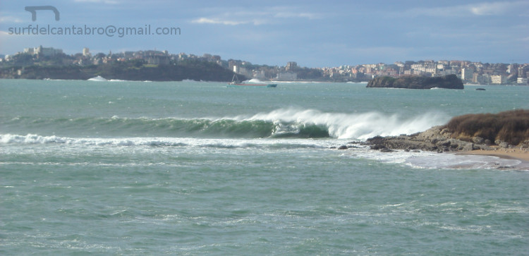
1. Utilización. ¿ En que época del año vamos a usar el traje ? . Según la estación del año en la que practiquemos surf el grosor del traje y su tipo varían. Las variaciones incluyen trajes: largo o cortos, distintos grosores en milímetros del neopreno, elaboración del traje: sellado o costuras planas …

2. Tallaje. Las tallas de los trajes de surf vienen determinadas por las marcas. Prácticamente todos los fabricantes tienen su propio tallaje. Esto no significa que no sean equivalentes entre las distintas métricas. Pero si que podemos encontrar diferencias entre tallas en principio similares.

3. Medidas. Se trata de de obtener una imagen holográfica de nuestro contorno corporal a partir de unas mediciones hechas en centímetros o pulgadas (1 pulgada = 2,54 centímetros). Los datos más importantes son los siguientes :

  • Estatura
  • Peso, kg/LB (1 kg = 2 lb)
  • Pecho
  • Cintura
  • Pelvis (parte inferior de la cadera)

4. Grosor. Este parámetro esta muy relacionado con la temperatura del agua. Tabla orientativa (milímetros – Grados Centígrados):

  • 2 mm : 17-21
  • 3 mm : 14-17
  • 4 mm : 10-14
  • 5 mm : 8-10
  • 6 mm : 8 ó menos

Nota: los trajes de surf no tienen generalmente toda su superficie con el mismo grosor. Por ejemplo si su grosor es de 4 mm, se refiere al grosor de las piernas y el pecho, los brazos 3 mm. Hay que tener esto en cuenta. Es por ello que se pueden acompañar de guantes, escarpines y gorro; según sea necesario.

5. Tipos de trajes. Principales criterios :

  • Corto ó largo. Cualquier combinación respecto a la cobertura del cuerpo.
  • Costuras planas, ciegas o selladas (Mayor aislamiento de derecha a izquierda).
  • Cremallera : en la espalda( más cómodo de poner) o en el pecho( entra menos agua).

Consejo : el traje de surf debe quedar ajustado y que nos permita respirar cómodamente. Prestar atención al material de ciertas partes del traje, el cuello es preferible que sea hipoalergénico.

How to choose a wetsuit

Icono Inglés. Icon English When you choose a suit of surf is a decision that we are going to enjoy or suffer for several years. All of this depends on taking the most appropriate option for each one.

In this article I explain my point of view and experience in this regard. Looking forward that can serve as a guide to buying a suit of surfing.

Parameters for a good choice :

  1. Purpose
  2. Sizing
  3. Measures
  4. Thickness
  5. Type of wetsuits

1. Purpose. What time of year we are going to use the costume ? . According to the season of the year in which we practice surfing the thickness of the wetsuit and its type are different. Variations include: wetsuits long or short, different thicknesses in millimeters of the neoprene, development of the wetsuit: sealing or flat seams …

2. Sizing. The sizing of the wetsuits are determined by the marks. Virtually all manufacturers have their own scale . This does not mean they are not equivalent between the various metrics. But we could find differences between the same size with different brands.

3. Measures. This is to obtain a holographic image of our body contour from a few measurements made in inches or centimeters (1 inch = 2.54 centimeters). The most important data are the following :

  • Height
  • Weight, kg/lb (1 kg = 2 lb)
  • Chest
  • Waist
  • Pelvis (bottom of the hip)

4. Thickness. This parameter is closely related to the temperature of the water. Indicative Table (millimeters – degrees Celsius):

  • 2 mm : 17-21
  • 3 mm : 14-17
  • 4 mm : 10-14
  • 5 mm : 8-10
  • 6 mm : 8 ó menos

Note: the wetsuits do not usually have their entire surface with the same thickness. For example if its thickness is 4 mm, refers to the thickness of the legs and chest, the arms, 3 mm. This needs to be taken into account. That is why you can accompany of gloves, boots and hat; as needed.

5. Types of wetsuits. Main concepts:

  • Short or long. Any combination for coverage of the body.
  • Flat seams, blind or sealed (greater isolation from right to left).
  • Zip : in the back( more convenient to put) or in the chest( enters less water) .

Advise : the wetsuit should be tight and must to allows us to breathe comfortably.

Icon close Sponsor

Share

Isla de Mouro

Icono Español. Icon Spanish La Isla de Mouro se encuentra ubicada a la entrada de la Bahía de Santander. Está situada entre La Península de la Magdalena y la Isla de Santa Marina. Ocupa un espacio de 1,7 hectáreas. Formada por rocas que acantilan todo su contorno, en su parte alta es prácticamente llana y cuenta con un faro que en la actualidad está automatizado, llamado Faro de La Isla de Mouro.

Es un lugar ideal para practicar submarinismo por la riqueza de sus fondos. Tiene una flora abundante y variada. Destaca la presencia de una planta, el hinojo marino. Es una especie muy utilizada como condimento gastronómico. Ya en el siglo XVI los buques franceses, ingleses y flamencos en su camino de vuelta desde Santander se aprovisionaban de ella en la Isla de Mouro.

La Isla de Mouro cuenta con una población de aves que nidifican en ella. Las especies de peces que la habitan y visitan es abundante, pues a la riqueza de sus fondos marinos se añade su emplazamiento. A la entrada de la bahía y próxima a su canal. Registra una gran parte de las especies de peces que se pueden encontrar en el Mar Cantábrico.

Destaca como hecho histórico la conquista de la isla por parte de los ingleses a la tropas napoleónicas, durante la Guerra de la Independencia Española (1808 – 1814). Siendo Inglaterra aliada de España.

Mouro Island

Icono Inglés. Icon English The Mouro Island is located at the entrance to the Bay of Santander. It is placed between the Peninsula of la Magdalena and the Santa Marina Island. It occupies an area of 1.7 hectares. Formed by rocks that acantilan all around, in its upper part is virtually flat and with a lighthouse which is now automated, called Lighthouse of Mouro Island.

It is an ideal place to practise diving for the wealth of its funds. It has an abundant and varied flora. It emphasizes the presence of a plant, the marine fennel. It is a species much used as gastronomic seasoning. Already in the XVIth century the French, English and Flemish ships in its way back from Santander were supplied of it in the Island of Mouro.

The Mouro Island has a population of birds that nest in it. The species of fish that inhabit and visit it is abundant, because of the wealth of its seabed and its location. At the entrance to the bay and next to its channel. Registers a large part of the fish species that can be found in Cantabrian Sea.

Stands out as historical fact the conquest of the island by the British to the Napoleonic troops, during the Spanish War of Independence (1808 – 1814). Being England ally of Spain.

Separador. DividerIcono Español-Inglés. Icon Spanish-English
islademouro
islademouro2Icono separador. Icon divider

Icon close Sponsor

Share

Playa de los Peligros. Origen del nombre

Icono Español. Icon Spanish «La Playa de los Peligros» se encuentra en el arenal interior de la Bahía de Santander, a la sombra de la Península de La Magdalena. Siendo esta zona el principal punto estratégico y defensivo de la ciudad, pues daba acceso a la bahía; punto de entrada a la ciudad.

Durante los siglos III y IV D.C se produjeron los ataques de los bagaudas. Ladrones y campesinos sublevados que buscaban el sustento con el pillaje. Desde esta época hasta el siglo VIII se suceden las invasiones bárbaras. Iniciadas por pueblos germánicos principalmente. Las últimas invasiones son hechas por vikingos y magiares(pueblo del este de Europa, localizado en la actual Hungría). Es Napoleón quien configura una nueva estrategia para la defensa de la península. Pudiendo ser atacada por todos los flancos y con el fin de optimizar la tarea militar dispone sus hombres en las zonas anteriores y colindantes a la península.

Todos estos hechos reflejan la imposibilidad de defender la zona completamente. Durante el siglo XIX y principios del siglo XX entran a la villa por esta playa los piratas para saquear. Por este motivo se la conoce como «Playa de los Peligros«.

Playa de Los Peligros. Origin of the name

Icono Inglés. Icon English «Los Peligros Beach» is located in the arenal that is inside of the Bay of Santander, in the shadow of the peninsula of La Magdalena. This area was the main strategic and defensive point of the city, giving access to the bay; entry point to the city.

During the centuries III and IV D. C the attacks of the bagaudas were happened. They were thieves and peasant rebels who sought the livelihood with the pillage. From this time until the eighth century there was a succession of barbaric invasions. Initiated by Germanic peoples primarily. The latest invasions are made by vikings and Magyars(groups from the eastern of Europe, located in what is today Hungary). It was Napoleon who sets up a new strategy for the defense of the peninsula. As this place may be attacked from all sides and in order to optimize the military task has its men in the previous and adjacent areas to the peninsula.

All these facts reflect the inability to defend the area completely. During the nineteenth and early twentieth century the pirates come to the city through the beach to plunder. For this reason it is known as «Los Peligros Beach«.

Icon close Sponsor

Share

Playa de los Peligros: Windsurf, Kitesurf

Icono Español. Icon Spanish La Playa de Los Peligros está situada en la ciudad de Santander, junto a la Playa de la Magdalena.

Para llegar a Los Peligros hay dos vías. La primera desde la Calle Castelar cogiendo el desvío a mano derecha para ir al Palacio de Festivales de Cantabria. Después continuamos la carretera hasta el final. La segunda opción desde la Avenida Reina Victoria, viniendo de la península de la Magdalena. Al Final de la avenida, girando a la izquierda se accede a parte del recorrido anterior.

Los Peligros es una playa de arena blanca y fina. Sus aguas son tranquilas y sin oleaje. Es adecuada para el baño, el disfrute del mar y su arenal. Cuenta con un parking amplio que se suele llenar en verano. El paseo hasta la playa constituye en sí mismo un pequeño viaje. Al tiempo que se ve una parte portuaria antigua de la ciudad se visualiza la Bahía de Santander y un puzzle montañoso al fondo.

Los días de viento esta sencilla zona se convierte en un circuito deportivo frecuentado por velas y cometas de winsurf y kitesurf. Desde la playa se entra a estas autopistas virtuales que cuentan con suficiente espacio para disfrutar de estas modalidades de surf. En este lugar generalmente el viento está presente en mayor o menor grado. Convirtiendo a la playa de Los Peligros en un lugar ideal para la práctica del windsurf y kitesurf.

Playa de Los Peligros: windsurf, kitesurf

Icono Inglés. Icon English Los Peligros Beach is located in the city of Santander, next to the Magdalena Beach.

To reach Los Peligros there are two ways. The first from the Castelar Street. Taking the detour to the right to go to the Palacio de Festivales de Cantabria. Then we continue the road to the end. The second option from the Avenida Reina Victoria, coming from the peninsula of la Magdalena. At the end of the avenue, turning to the left to access part of the above route.

Los Peligros is a beach of fine and white sand. Its waters are calm and without waves. It is suitable for the swiming, the enjoyment of the sea and its arenal. Account with an ample car parking which is usually fill in summer. The walk down to the beach is a small trip. At the same time that we see a part of the ancient port part of the city is displayed the Santander Bay and a puzzle of mountains in the background.

The windy days this area becomes a sporting circuit frequented by sails and kites of windsurfing and kitesurfing. From the beach you access to several and endless virtual highways that have enough space to enjoy these modalities of surfing. The wind is usually present to a greater or lesser degree in this zone. Turning to Los Peligros Beach in an ideal place for windsurfing and kitesurfing.

Separador. DividerIcono Español-Inglés. Icon Spanish-EnglishLos PeligrosIcono separador. Icon divider
Icon close Sponsor

Share

El viento extremo, un motivo para una ola gigante

Icono Español. Icon Spanish. El viento extremo La fuerza extrema del viento es uno de los factores que dan lugar olas gigantes. Durante este invierno se han sucedido temporales, borrascas y ciclogénesis explosivas en el Mar Cantábrico con una frecuencia inusual. ¿ Cuál es la causa ?. Leer más … Icono. Icon

The extreme wind, a reason for a giant wave

Icono Inglés. Icon English. The extreme wind The extreme force of the wind is one of the factors that give place giant waves. This winter there have been temporary, squalls and explosive cyclogenesis in the Cantabrian Sea with an unusual frequency. What is the cause? Read more … Icono. Icon

Separador. DividerIcono Español-Inglés. Icon Spanish-English. El viento extremo. The extreme windIcono. Icon
Icono separador. Icon divider

Icon close Sponsor

Share

La península de La Magdalena: submarinismo

Icono Español. Icon Spanish La península de La Magdalena se encuentra en la ciudad de Santander. Tiene una superficie de 24,5 hectáreas. En la actualidad la península es un parque público abierto durante el día. Su horario de verano es de 8:00 a 22:00, el resto del año de 9:00 a 20:30.

En ella, están la Playa de la Magdalena, la Playa de Bikinis y la Playa de la Reina. Son zonas de aguas claras y tranquilas. Generalmente tienen poca o nula presencia de olas y es por ello que son ideales para el baño, y el disfrute de la playa. Dentro del parque se puede hacer pícnic, habiendo varias zonas con mesas habilitadas para ello. Estas zonas además si sitúan al lado de la playa.

En la propia ciudad se encuentra esta pequeña joya de la naturaleza, la península de La Magdalena. Concebida en la actualidad para el uso mundano y el disfrute divino. Destaca en ella la practica del submarinismo. El rápido y fácil acceso al lugar. Las aguas claras. La tranquilidad del mar que baña la península por el interior de la bahía. Todos estos factores propician un buceo de calidad.

Varios son los puntos de entrada para hacer submarinismo. Desde las playas de La Magdalena y Bikinis se recorre la pequeña ensenada acotada por la Isla de los ratones y el Puente de Bikinis. Desde el puente podemos rodear la isla o acercarnos al Embarcadero Real. Desde el embarcadero se realiza la travesía hacía una parte de la cara norte de la península. Situados en el acceso noreste es posible elegir alguno de los puntos anteriores o conocer los fondos marinos próximos al punto de entrada y situados bajo el Palacio de la Magdalena.

A través del buceo se descubre un paisaje submarino difícil de imaginar desde tierra. Diversidad de peces, moluscos y crustáceos nadan y caminan conforme avanzamos la ruta elegida. Lubinas, doradas, cabrachos, salmonetes y jargos conviven con distintas especies de moluscos cefalópodos como la sepia y el magano (calamar pequeño). Ambos buscan su alimento entre mejillones, lapas, caracolillos de mar y varios tipos de crustáceos. El fondo de arena blanca se entremezcla con las rocas. Rocas que forman canales y figuras, modeladas por las condiciones meteorológicas y el paso del tiempo. Son un testimonio «vivo» del pasado geológico de La Península de la Magdalena.

Separador. DividerIcono Español-Inglés. Icon Spanish-EnglishAcceso, buceo: La MagdalenaIcono separador. Icon divider

The Magdalena peninsula: scuba diving

Icono Inglés. Icon English The Magdalena peninsula is located in the city of Santander. It has an area of 24.5 hectares. At present, the peninsula is a public park open during the day. Its summer opening hours are from 8:00 to 22:00, the rest of the year from 9:00 to 20:30.

In it, are the Magdalena Beach, Bikinis Beach and The beach of the Queen. All of them are areas of clear and calm waters. Generally have little or no presence of waves so it is an ideal place for the swimming, and the enjoyment of the beach. Within the park you can picnic, having several areas with tables set aside for this purpose. These tables are near the beach.

In the city is this little gem of the nature, the «peninsula de la Magdalena». Conceived today for use worldly and the divine enjoyment. It stands out in the practice of scuba diving. The quick and easy access to the site. The crystal clear waters. The tranquility of the sea, which washes the peninsula by the interior of the bay. All these factors contribute to a quality scuba diving.

There are several entry points for diving. From the beaches of La Magdalena and Bikinis you can go to the small bay delimited by the Mice Island and the Bikinis Bridge. From the bridge we can surround the island or go to the Royal Pier. From the jetty is performed the journey toward a part of the north face of the peninsula. Located in the northeast access is possible to choose any of the above points or know the seabed near the entry point and located under the Magdalena Palace.

Through the scuba diving here you are going to discover a submarine landscape hard to imagine from the ground. Diversity of fish, molluscs and crustaceans swim and walk as we go along the route chosen. Sea Bass, golden, scoprpion fish, red mullet and jargos coexist with various species of cephalopod mollusks such as sepia and the magano (small squid). Both are looking for its food between mussels, limpets and sea snails and several types of crustaceans. The seabed of white sand is intermingled with the rocks. Rocks that form channels and figures, modeled by the weather and the passage of time. Living witnesses in the geological past of the «Peninsula de la Magdalena».

Icon close Sponsor

Share

El sardinero, localización

Icono Español. Icon Spanish Las dos playas de El Sardinero están situadas en la ciudad de Santander. Ambas playas reciben el mismo nombre y se las conoce como: Primera Playa del Sardinero y Segunda Playa del Sardinero. Se accede a El Sardinero por múltiples vías una vez situados en Santander. Se puede llegar a Santander desde cualquier punto de la geografía española, compartiendo todos los trayectos cuatro localizaciones que pueden ser de partida o de transito. Estas son : Oviedo, Palencia, Bilbao y Burgos. Las tres primeros por autovía y la último por carretera nacional; atravesando el Puerto del Escudo. Ya emplazados en Santander o cercanías, hay dos opciones. Desde el oeste utilizando la S-20, llamada la Autovía del Sardinero. La otra opción es por medio de la S-10, atravesando la ciudad; pues la configuración de Santander se orienta hacia sus playas.

Nota: el trayecto por la S-20 ha sido selecionado con origen en el Barrio de La Albericia, para poder poder visualizar la autovía. Se puede partir desde cualquier otro punto que conduzca a la S-20.

El Sardinero, Localization

Icono Inglés. Icon English The two beaches of «El Sardinero» are located in the city of Santander. Both places are given the same name and are known as: First Sardinero Beach and Second Sardinero Beach. El Sardinero is accessed by multiple pathways once you have been located in Santander. You can reach Santander from any point of the Spanish geography. All the journeys share one of four possible locations that may be of heading or transit. These are: Oviedo, Palencia, Bilbao and Burgos. The first three by motorway and the last by national road; going through the port of «El Escudo«. When you already are in Santander or vicinity you can choose between two options. From the west using the S-20, called the Highway of «El Sardinero». The other option is through the S-10, which passes through the city. The configuration of Santander is oriented toward its beaches.

Note: the journey by the S-20 has been selected with origin in the district of La Albericia, in order to be able to display the dual carriageway. You can travel from any other point that is conected to the S-20.

Icono Español-Inglés. Icon Spanish-English Localización/Localization

Oviedo, El Sardinero: LocalizationPalencia, El Sardinero: LocalizationSantander, El Sardinero; S-10 : LocalizationBilbao, El Sardinero : Localization

Icon close Sponsor

Share