

Somo, playa
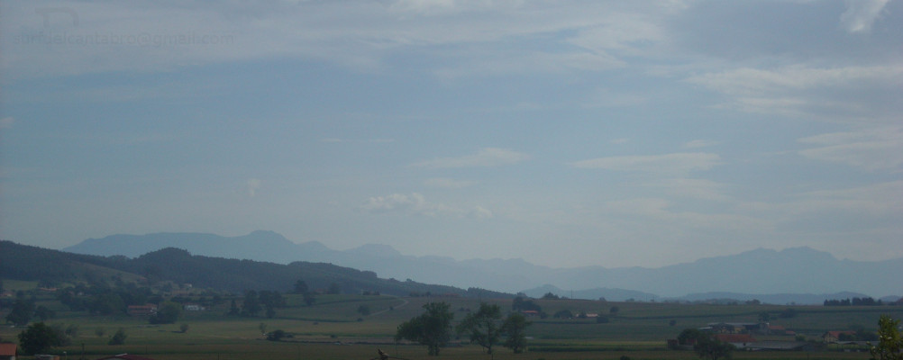
![]() Somo es una localidad emplazada en el sur de la Bahía de Santander, que pertenece al municipio de Ribamontán al Mar. Comunicada con Pedreña por el Puente de Somo y con Loredo por carretera nacional, tiene además un servicio regular de lanchas que lo conecta con Santander.
Somo es una localidad emplazada en el sur de la Bahía de Santander, que pertenece al municipio de Ribamontán al Mar. Comunicada con Pedreña por el Puente de Somo y con Loredo por carretera nacional, tiene además un servicio regular de lanchas que lo conecta con Santander.
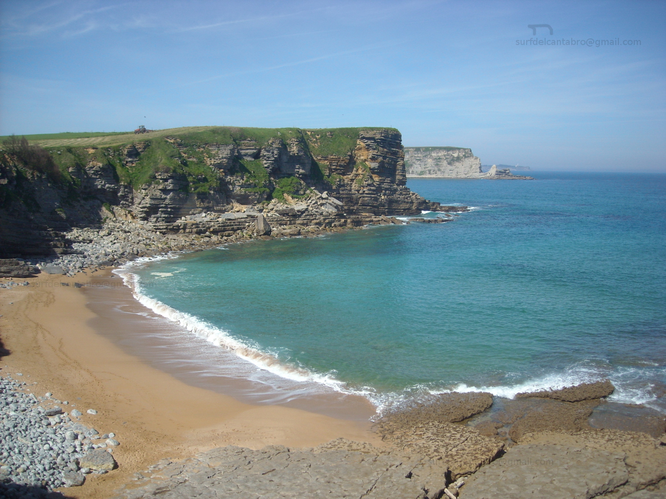
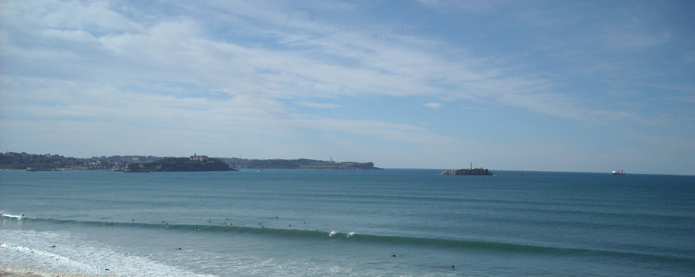
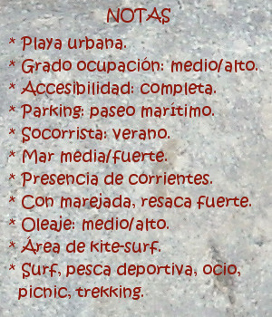
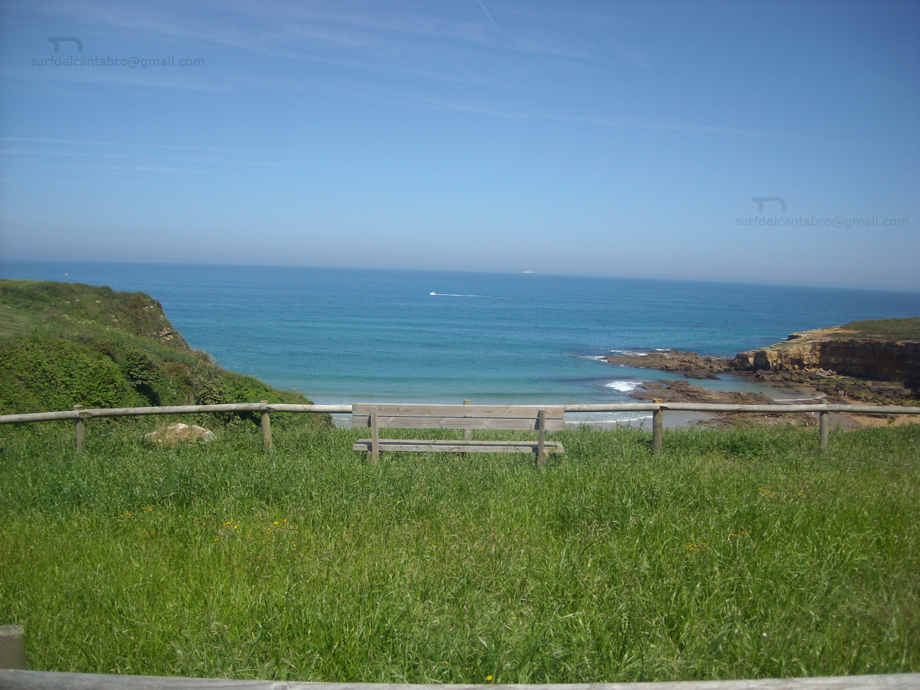
La playa de Somo, con una longitud de 3,5 kilómetros, es una de las playas más grandes de Cantabria. Su arenal se prolonga a través de la playa de Loredo, acotado en su extremo derecho por la Isla de Santa Marina, ocupa una basta extensión de 5 kilómetros de recorrido. En el extremo izquierdo existe un amplia área dunar, que se introduce en la centro de la bahía. Esta parte de la playa se llama El Puntal. La cara sur de esta lengua de arena y vegetación tiene una longitud de tres kilómetros, finalizando en el embarcadero de Somo. Se abre, en esta parte, una zona protegida del contacto directo con el oleaje; existiendo así un área idónea para la practica del windsurf y kitesurf.
La playa contiene varias zonas diferenciadas con distintos tipos de ola. La parte más cercana al Puntal dibuja su trazado con una ligera curva, que propicia la aparición de olas que abren a derechas; cuando las condiciones del mar son favorables. La segunda zona, conocida como El Barco, recibe su nombre por existir el casco de un barco naufragado y parcialmente hundido en el fondo de arena. Este lugar presenta corrientes cambiantes y remolinos, además del peligro que supone practicar surf en las cercanías de los restos. Tiene buenas olas, que abren a ambos lados, siendo adecuado el espacio emplazado a 100 metros por detrás del barco. El tercer punto se coloca a la derecha. Conocido como el camping, abarca una extensión mayor y por ello acoge varios tipos de ola que abren a ambos lados, según su proximidad a la zona del Barco o La Curva.
Aquí se recogen algunos datos, junto con una breve descripción de la Playa de Somo. La percepción y conocimiento de sus aguas y olas, de su fondo arenoso, del entorno verde que la acompaña, … deben ser vividos.

Somo, beach
![]() Somo is a locality placed in the south of the Bay of Santander, which belongs to the municipality of Ribamontán al Mar. Communicated with Pedreña through The Bridge of Somo and Loredo by national road; it also has a regular service of boats that connects it with Santander.
Somo is a locality placed in the south of the Bay of Santander, which belongs to the municipality of Ribamontán al Mar. Communicated with Pedreña through The Bridge of Somo and Loredo by national road; it also has a regular service of boats that connects it with Santander.
Somo’s beach, with a length of 3,5 kilometres, is one of the biggest beach of Cantabria. Its sandbank extends across Loredo’s beach, annotated in its right wing for the Island of Santa Marina, occupies an extension of 5 kilometres of tour. In the left wing, exists a wide dune area, which has introduced in the center of the bay. This part of the beach is called El Puntal. The south face of this language of sand and vegetation has a length of three kilometres, that finishes in Somo’s pier. There is , in this part, a zone protected from the direct contact with the surge; that creates a suitable area for the practice of windsurfing and kitesurf.
The beach contains several zones differentiated with different types of wave. The nearest part to El Puntal draws its tracing with a light curve, which propitiates the appearance of waves that open to right; when the conditions of the sea are favorable. The second zone known as El Barco, receives its name due to exists the hull of a ship wreck and partially sunk in the back of sand. This place presents changeable currents and whirlpools, besides the danger that supposes practising surf in the surroundings of the remains. It has good waves, which open to both sides, being suitable the space located to 100 meters behind the ship. The third point is placed to the right. Acquaintance as El Camping, it includes a major extension and that is the reason to receive several types of wave that they open for both sides, according to his proximity for the zone of El Barco or La Curva.
Here is gathered some information, together with a brief description of Somo’s Beach. The perception and knowledge of its waters and waves, of its sandy bottom, of the green environment that accompanies it, … must be lived.
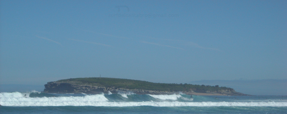
Isla de Santa Marina, lugar
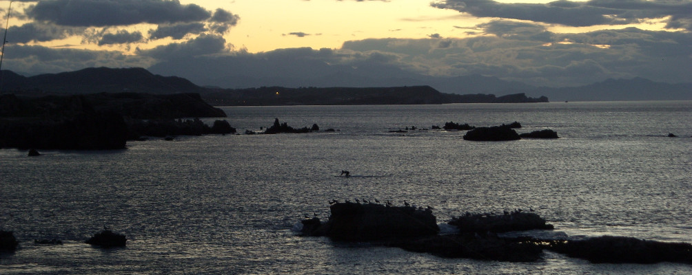
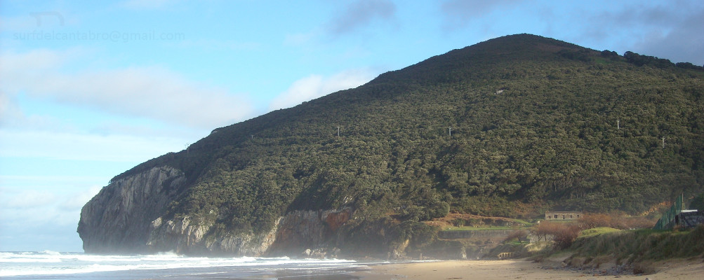
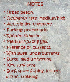
![]() La Isla de Santa Marina se encuentra al final del extenso arenal que une Somo con Loredo. En frente de la costa, separada de tierra firme por apenas 50 metros en marea baja, está una isla que tiene una extensión de 18,5 hectáreas. Formada por rocas y cubierta parcialmente de vegetación, convive con el Mar Cantábrico que la baña, golpea y moldea. Su contorno submarino se halla cubierto por rocas y pequeños arrecifes, propiciados por el efecto del mar y el clima.
La Isla de Santa Marina se encuentra al final del extenso arenal que une Somo con Loredo. En frente de la costa, separada de tierra firme por apenas 50 metros en marea baja, está una isla que tiene una extensión de 18,5 hectáreas. Formada por rocas y cubierta parcialmente de vegetación, convive con el Mar Cantábrico que la baña, golpea y moldea. Su contorno submarino se halla cubierto por rocas y pequeños arrecifes, propiciados por el efecto del mar y el clima.
El brazo de mar que la separa de la costa tiene corrientes fuertes y peligrosas, constituyendo una zona de gran interés para la práctica de la pesca recreativa y el submarinismo. Aparecen, a partir de esa separación, dos zonas diferentes en la isla que originan dos grandes olas. En la cara de la Santa Marina que mira a la Bahía de Santander, aparece una ola que abre a derechas. Cuando las condiciones del océano se endurecen, esta ola supera con facilidad los cinco metros de altura. Las factores extremos de la mar, el fondo rocoso y las corrientes hacen que la ola sólo sea aconsejada para profesionales y gente muy experimentada. En el otro lado la isla, que saluda a mar abierto, aparece una ola que abre a izquierda cuyo tamaño puede superar también los cinco metros de altura con las condiciones adecuadas. A mayor distancia de la costa, prácticamente en alta mar, las condiciones se endurecen aún más, siendo sólo apto para profesionales y gente experimentada consciente de los riesgos.
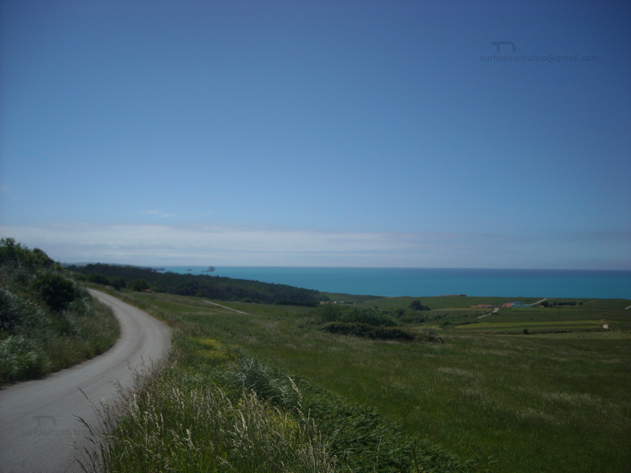
El parking que se sitúa en frente de la isla, en posición elevada, proporciona una visión panorámica de la bahía y el entorno. Desde allí se abren dos sendas que llegan por la izquierda hasta la playa de Loredo y por la derecha hasta la playa de Langre. Caminos que avanzan paralelos a la línea de costa. Acantilados y otras formaciones geológicas además de la flora y fauna existentes en los bosques cercanos acompañarán el recorrido.
Es Santa Marina una isla singular, no sólo por ser la más extensa de la costa cantábrica, pues proporciona experiencias a cualquier persona, deportista o caminante, que a ella se acerque.
Santa Marina Island, place
![]() Santa Marina Island is placed at the end of the extensive sandbank that joins Somo with Loredo. Opposite the coast, separated from firm land by scarcely 50 meters in low tide, there is an island that has an extension of 18,5 hectares. Formed by rocks and covered partially of vegetation, it coexists with Cantabrian Sea that bathes, throbs and molds it. Its submarine contour is covered by rocks and small reefs propitiated by the effect of the sea and the climate. The inlet that separates it from the coast has strong and dangerous currents, constituting a zone of great interest for the recreative fishing and the scuba diving. Two different zones appear in the island, from this separation, that originate two big waves. In the face of the Santa Marina Island that looks towards the Bay of Santander, there appears a wave that opens to right. When the conditions of the ocean harden, this wave overcomes with facility five meters of height. Extreme conditions of the sea, the rocky bottom and the currents do that the wave only would be recomended for professionals and very experienced surfers. In the other side of the island, which greets to open sea, appears a wave that opens to left side which size can overcome also five meters of height with the suitable conditions. To major distance of the coast, practically on the high sea, the conditions harden even more, being only suitable for professionals and experienced conscious surfers of the risks.
Santa Marina Island is placed at the end of the extensive sandbank that joins Somo with Loredo. Opposite the coast, separated from firm land by scarcely 50 meters in low tide, there is an island that has an extension of 18,5 hectares. Formed by rocks and covered partially of vegetation, it coexists with Cantabrian Sea that bathes, throbs and molds it. Its submarine contour is covered by rocks and small reefs propitiated by the effect of the sea and the climate. The inlet that separates it from the coast has strong and dangerous currents, constituting a zone of great interest for the recreative fishing and the scuba diving. Two different zones appear in the island, from this separation, that originate two big waves. In the face of the Santa Marina Island that looks towards the Bay of Santander, there appears a wave that opens to right. When the conditions of the ocean harden, this wave overcomes with facility five meters of height. Extreme conditions of the sea, the rocky bottom and the currents do that the wave only would be recomended for professionals and very experienced surfers. In the other side of the island, which greets to open sea, appears a wave that opens to left side which size can overcome also five meters of height with the suitable conditions. To major distance of the coast, practically on the high sea, the conditions harden even more, being only suitable for professionals and experienced conscious surfers of the risks.
The parking that is in front of the island, in high position, provides a panoramic vision of the bay and the environment. From there, two paths begin its travel; that come for the left side up to Loredo’s beach and for the right up to Langre’s beach. Routes that advance parallel to the line of coast. Cliffs and other geological formations besides the existing flora and fauna in the nearby forests will accompany the tour.
A singular island is Santa Marina, not only for being the most extensive of the Cantabrian coast, since it provides experiences to any person, sportsman or wayfarer, who approach it.
Loredo, playa
![]() Loredo es una localidad cantábra, perteneciente al municipio de Ribamontán al Mar y situada al sur de la Bahía de Santander. Su playa, que recibe el nombre de la localidad, tiene una longuitud de 1200 metros y una anchura media de 60 metros. El trazado del arenal se dibuja a través de la configuración que la bahía ha proporcionado al terreno, curvando la playa en la parte contigua a Somo y extendiendo el final hasta el otro extremo; donde aparece la Isla de Santa Marina. Este peculiar dibujo da origen a una de las zonas con mayor presencia de olas en Cantábria, conocida como La Curva. Existen varios tipos diferentes de olas con distintas salidas y tamaños.
Loredo es una localidad cantábra, perteneciente al municipio de Ribamontán al Mar y situada al sur de la Bahía de Santander. Su playa, que recibe el nombre de la localidad, tiene una longuitud de 1200 metros y una anchura media de 60 metros. El trazado del arenal se dibuja a través de la configuración que la bahía ha proporcionado al terreno, curvando la playa en la parte contigua a Somo y extendiendo el final hasta el otro extremo; donde aparece la Isla de Santa Marina. Este peculiar dibujo da origen a una de las zonas con mayor presencia de olas en Cantábria, conocida como La Curva. Existen varios tipos diferentes de olas con distintas salidas y tamaños.
La playa alberga además el Derby de Loredo, competición hípica más antigua e importante del norte de España. Celebrada entre finales del mes de julio y principios de agosto , incluye varias categorías y es una prueba valedera para el campeonato de España y del mundo en su especialidad.
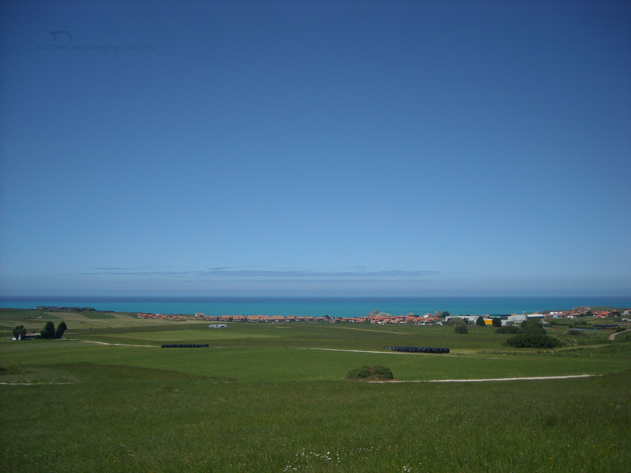
Todo el entorno de la playa está rodeado por una amplia zona verde, con formaciones dunares. El cierre de la playa se sitúa sobre terreno elevado y cercano al arenal, proporcionando una vista amplia de la bahía que culmina con la imagen de la ciudad de Santander al otro lado, o la extensión infinita del mar sobre el horizonte. Es por ello que la zona se convierte así en un lugar ideal para el ocio, el disfrute de la costa y el picnic.
Loredo, beach
![]() Loredo is a Cantabrian locality, belonging to the municipality of Ribamontán al Mar and placed to the south of the Bay of Santander. Its beach, which receives the name of the locality, has a longuitud of 1200 meters and an average width of 60 meters. The tracing of the sandbank shows itself across the configuration that the bay has provided to the area, curving the beach in the contiguous part to Somo and extending it up to another end; where there appears the Santa Marina Island. This peculiar drawing gives origin to one of the zones with major presence of waves in Cantábria, known as La Curva. Several types different from waves exist with distinct exits and sizes.
Loredo is a Cantabrian locality, belonging to the municipality of Ribamontán al Mar and placed to the south of the Bay of Santander. Its beach, which receives the name of the locality, has a longuitud of 1200 meters and an average width of 60 meters. The tracing of the sandbank shows itself across the configuration that the bay has provided to the area, curving the beach in the contiguous part to Somo and extending it up to another end; where there appears the Santa Marina Island. This peculiar drawing gives origin to one of the zones with major presence of waves in Cantábria, known as La Curva. Several types different from waves exist with distinct exits and sizes.
The beach shelters the Derby of Loredo, the most ancient and important equine competition of the north of Spain. Celebrated between ends of July and beginning of August, it includes several categories and is a valid test for the championship of Spain and of the world in its speciality.
The whole environment of the beach is surrounded by a wide green space, with dune formations. The closing of the beach is on highland area and near to the sandbank, providing a wide sight of the bay that culminates with the image of the city of Santander to the other side, or the infinite extension of the sea on the horizon. It is for it that the zone turns this way into an ideal place for the leisure, the enjoyment of the coast and the picnic.
Mejoras técnicas
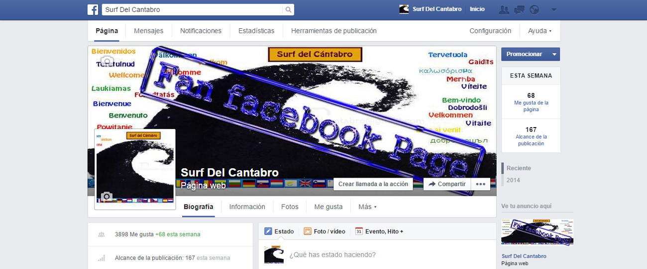
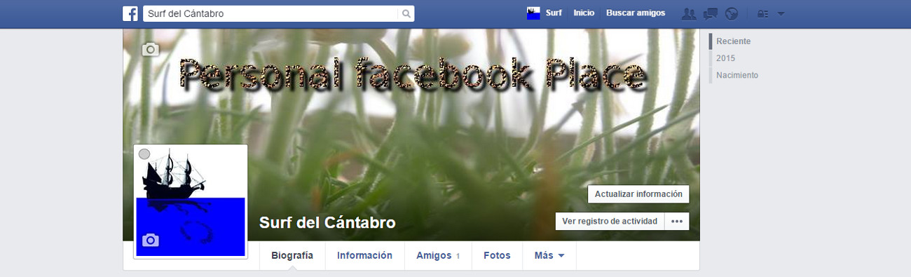
![]() Gracias a los lectores y seguidores de todo el Planeta por visitar y seguir Surf del Cantabro. Debido al gran número de contactos que tenía el perfil personal de facebook, la compañía indica que dicho perfil se debe convertir en página. Por este motivo todos los contactos se han transformado automáticamente en seguidores. Muchas gracias a todas las personas y organizaciones por el interés y apoyo en este proyecto. También he creado un nuevo perfil personal para poder seguir teniendo contacto directo con todas las personas que lo quieran. Este nuevo perfil denominado : Surf del Cántabro tiene una nueva imagen indicando que es un perfil personal de facebook. La nueva página de facebook, denominada como: Surf del Cantabro, tiene también una imagen indicativa de esta mejora.
Gracias a los lectores y seguidores de todo el Planeta por visitar y seguir Surf del Cantabro. Debido al gran número de contactos que tenía el perfil personal de facebook, la compañía indica que dicho perfil se debe convertir en página. Por este motivo todos los contactos se han transformado automáticamente en seguidores. Muchas gracias a todas las personas y organizaciones por el interés y apoyo en este proyecto. También he creado un nuevo perfil personal para poder seguir teniendo contacto directo con todas las personas que lo quieran. Este nuevo perfil denominado : Surf del Cántabro tiene una nueva imagen indicando que es un perfil personal de facebook. La nueva página de facebook, denominada como: Surf del Cantabro, tiene también una imagen indicativa de esta mejora.
Muchas gracias por el interés, y la pasión por el mar; que nos une.
Nota: se muestran más abajo imágenes descriptivas de la nueva situación.
![]() Thanks to the readers and followers of the whole Planet for visiting and to follow Surf del Cantabro. Due to the great number of contacts that the personal profile had in facebook, the company indicates that the above mentioned profile must turn into page. For this motive all the contacts have transformed automatically into followers. Thank you very much to all the persons and organizations for the interest and support in this project. I have also created a new personal profile to be able to continue having direct contact with all the persons who want it. This new profile called: Surf del Cántabro has a new image indicating that it is a personal profile of facebook. The new page of facebook, named like: Surf del Cantabro, it has also an indicative image of this improvement.
Thanks to the readers and followers of the whole Planet for visiting and to follow Surf del Cantabro. Due to the great number of contacts that the personal profile had in facebook, the company indicates that the above mentioned profile must turn into page. For this motive all the contacts have transformed automatically into followers. Thank you very much to all the persons and organizations for the interest and support in this project. I have also created a new personal profile to be able to continue having direct contact with all the persons who want it. This new profile called: Surf del Cántabro has a new image indicating that it is a personal profile of facebook. The new page of facebook, named like: Surf del Cantabro, it has also an indicative image of this improvement.
Thank you very much for the interest, and the passion for the Sea; that joins us.
Note: there are below descriptive images of the new situation.
![]()
Images of the New places.
Personal facebook Place
Fan facebook Page