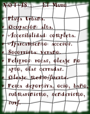
El Muro, lugar
![]() El Muro es una zona que abre un singular circuito para la práctica del surf. Situado en ampliación de la dársena urbana que delimita la ciudad de Santander con la Segunda playa del Sardinero, tiene fácil acceso y cuenta con todos los servicios.
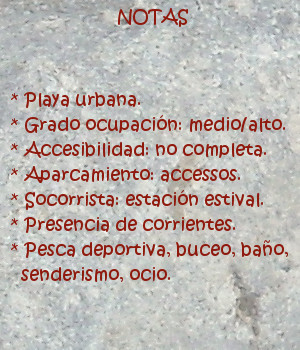
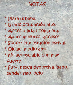
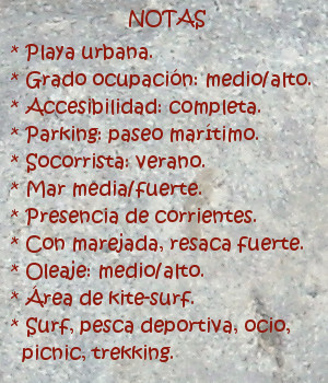
El Muro es una zona que abre un singular circuito para la práctica del surf. Situado en ampliación de la dársena urbana que delimita la ciudad de Santander con la Segunda playa del Sardinero, tiene fácil acceso y cuenta con todos los servicios.
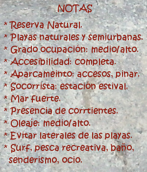
La prolongación de este espacio natural ha introducido su diseño dentro de la Ensenada del Sardinero. Un gran mirador semicircular señala lo puntos más notables de la bahía y actúa como acumulador del oleaje. Llegan las olas hasta este punto para aglutinar masas de agua que abren a izquierdas y pueden alcanzar recorrido medio. Cuando la dirección del oleaje es casi perpendicular a la dársena y ligeramente orientado hacia ella; se dan las mejores condiciones para olas buenas y seguras. El exceso de inclinación provocan que las olas cierren contra el muro; tornando la navegación difícil y peligrosa.
Múltiples opciones aparecerán contemplando el entorno desde EL Muro. Las playas vistas en la distancia, las rocas y promontorios recorridos por un paseo marítimo invitan al caminante a iniciar un pequeño viaje acompañado por el natural, caótico y armónico sonido del mar.

El Muro, place
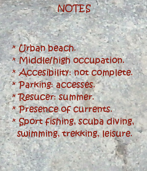
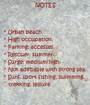
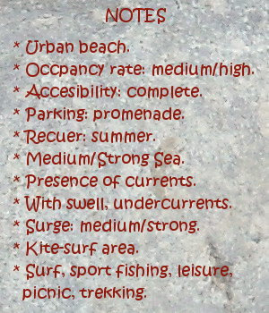
![]() El Muro is a zone that opens a singular circuit for the practice of surf. Placed in extension of the urban dock that delimits the city of Santander with the Second Sardinero beach , it has easy access and possesses all the services.
El Muro is a zone that opens a singular circuit for the practice of surf. Placed in extension of the urban dock that delimits the city of Santander with the Second Sardinero beach , it has easy access and possesses all the services.
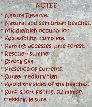
The prolongation of this natural space has introduced its design in the Inlet of the Sardinero. A great semicircular viewing-point indicates the most notable points of the bay and acts as accumulator of the surge. The waves come up to this point to agglutinate water masses that open to left sides and can reach medium tour. When the wave direction is almost perpendicular to the dock and lightly orientated towards it; are given the best conditions for good and sure waves. The excess of inclination provoke that the waves close against the wall; turning the navigation difficult and dangerous.
Multiple options will appear contemplating the environment from El Muro. The beaches are seen in the distance, the rocks and promontories crossed by a promenade invite the wayfarer to initiate an small trip accompanied by the natural, chaotic and harmonic sound of the Sea.