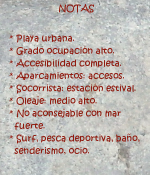
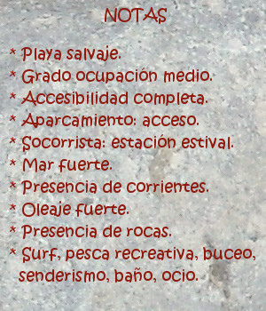
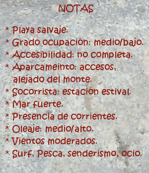
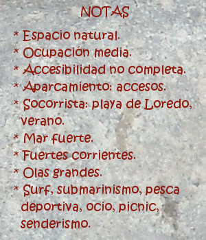
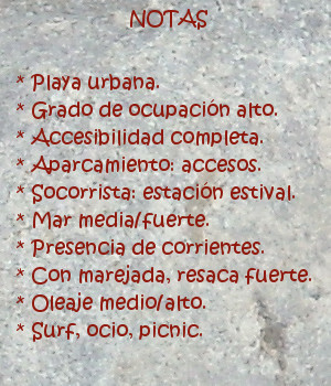
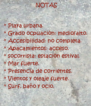
Los Locos, playa
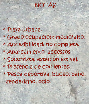
![]() La playa de Los Locos está situada en el municipio de Suances, en la costa central de Cantabria. Su longitud aproximada de 500 metros y anchura media de 20 metros constituye el emplazamiento natural donde terminan las olas que entran a la Ensenada de Cabrera. Es Los Locos una playa urbana que presenta cierto aislamiento debido a su ubicación. Localizada a los pies de los acantilados que unen Suances con la Punta del Dichoso y forman estos una península que hace de cierre y acota su ala este.
La playa de Los Locos está situada en el municipio de Suances, en la costa central de Cantabria. Su longitud aproximada de 500 metros y anchura media de 20 metros constituye el emplazamiento natural donde terminan las olas que entran a la Ensenada de Cabrera. Es Los Locos una playa urbana que presenta cierto aislamiento debido a su ubicación. Localizada a los pies de los acantilados que unen Suances con la Punta del Dichoso y forman estos una península que hace de cierre y acota su ala este.
Es una de las zonas de la costa cántabra que presenta olas durante todo el año. El fuerte oleaje y la presencia de vientos contribuyen a la calidad de sus ondas. El pico central adquiere buen tamaño, 2 metros aproximadamente. Cercano al ala oeste, abre a ambos lados. Destacando su salida izquierda que puede alcanzar largo recorrido con presencia de tubos.
El acceso al arenal se realiza por un pronunciado desnivel a través de la calzada que hay habilitada. En el momento del descenso, es cuando veremos la playa. Percibiendo sus dimensiones reales y naturaleza propia que van más allá de las palabras. Alzando la vista, ante el caminante, aparece una visión panorámica de toda la zona. La avalancha de estímulos e información dan paso al sencillo disfrute de los sentidos. Cuando los atardeceres son coloreados, y el olor del Mar Cantábrico inunda las inmediaciones de la playa de Los Locos, comienza la hora de los sueños que algún amanecer podrá plasmar.

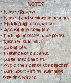
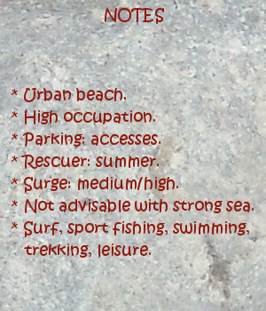
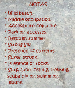
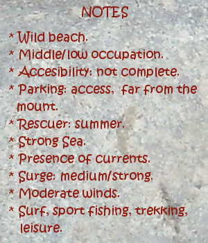
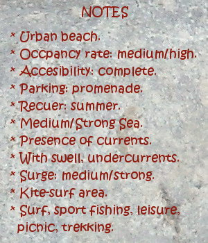
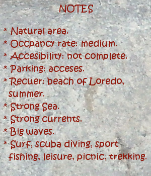
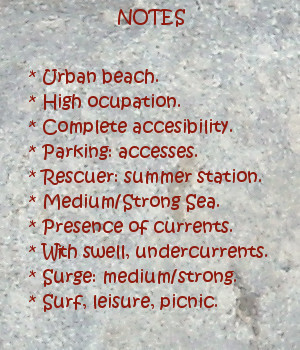
Los Locos, beach
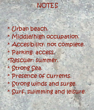
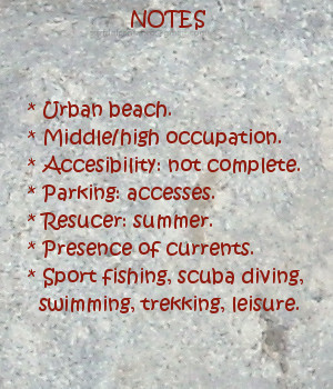
![]() The beach of Los Locos is placed in the municipality of Suances, in the central coast of Cantabria. Its approximate length of 500 meters and average width of 20 meters constitutes the natural emplacement where finish the waves that enter to the Inlet of Cabrera. It is The Madmen an urban beach that presents certain isolation due to its location. Located to the feet of the cliffs that joins Suances with El Dichoso Tip, these form a peninsula that it does of closing and protect its east wing.
The beach of Los Locos is placed in the municipality of Suances, in the central coast of Cantabria. Its approximate length of 500 meters and average width of 20 meters constitutes the natural emplacement where finish the waves that enter to the Inlet of Cabrera. It is The Madmen an urban beach that presents certain isolation due to its location. Located to the feet of the cliffs that joins Suances with El Dichoso Tip, these form a peninsula that it does of closing and protect its east wing.
It is one of the zones of the Cantabrian coast that presents waves all the year. The strong surge and the wind presence contribute to the quality of its waves. The central break acquires good size, 2 meters approximately. It rise near the west wing, and opens to both sides. Emphasizing its left path that can reach an important length with presence of pipes.
The access to the sandbank is realized by a pronounced slope across the causeway that has been enabled. In the moment of the descent, is when we will see the beach. Perceiving its real dimensions and own nature that go beyond the words. Lifting the sight, in front of the wayfarer, appears a panoramic vision of the whole zone. The avalanche of stimuli and information give step to the unassuming enjoyment of the senses. When the late afternoons are colored, and the smell of the Cantabrian Sea floods the surrounding areas of Los Locos beach, begins the hour of the dreams that some dawn will be able to form.